 Add to Chrome
 Add to Firefox
 Add to Edge
GeoWeaver: Accurate Long-Sequence 3D Reconstruction via Hierarchical Geometric Assembly
Aug 18, 2026
Long-sequence 3D reconstruction from RGB videos requires both accurate local geometry and globally consistent camera motion. Feed-forward models provide strong depth and pose predictions, but their memory cost prevents joint inference over long sequences. Chunk-wise processing improves scalability, yet independently predicted chunks often exhibit scale drift, pose errors, and point-cloud misalignment. We present GeoWeaver, a unified framework comprising a Geometric Prior Model (GPM) and Test-Time Adaptation (TTA). The GPM predicts chunk-wise depth, confidence, and camera parameters as adjustable geometric priors. TTA then performs sequential initialization, global chunk-level Sim(3) alignment, and coarse-to-fine refinement of camera poses, affine depth corrections, and intrinsics. Dense correspondences provide adjacent, cross-chunk, and long-range constraints, while a robust CDF-style objective jointly optimizes weighted 2D reprojection and 3D consistency residuals. This design preserves local geometric accuracy while correcting accumulated pose, scale, depth, and calibration errors. Experiments across diverse long-sequence benchmarks demonstrate improved camera accuracy, global consistency, and point-cloud quality. Ablations verify the contribution of each adaptation stage, and applying the same TTA procedure to different geometric prior models consistently improves their trajectory estimates, demonstrating that GeoWeaver is not tied to a specific GPM.

UniQuery4R: Unified 4D Scene Reconstruction from a Single Query
Aug 18, 2026Reconstructing dynamic 4D scenes requires jointly estimating correspondence, geometry, object motion, and camera motion. Existing feed-forward methods typically predict dense task-specific maps or independently process source-target pairs, leading to unnecessary computation for sparse queries and limited feature reuse across different frame pairs. We present UniQuery4R, a query-conditioned framework that encodes a multi-frame clip once and selects the source view, target view, and continuous source-image coordinate only at decoding time via source-to-target cross-attention. Each query jointly predicts target correspondence, target-time 3D position, and scene flow, along with source depth, while camera parameters are estimated per view. This design allows the encoded clip to be reused across arbitrary source-target selections and supports both sparse inference and dense reconstruction through batched queries, without learned temporal embeddings tied to a fixed clip length. We further introduce a direction-magnitude parameterization of scene flow with separate supervision for moving and static points. Among the evaluated methods, UniQuery4R achieves the best macro-average results on WorldTrack for both scene-flow estimation and dynamic-point reconstruction.
PandaSet: Advanced Sensor Suite Dataset for Autonomous Driving
Dec 23, 2021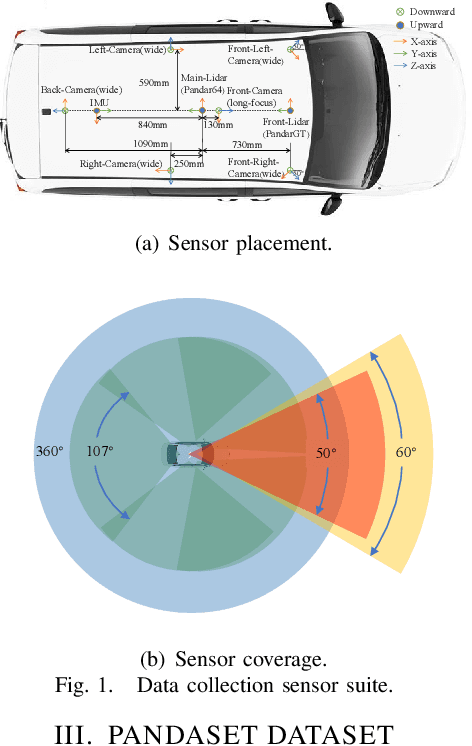
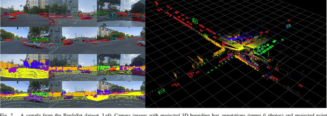
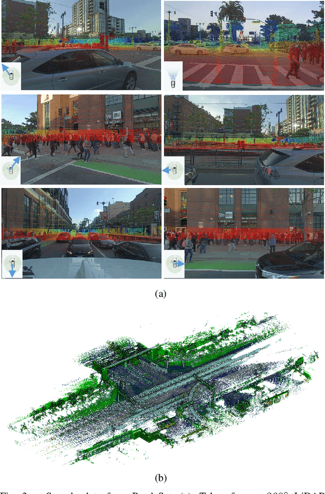
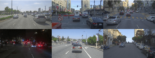
The accelerating development of autonomous driving technology has placed greater demands on obtaining large amounts of high-quality data. Representative, labeled, real world data serves as the fuel for training deep learning networks, critical for improving self-driving perception algorithms. In this paper, we introduce PandaSet, the first dataset produced by a complete, high-precision autonomous vehicle sensor kit with a no-cost commercial license. The dataset was collected using one 360{\deg} mechanical spinning LiDAR, one forward-facing, long-range LiDAR, and 6 cameras. The dataset contains more than 100 scenes, each of which is 8 seconds long, and provides 28 types of labels for object classification and 37 types of labels for semantic segmentation. We provide baselines for LiDAR-only 3D object detection, LiDAR-camera fusion 3D object detection and LiDAR point cloud segmentation. For more details about PandaSet and the development kit, see https://scale.com/open-datasets/pandaset.
MULLS: Versatile LiDAR SLAM via Multi-metric Linear Least Square
Feb 07, 2021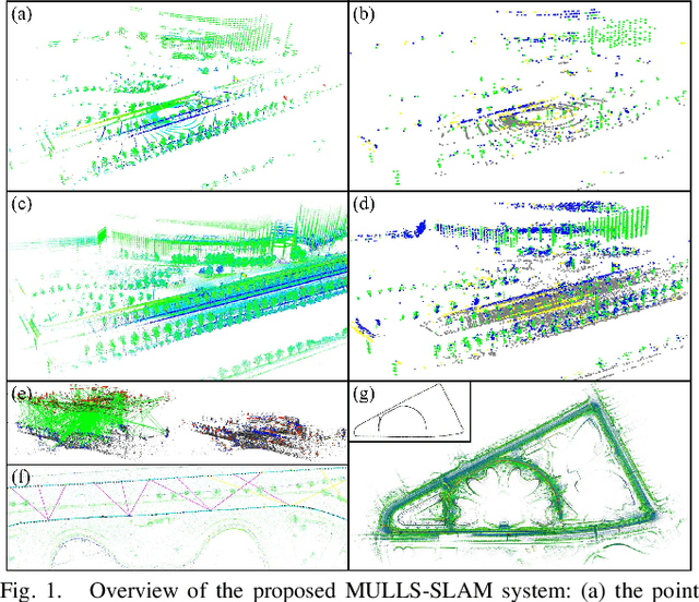
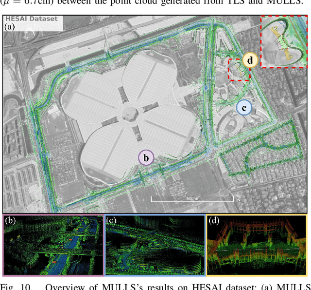
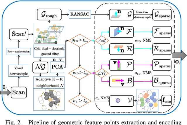

The rapid development of autonomous driving and mobile mapping calls for off-the-shelf LiDAR SLAM solutions that are adaptive to LiDARs of different specifications on various complex scenarios. To this end, we propose MULLS, an efficient, low-drift, and versatile 3D LiDAR SLAM system. For the front-end, roughly classified feature points (ground, facade, pillar, beam, etc.) are extracted from each frame using dual-threshold ground filtering and principal components analysis. Then the registration between the current frame and the local submap is accomplished efficiently by the proposed multi-metric linear least square iterative closest point algorithm. Point-to-point (plane, line) error metrics within each point class are jointly optimized with a linear approximation to estimate the ego-motion. Static feature points of the registered frame are appended into the local map to keep it updated. For the back-end, hierarchical pose graph optimization is conducted among regularly stored history submaps to reduce the drift resulting from dead reckoning. Extensive experiments are carried out on three datasets with more than 100,000 frames collected by six types of LiDAR on various outdoor and indoor scenarios. On the KITTI benchmark, MULLS ranks among the top LiDAR-only SLAM systems with real-time performance.