 Add to Chrome
 Add to Firefox
 Add to Edge
Creating Impactful Autonomous Driving Datasets: A Strategic Guide from Research Gap to Benchmark
Jul 01, 2026
Well-designed autonomous driving datasets have fundamentally shaped research progress, yet existing literature primarily describes what datasets contain rather than how to strategically design impactful ones. This is especially limiting for small and medium-sized labs and startups that cannot afford to misallocate scarce resources. We argue that impactful dataset creation begins with a diagnosis: whether a research question is blocked by a data problem or an evaluation problem, and proceeds by selecting the minimal data operator(s) that closes the resulting gap, recording new data only when no cheaper operator(s) suffices. We analyze the evolution of major autonomous driving (AD) datasets through this lens and distill a strategic framework spanning gap identification, operator choice, sensor suite design, and annotation strategy. We ground the framework in a running case study of our KITScenes dataset family. The datasets are available at: https://kitscenes.com/

The Road Ahead in Autonomous Driving: The KITScenes Multimodal Dataset
Jun 01, 2026Existing autonomous driving datasets have enabled major progress, but fall short in sensor fidelity, map completeness, or geographic diversity. We present KITScenes Multimodal, a European dataset built around high-fidelity sensors and maps. Our fully synchronized sensor suite combines high-resolution global-shutter cameras, long-range lidar beyond 400m, 4D imaging radar, and redundant GNSS/INS localization. Our HD maps are, to our knowledge, the most complete of any sensor dataset, validated through autonomous driving trials on open-source software. For the first time in a public dataset, all driving-relevant traffic elements, such as traffic lights, are mapped in 3D to a reprojection-accurate level with full topological connectivity. Recorded in cities with irregular street layouts and mixed traffic modes, our dataset complements existing datasets by broadening the available geographic diversity. We also introduce four benchmarks, each advancing spatial learning for embodied AI: online HD map construction, long-range depth estimation, novel view synthesis, and end-to-end driving. Project page: https://kitscenes.com/
Mosaic: An Extensible Framework for Composing Rule-Based and Learned Motion Planners
Apr 15, 2026Safe and explainable motion planning remains a central challenge in autonomous driving. While rule-based planners offer predictable and explainable behavior, they often fail to grasp the complexity and uncertainty of real-world traffic. Conversely, learned planners exhibit strong adaptability but suffer from reduced transparency and occasional safety violations. We introduce Mosaic, an extensible framework for structured decision-making that integrates both paradigms through arbitration graphs. By decoupling trajectory verification and scoring from the generation of trajectories by individual planners, every decision becomes transparent and traceable. Trajectory verification at a higher level introduces redundancy between the planners, limiting emergency braking to the rare case where all planners fail to produce a valid trajectory. Through unified scoring and optimal trajectory selection, rule-based and learned planners with complementary strengths and weaknesses can be combined to yield the best of both worlds. In experimental evaluation on nuPlan, Mosaic achieves 95.48 CLS-NR and 93.98 CLS-R on the Val14 closed-loop benchmark, setting a new state of the art, while reducing at-fault collisions by 30% compared to either planner in isolation. On the interPlan benchmark, focused on highly interactive and difficult scenarios, Mosaic scores 54.30 CLS-R, outperforming its best constituent planner by 23.3% - all without retraining or requiring additional data. The code is available at github.com/KIT-MRT/mosaic.
Human-Aided Trajectory Planning for Automated Vehicles through Teleoperation and Arbitration Graphs
Feb 04, 2025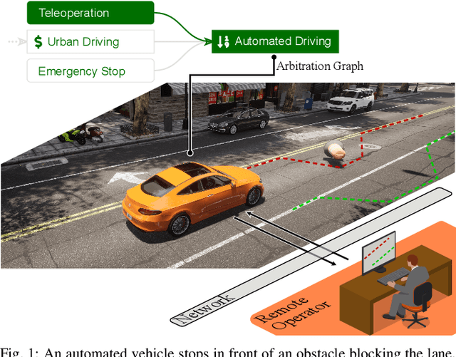

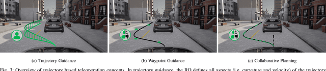
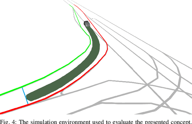
Teleoperation enables remote human support of automated vehicles in scenarios where the automation is not able to find an appropriate solution. Remote assistance concepts, where operators provide discrete inputs to aid specific automation modules like planning, is gaining interest due to its reduced workload on the human remote operator and improved safety. However, these concepts are challenging to implement and maintain due to their deep integration and interaction with the automated driving system. In this paper, we propose a solution to facilitate the implementation of remote assistance concepts that intervene on planning level and extend the operational design domain of the vehicle at runtime. Using arbitration graphs, a modular decision-making framework, we integrate remote assistance into an existing automated driving system without modifying the original software components. Our simulative implementation demonstrates this approach in two use cases, allowing operators to adjust planner constraints and enable trajectory generation beyond nominal operational design domains.