 Add to Chrome
 Add to Firefox
 Add to Edge
NavWAM: A Navigation World Action Model for Goal-Conditioned Visual Navigation
Jun 11, 2026
Goal-conditioned visual navigation requires a robot to act under partial observability by anticipating how its motion will change the future egocentric view and whether that change brings it closer to the goal. Navigation world models provide such visual foresight, but they remain prediction modules that require an external planner to convert predicted futures into closed-loop control. We propose Navigation World Action Model (NavWAM), a diffusion-transformer policy that turns navigation world-model prediction into executable action by representing future observations, goal-progress values, and action chunks in a shared latent sequence. By learning future prediction jointly with the action and value targets that determine closed-loop behavior, NavWAM makes visual foresight directly usable for robot control. We build NavWAM through simulation pretraining and real-robot adaptation, and evaluate it on image-goal navigation against planning-based world models and a representative direct navigation policy. Across offline benchmarks and closed-loop real-robot deployment, NavWAM improves over planning-based world-model baselines in our evaluations while using the default policy mode without CEM-style action search. Project page: https://dachii-azm.github.io/navwam/

UAV/UGV Autonomous Cooperation: UAV Assists UGV to Climb a Cliff by Attaching a Tether
Mar 12, 2019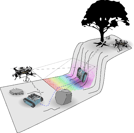
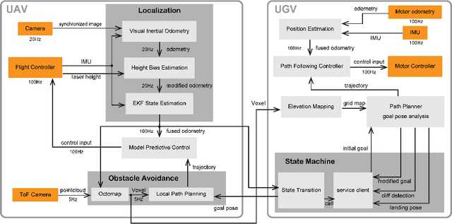
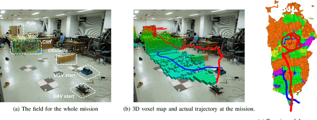
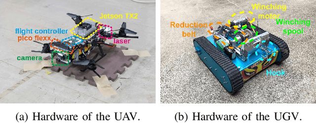
This paper proposes a novel cooperative system for an Unmanned Aerial Vehicle (UAV) and an Unmanned Ground Vehicle (UGV) which utilizes the UAV not only as a flying sensor but also as a tether attachment device. Two robots are connected with a tether, allowing the UAV to anchor the tether to a structure located at the top of a steep terrain, impossible to reach for UGVs. Thus, enhancing the poor traversability of the UGV by not only providing a wider range of scanning and mapping from the air, but also by allowing the UGV to climb steep terrains with the winding of the tether. In addition, we present an autonomous framework for the collaborative navigation and tether attachment in an unknown environment. The UAV employs visual inertial navigation with 3D voxel mapping and obstacle avoidance planning. The UGV makes use of the voxel map and generates an elevation map to execute path planning based on a traversability analysis. Furthermore, we compared the pros and cons of possible methods for the tether anchoring from multiple points of view. To increase the probability of successful anchoring, we evaluated the anchoring strategy with an experiment. Finally, the feasibility and capability of our proposed system were demonstrated by an autonomous mission experiment in the field with an obstacle and a cliff.