 Add to Chrome
 Add to Firefox
 Add to Edge
IMPA-Net: Meteorology-Aware Multi-Scale Attention and Dynamic Loss for Extreme Convective Radar Nowcasting
Apr 27, 2026
Short-range prediction of convective precipitation from weather radar observations is essential for severe weather warnings. However, deep learning models trained with pixel-wise error metrics tend to produce overly smooth forecasts that suppress intense echoes critical for hazard detection. This issue is exacerbated by insufficient multi-scale feature interaction and suboptimal fusion of heterogeneous geophysical inputs. We propose IMPA-Net (Integrated Multi-scale Predictive Attention Network), a deterministic 0-2 hour nowcasting framework that addresses these limitations through meteorologically-informed designs at the input, architecture, and loss function levels. A parameter-free Spatial Mixer reorganizes heterogeneous input channels at the mesoscale-$γ$ neighborhood (~2 km) via deterministic channel permutation, providing a structured cross-field prior. An integrated multi-scale predictive attention module serves as the spatiotemporal translator, capturing dynamics from mesoscale-$β$ to mesoscale-$γ$ scales. A Meteorologically-Aware Dynamic Loss employs three-level asymmetric weighting -- adapting across training epochs, storm intensity, and forecast lead time -- to counteract regression-to-the-mean. Evaluated against seven baselines on a multi-source radar dataset over eastern China, IMPA-Net raises the Heidke Skill Score at $\geq$45 dBZ from 0.049 (SimVP baseline) to 0.143 under matched settings. Relative to pySTEPS, it provides a better trade-off between severe-event detection and false-alarm control. Spectral analysis confirms preserved energy across mesoscale bands where competing methods show progressive smoothing. These improvements are shown within a single domain and convective regime; generalizability to other orographic and climatic regions remains to be tested.

Convolutional Neural Network for Convective Storm Nowcasting Using 3D Doppler Weather Radar Data
Nov 14, 2019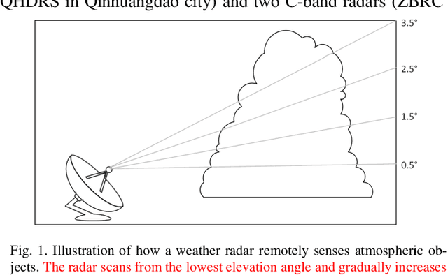
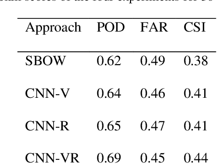
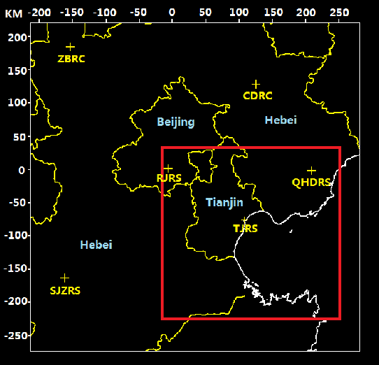
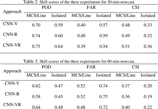
Convective storms are one of the severe weather hazards found during the warm season. Doppler weather radar is the only operational instrument that can frequently sample the detailed structure of convective storm which has a small spatial scale and short lifetime. For the challenging task of short-term convective storm forecasting, 3-D radar images contain information about the processes in convective storm. However, effectively extracting such information from multisource raw data has been problematic due to a lack of methodology and computation limitations. Recent advancements in deep learning techniques and graphics processing units now make it possible. This article investigates the feasibility and performance of an end-to-end deep learning nowcasting method. The nowcasting problem was transformed into a classification problem first, and then, a deep learning method that uses a convolutional neural network was presented to make predictions. On the first layer of CNN, a cross-channel 3D convolution was proposed to fuse 3D raw data. The CNN method eliminates the handcrafted feature engineering, i.e., the process of using domain knowledge of the data to manually design features. Operationally produced historical data of the Beijing-Tianjin-Hebei region in China was used to train the nowcasting system and evaluate its performance; 3737332 samples were collected in the training data set. The experimental results show that the deep learning method improves nowcasting skills compared with traditional machine learning methods.
Application of Multi-channel 3D-cube Successive Convolution Network for Convective Storm Nowcasting
Mar 02, 2017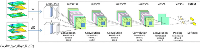
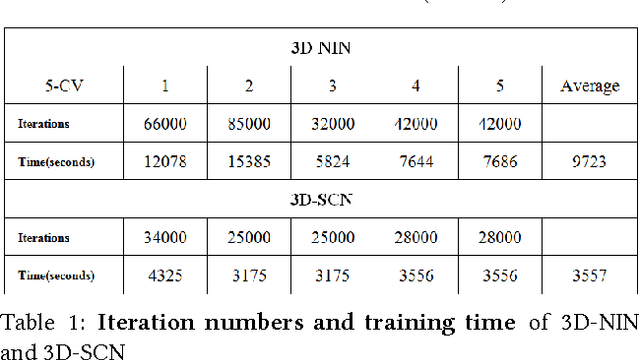
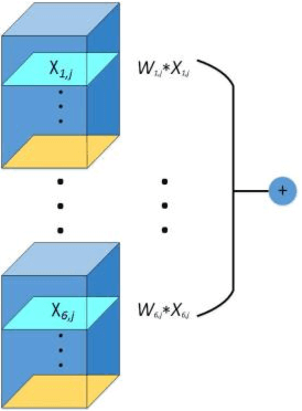
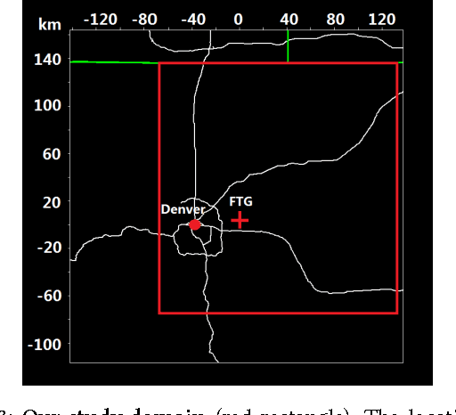
Convective storm nowcasting has attracted substantial attention in various fields. Existing methods under a deep learning framework rely primarily on radar data. Although they perform nowcast storm advection well, it is still challenging to nowcast storm initiation and growth, due to the limitations of the radar observations. This paper describes the first attempt to nowcast storm initiation, growth, and advection simultaneously under a deep learning framework using multi-source meteorological data. To this end, we present a multi-channel 3D-cube successive convolution network (3D-SCN). As real-time re-analysis meteorological data can now provide valuable atmospheric boundary layer thermal dynamic information, which is essential to predict storm initiation and growth, both raw 3D radar and re-analysis data are used directly without any handcraft feature engineering. These data are formulated as multi-channel 3D cubes, to be fed into our network, which are convolved by cross-channel 3D convolutions. By stacking successive convolutional layers without pooling, we build an end-to-end trainable model for nowcasting. Experimental results show that deep learning methods achieve better performance than traditional extrapolation methods. The qualitative analyses of 3D-SCN show encouraging results of nowcasting of storm initiation, growth, and advection.