 Add to Chrome
 Add to Firefox
 Add to Edge
Efficient Cross-View Localization in 6G Space-Air-Ground Integrated Network
Mar 12, 2026Recently, visual localization has become an important supplement to improve localization reliability, and cross-view approaches can greatly enhance coverage and adaptability. Meanwhile, future 6G will enable a globally covered mobile communication system, with a space-air-ground integrated network (SAGIN) serving as key supporting architecture. Inspired by this, we explore an integration of cross-view localization (CVL) with 6G SAGIN, thereby enhancing its performance in latency, energy consumption, and privacy protection. First, we provide a comprehensive review of CVL and SAGIN, highlighting their capabilities, integration opportunities, and potential applications. Benefiting from the fast and extensive image collection and transmission capabilities of the 6G SAGIN architecture, CVL achieves higher localization accuracy and faster processing speed. Then, we propose a split-inference framework for implementing CVL, which fully leverages the distributed communication and computing resources of the 6G SAGIN architecture. Subsequently, we conduct joint optimization of communication, computation, and confidentiality within the proposed split-inference framework, aiming to provide a paradigm and a direction for making CVL efficient. Experimental results validate the effectiveness of the proposed framework and provide solutions to the optimization problem. Finally, we discuss potential research directions for 6G SAGIN-enabled CVL.
Vision-Based UAV Localization System in Denial Environments
Jan 23, 2022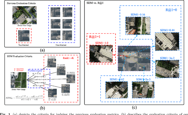
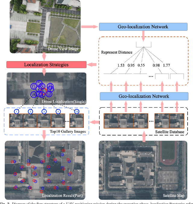
Unmanned Aerial Vehicle (UAV) localization capability is critical in a Global Navigation Satellite System (GNSS) denial environment. The aim of this paper is to investigate the problem of locating the UAV itself through a purely visual approach. This task mainly refers to: matching the corresponding geo-tagged satellite images through the images acquired by the camera when the UAV does not acquire GNSS signals, where the satellite images are the bridge between the UAV images and the location information. However, the sampling points of previous cross-view datasets based on UAVs are discrete in spatial distribution and the inter-class relationships are not established. In the actual process of UAV-localization, the inter-class feature similarity of the proximity position distribution should be small due to the continuity of UAV movement in space. In view of this, this paper has reformulated an intensive dataset for UAV positioning tasks, which is named DenseUAV, aiming to solve the problems caused by spatial distance and scale transformation in practical application scenarios, so as to achieve high-precision UAV-localization in GNSS denial environment. In addition, a new continuum-type evaluation metric named SDM is designed to evaluate the accuracy of model matching by exploiting the continuum of UAVs in space. Specifically, with the ideas of siamese networks and metric learning, a transformer-based baseline was constructed to enhance the capture of spatially subtle features. Ultimately, a neighbor-search post-processing strategy was proposed to solve the problem of large distance localisation bias.