 Add to Chrome
 Add to Firefox
 Add to Edge
DAPM: UAV Monocular Depth Estimation from Any Height, Pitch, Roll and FOV
Jul 23, 2026
Monocular depth estimation is a fundamental prerequisite for 3D reconstruction and autonomous navigation in Unmanned Aerial Vehicles (UAVs). In practical deployments, UAVs operate under highly dynamic camera poses characterized by continuous variations in height, pitch, roll, and field of view (FOV). Existing monocular depth estimation methods frequently fail to generalize across such diverse perspectives and the expansive scale of depth distributions inherent in aerial scenes. To address these challenges, we establish a quantitative representation of UAV viewing angles through rigorous theoretical analysis, deriving the geometric correspondence between viewing angles and view distances using the ground plane as a reference for observation. Building upon this, we propose Depth Estimation for Any Perspectives Model (DAPM), representing the first monocular framework specifically designed for UAV aerial imagery to jointly estimate camera pose and depth under continuously varying viewpoints. Specifically, we introduce an Ideal Ground Depth (IGD) module that leverages the derived geometric relationships between UAV perspectives and view distances to implement dense camera-pose supervision and enhance depth features. And we further develop a coarse-to-fine Progressive Quantization Bins (PQB) module. By incorporating progressive supervision and hierarchical quantization bins, the PQB module enables robust estimation in complex UAV aerial imagery. To evaluate the proposed framework, we present the UAV Any Perspectives Depth (UAPD) dataset, featuring comprehensive and continuous distributions of pose parameters. Experimental results on UAPD demonstrate that DAPM achieves state-of-the-art performance across both depth and camera-pose estimation metrics. The source code and datasets are available at: https://github.com/ThisIsLT/DAPM.

ReCon1M:A Large-scale Benchmark Dataset for Relation Comprehension in Remote Sensing Imagery
Jun 10, 2024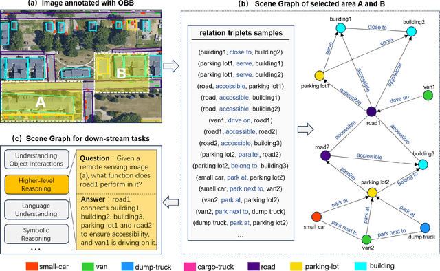
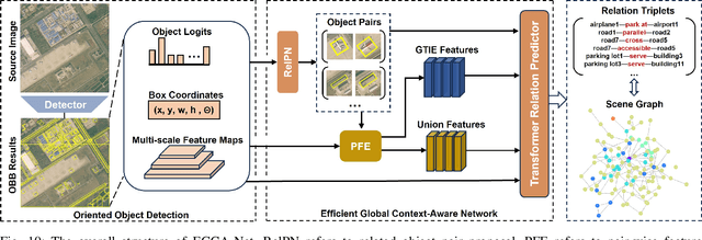
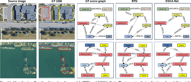
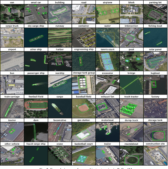
Scene Graph Generation (SGG) is a high-level visual understanding and reasoning task aimed at extracting entities (such as objects) and their interrelationships from images. Significant progress has been made in the study of SGG in natural images in recent years, but its exploration in the domain of remote sensing images remains very limited. The complex characteristics of remote sensing images necessitate higher time and manual interpretation costs for annotation compared to natural images. The lack of a large-scale public SGG benchmark is a major impediment to the advancement of SGG-related research in aerial imagery. In this paper, we introduce the first publicly available large-scale, million-level relation dataset in the field of remote sensing images which is named as ReCon1M. Specifically, our dataset is built upon Fair1M and comprises 21,392 images. It includes annotations for 859,751 object bounding boxes across 60 different categories, and 1,149,342 relation triplets across 64 categories based on these bounding boxes. We provide a detailed description of the dataset's characteristics and statistical information. We conducted two object detection tasks and three sub-tasks within SGG on this dataset, assessing the performance of mainstream methods on these tasks.