 Add to Chrome
 Add to Firefox
 Add to Edge
AI based signage classification for linguistic landscape studies
Oct 27, 2025Linguistic Landscape (LL) research traditionally relies on manual photography and annotation of public signages to examine distribution of languages in urban space. While such methods yield valuable findings, the process is time-consuming and difficult for large study areas. This study explores the use of AI powered language detection method to automate LL analysis. Using Honolulu Chinatown as a case study, we constructed a georeferenced photo dataset of 1,449 images collected by researchers and applied AI for optical character recognition (OCR) and language classification. We also conducted manual validations for accuracy checking. This model achieved an overall accuracy of 79%. Five recurring types of mislabeling were identified, including distortion, reflection, degraded surface, graffiti, and hallucination. The analysis also reveals that the AI model treats all regions of an image equally, detecting peripheral or background texts that human interpreters typically ignore. Despite these limitations, the results demonstrate the potential of integrating AI-assisted workflows into LL research to reduce such time-consuming processes. However, due to all the limitations and mis-labels, we recognize that AI cannot be fully trusted during this process. This paper encourages a hybrid approach combining AI automation with human validation for a more reliable and efficient workflow.
An optimal sensors-based simulation method for spatiotemporal event detection
Aug 16, 2022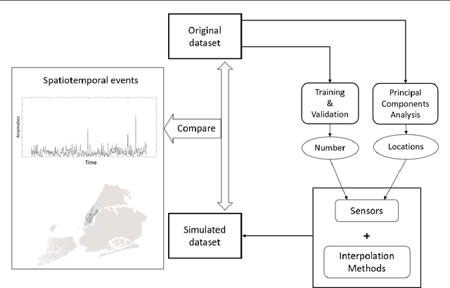
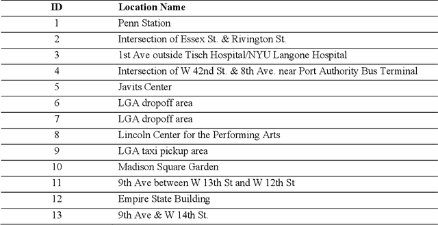
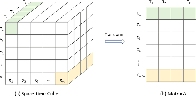
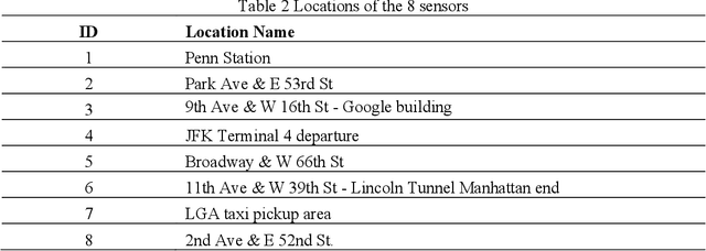
Human movements in urban areas are essential for understanding the human-environment interactions. However, activities and associated movements are full of uncertainties due to the complexity of a city. In this paper, we propose an optimal sensors-based simulation method for spatiotemporal event detection using human activity signals derived from taxi trip data. A sensor here is an abstract concept such that only the true observation data at the sensor location will be treated as known data for the simulation. Specifically, we first identify the optimal number of sensors and their locations that have the strongest correlation with the whole dataset. The observation data points from these sensors are then used to simulate a regular, uneventful scenario using the Discrete Empirical Interpolation Method. By comparing the simulated and observation scenarios, events are extracted both spatially and temporally. We apply this method in New York City with taxi trip records data. Results show that this method is effective in detecting when and where events occur.