 Add to Chrome
 Add to Firefox
 Add to Edge
Balancing multiscale similarity and cartographic constraints: A similarity-driven optimization framework for line generalization
Jul 28, 2026
Cartographic generalization is essential for generating multiscale map representations by balancing information preservation and cartographic readability. However, automated generalization remains challenging because existing approaches often treat spatial similarity evaluation, cartographic constraints, and parameter optimization as separate processes, limiting adaptive and interpretable control across scales. This study formulates cartographic generalization as a constrained multiscale similarity optimization problem and proposes a similarity-driven framework for adaptive generalization control. The framework integrates multiscale spatial similarity as an optimization objective to quantify representation consistency between original and generalized data, while incorporating cartographic constraints to regulate readability, smoothness, and geometric validity. A unified objective function is optimized to automatically identify scale-dependent parameter configurations for different generalization algorithms. Experiments using multiple line simplification algorithms, target scales, and similarity measures, including geometric, structural, and learning-based metrics, demonstrate that the proposed framework achieves an effective balance between similarity preservation and cartographic abstraction. The results further show that combining similarity optimization with cartographic constraints provides more consistent and interpretable parameter control than relying on similarity evaluation alone. This study provides a unified optimization perspective that connects similarity assessment, constraint modeling, and algorithm control, contributing to adaptive and automated cartographic generalization.

Significant Wave Height Prediction based on Wavelet Graph Neural Network
Jul 20, 2021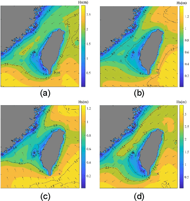
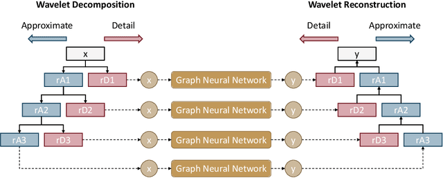
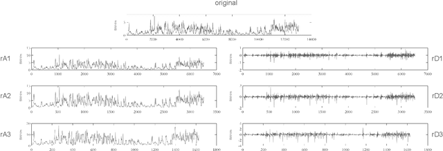
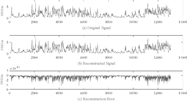
Computational intelligence-based ocean characteristics forecasting applications, such as Significant Wave Height (SWH) prediction, are crucial for avoiding social and economic loss in coastal cities. Compared to the traditional empirical-based or numerical-based forecasting models, "soft computing" approaches, including machine learning and deep learning models, have shown numerous success in recent years. In this paper, we focus on enabling the deep learning model to learn both short-term and long-term spatial-temporal dependencies for SWH prediction. A Wavelet Graph Neural Network (WGNN) approach is proposed to integrate the advantages of wavelet transform and graph neural network. Several parallel graph neural networks are separately trained on wavelet decomposed data, and the reconstruction of each model's prediction forms the final SWH prediction. Experimental results show that the proposed WGNN approach outperforms other models, including the numerical models, the machine learning models, and several deep learning models.