 Add to Chrome
 Add to Firefox
 Add to Edge
MMUSV-Sim: A Perception-Oriented Simulation and Data-Generation Platform for Multi-USV Cooperative Perception
Aug 14, 2026
Cooperative perception among multiple unmanned surface vehicles (USVs) combines complementary observations to extend maritime target sensing beyond the view range and field of a single platform. Developing such systems at scale calls for a unified workflow for configurable multi-USV scenarios, multimodal acquisition, and shared annotations. We present MMUSV-Sim, a perception-oriented maritime simulation and data-generation platform built on Unreal Engine 5 and Project AirSim. It provides island, open-sea, and port environments; configurable weather, time of day, and wave conditions; a diverse vessel asset library; and spline-based multi-vessel motion. MMUSV-Sim acquires RGB, depth, semantic, LiDAR, and radar observations across multiple USVs and captures a common world state for per-agent annotation export. Experiments verify that the configured wave settings produce the intended changes in vessel heave, roll, and pitch, and evaluate the geometric consistency between projected annotations and semantic renderings. In LiDAR-based cooperative BEV vessel detection experiments on the generated multi-USV dataset, Early Fusion achieves an AP@0.5 of 72.74, compared with 45.54 using a single USV.

U2UData: A Large-scale Cooperative Perception Dataset for Swarm UAVs Autonomous Flight
Aug 05, 2024
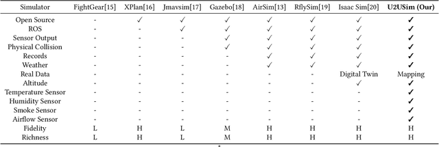
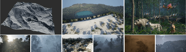
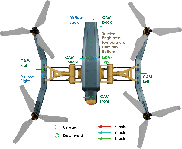
Modern perception systems for autonomous flight are sensitive to occlusion and have limited long-range capability, which is a key bottleneck in improving low-altitude economic task performance. Recent research has shown that the UAV-to-UAV (U2U) cooperative perception system has great potential to revolutionize the autonomous flight industry. However, the lack of a large-scale dataset is hindering progress in this area. This paper presents U2UData, the first large-scale cooperative perception dataset for swarm UAVs autonomous flight. The dataset was collected by three UAVs flying autonomously in the U2USim, covering a 9 km$^2$ flight area. It comprises 315K LiDAR frames, 945K RGB and depth frames, and 2.41M annotated 3D bounding boxes for 3 classes. It also includes brightness, temperature, humidity, smoke, and airflow values covering all flight routes. U2USim is the first real-world mapping swarm UAVs simulation environment. It takes Yunnan Province as the prototype and includes 4 terrains, 7 weather conditions, and 8 sensor types. U2UData introduces two perception tasks: cooperative 3D object detection and cooperative 3D object tracking. This paper provides comprehensive benchmarks of recent cooperative perception algorithms on these tasks.