 Add to Chrome
 Add to Firefox
 Add to Edge
One-Stage Object Detectors in Autonomous Driving
Aug 19, 2026
Autonomous vehicles depend on fast and reliable perception systems to detect surrounding vehicles, pedestrians, cyclists, traffic signs, and other road objects in real time. This paper presents a comprehensive survey and analysis of one-stage object detectors for autonomous driving rather than an implementation of a new detection system. The survey reviews the evolution of major one-stage detectors, including YOLOv1, SSD, RetinaNet, EfficientDet, anchor-free detectors such as FCOS and CenterNet, and recent real-time models such as YOLOv10. It compares these architectures through their design choices, feature-fusion strategies, loss functions, deployment trade-offs, and reported benchmark performance. The paper also summarizes commonly used autonomous-driving datasets, evaluation metrics, open challenges, and future research directions. Overall, this survey highlights how one-stage detectors balance speed, accuracy, efficiency, and robustness, while also emphasizing the remaining gap between benchmark results and dependable real-world autonomous-driving performance.

Autonomous Agricultural Tractor: Integrated Weed Detection and LiDAR Navigation for Precision Paddy Farming
Aug 19, 2026Site-specific weed management in paddy farming offers substantial reductions in herbicide use over conventional broadcast spraying, but field deployment has been limited by three persistent challenges: robust crop-row navigation under canopy where GNSS degrades, real-time visual discrimination between rice and morphologically diverse weeds, and the asymmetric cost of misclassifying rice as weed, which is irreversible. This paper presents AgriNav, an integrated autonomous tractor system built around four ROS-coupled modules: a custom PyTorch reimplementation of WeedDet for rice detection, a parallel lightweight 1.68M-parameter CNN-FPN variant with asymmetric class weighting, an inverted-logic discrimination module that protects the rice class through a hardcoded confidence-gate veto, and a 6-state constant-velocity-turn-rate Extended Kalman Filter fusing GNSS, IMU, and wheel odometry with three-level outage bridging. Our primary system-level contribution is a four-mechanism LiDAR-camera fusion bridge that uses the navigation LiDAR for region-of-interest constraint, world-coordinate projection, ground-plane filtering, and bidirectional confidence fusion at zero additional hardware cost. Simulation experiments demonstrate continuous position tracking through a 20-second GNSS outage, crop row detection confidence above 0.9 throughout operation, and rice-detection confidences from 0.32 to 0.95 across paddy, aerial, and post-flood imagery. The LiDAR ROI constraint reduces detection inference region by an estimated 30 to 50 percent.
Real-time Motion Planning for autonomous vehicles in dynamic environments
Jun 05, 2024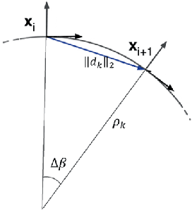
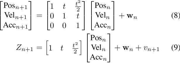
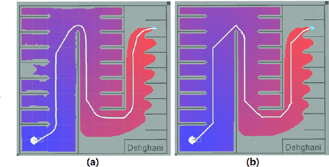
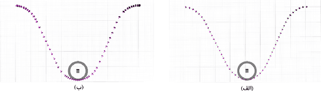
Recent advancements in self-driving car technologies have enabled them to navigate autonomously through various environments. However, one of the critical challenges in autonomous vehicle operation is trajectory planning, especially in dynamic environments with moving obstacles. This research aims to tackle this challenge by proposing a robust algorithm tailored for autonomous cars operating in dynamic environments with moving obstacles. The algorithm introduces two main innovations. Firstly, it defines path density by adjusting the number of waypoints along the trajectory, optimizing their distribution for accuracy in curved areas and reducing computational complexity in straight sections. Secondly, it integrates hierarchical motion planning algorithms, combining global planning with an enhanced $A^*$ graph-based method and local planning using the time elastic band algorithm with moving obstacle detection considering different motion models. The proposed algorithm is adaptable for different vehicle types and mobile robots, making it versatile for real-world applications. Simulation results demonstrate its effectiveness across various conditions, promising safer and more efficient navigation for autonomous vehicles in dynamic environments. These modifications significantly improve trajectory planning capabilities, addressing a crucial aspect of autonomous vehicle technology.
VirtualPainting: Addressing Sparsity with Virtual Points and Distance-Aware Data Augmentation for 3D Object Detection
Dec 26, 2023In recent times, there has been a notable surge in multimodal approaches that decorates raw LiDAR point clouds with camera-derived features to improve object detection performance. However, we found that these methods still grapple with the inherent sparsity of LiDAR point cloud data, primarily because fewer points are enriched with camera-derived features for sparsely distributed objects. We present an innovative approach that involves the generation of virtual LiDAR points using camera images and enhancing these virtual points with semantic labels obtained from image-based segmentation networks to tackle this issue and facilitate the detection of sparsely distributed objects, particularly those that are occluded or distant. Furthermore, we integrate a distance aware data augmentation (DADA) technique to enhance the models capability to recognize these sparsely distributed objects by generating specialized training samples. Our approach offers a versatile solution that can be seamlessly integrated into various 3D frameworks and 2D semantic segmentation methods, resulting in significantly improved overall detection accuracy. Evaluation on the KITTI and nuScenes datasets demonstrates substantial enhancements in both 3D and birds eye view (BEV) detection benchmarks
Facial Emotion Recognition using CNN in PyTorch
Dec 17, 2023In this project, we have implemented a model to recognize real-time facial emotions given the camera images. Current approaches would read all data and input it into their model, which has high space complexity. Our model is based on the Convolutional Neural Network utilizing the PyTorch library. We believe our implementation will significantly improve the space complexity and provide a useful contribution to facial emotion recognition. Our motivation is to understanding clearly about deep learning, particularly in CNNs, and analysis real-life scenarios. Therefore, we tunned the hyper parameter of model such as learning rate, batch size, and number of epochs to meet our needs. In addition, we also used techniques to optimize the networks, such as activation function, dropout and max pooling. Finally, we analyzed the result from two optimizer to observe the relationship between number of epochs and accuracy.