 Add to Chrome
 Add to Firefox
 Add to Edge
SEG-JPEG: Simple Visual Semantic Communications for Remote Operation of Automated Vehicles over Unreliable Wireless Networks
Feb 16, 2026Remote Operation is touted as being key to the rapid deployment of automated vehicles. Streaming imagery to control connected vehicles remotely currently requires a reliable, high throughput network connection, which can be limited in real-world remote operation deployments relying on public network infrastructure. This paper investigates how the application of computer vision assisted semantic communication can be used to circumvent data loss and corruption associated with traditional image compression techniques. By encoding the segmentations of detected road users into colour coded highlights within low resolution greyscale imagery, the required data rate can be reduced by 50 \% compared with conventional techniques, while maintaining visual clarity. This enables a median glass-to-glass latency of below 200ms even when the network data rate is below 500kbit/s, while clearly outlining salient road users to enhance situational awareness of the remote operator. The approach is demonstrated in an area of variable 4G mobile connectivity using an automated last-mile delivery vehicle. With this technique, the results indicate that large-scale deployment of remotely operated automated vehicles could be possible even on the often constrained public 4G/5G mobile network, providing the potential to expedite the nationwide roll-out of automated vehicles.
Simulating Malicious Attacks on VANETs for Connected and Autonomous Vehicle Cybersecurity: A Machine Learning Dataset
Feb 15, 2022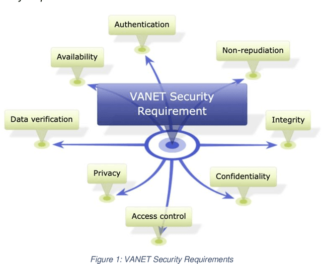
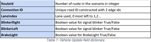
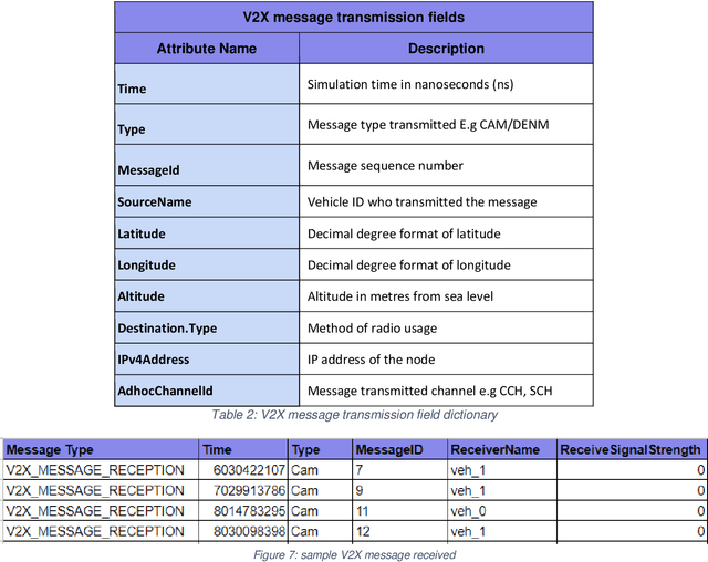
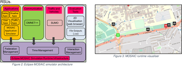
Connected and Autonomous Vehicles (CAVs) rely on Vehicular Adhoc Networks with wireless communication between vehicles and roadside infrastructure to support safe operation. However, cybersecurity attacks pose a threat to VANETs and the safe operation of CAVs. This study proposes the use of simulation for modelling typical communication scenarios which may be subject to malicious attacks. The Eclipse MOSAIC simulation framework is used to model two typical road scenarios, including messaging between the vehicles and infrastructure - and both replay and bogus information cybersecurity attacks are introduced. The model demonstrates the impact of these attacks, and provides an open dataset to inform the development of machine learning algorithms to provide anomaly detection and mitigation solutions for enhancing secure communications and safe deployment of CAVs on the road.
Crowdsourcing On-street Parking Space Detection
Mar 01, 2016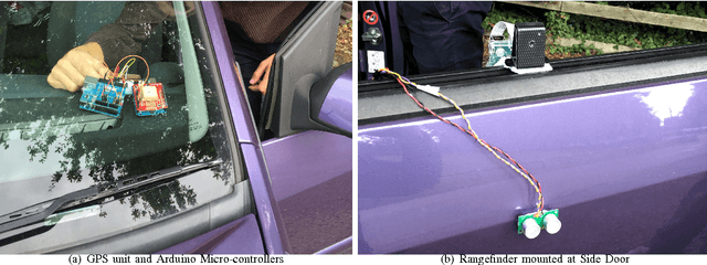
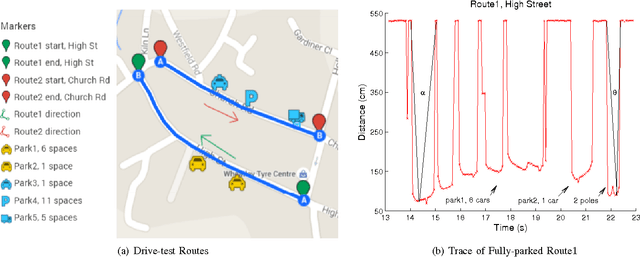
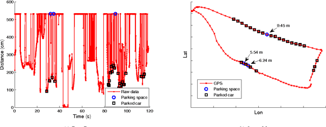
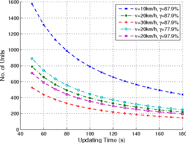
As the number of vehicles continues to grow, parking spaces are at a premium in city streets. Additionally, due to the lack of knowledge about street parking spaces, heuristic circling the blocks not only costs drivers' time and fuel, but also increases city congestion. In the wake of recent trend to build convenient, green and energy-efficient smart cities, we rethink common techniques adopted by high-profile smart parking systems, and present a user-engaged (crowdsourcing) and sonar-based prototype to identify urban on-street parking spaces. The prototype includes an ultrasonic sensor, a GPS receiver and associated Arduino micro-controllers. It is mounted on the passenger side of a car to measure the distance from the vehicle to the nearest roadside obstacle. Multiple road tests are conducted around Wheatley, Oxford to gather results and emulate the crowdsourcing approach. By extracting parked vehicles' features from the collected trace, a supervised learning algorithm is developed to estimate roadside parking occupancy and spot illegal parking vehicles. A quantity estimation model is derived to calculate the required number of sensing units to cover urban streets. The estimation is quantitatively compared to a fixed sensing solution. The results show that the crowdsourcing way would need substantially fewer sensors compared to the fixed sensing system.