 Add to Chrome
 Add to Firefox
 Add to Edge
Model-Based Systems Engineering Framework for SysML-Driven Design of Autonomous UAVs
Aug 10, 2026
Autonomous Unmanned Aerial Vehicles (UAVs) are complex cyber-physical systems that require the coordinated integration of flight control, navigation, perception, communication, power management, and mission-level decision-making under safety, timing, and reliability constraints. However, many autonomous UAV development workflows still rely on document-centric requirements, separated architectural descriptions, and software implementation artifacts, which can lead to ambiguity, interface inconsistencies, and weak traceability during early design. This paper presents a Model-Based Systems Engineering (MBSE) design framework for the SysML-driven development of autonomous UAVs. The proposed framework uses the Systems Modeling Language (SysML) as a formal design backbone to structure UAV development across four connected layers: stakeholder requirements, functional decomposition, logical architecture, and physical/software allocation. SysML requirement diagrams, activity diagrams, block definition diagrams, internal block diagrams, state machine diagrams, and parametric diagrams are used to capture the functional, structural, behavioral, interface, and performance aspects of the UAV system. The logical architecture is then systematically mapped to a Robot Operating System 2 (ROS 2) software architecture by relating SysML blocks to ROS 2 nodes, flow ports and connectors to topics, request-response interactions to services, and goal-oriented behaviors to actions. The framework is illustrated at the design level using representative autonomous UAV mission scenarios, including autonomous take-off, waypoint navigation, hover stabilization, obstacle avoidance, return-to-home, and emergency handling. The resulting model supports requirement allocation, interface definition, subsystem responsibility assignment, and verification planning before simulation or physical deployment.

Hierarchical Object Representation for Spatial Robot Perception: Points, Meshes, and Superquadrics
Jun 01, 2026Hierarchical 3D Scene Graphs (3DSG) have emerged as an actionable and scalable representation for long-term autonomy incorporating metric, semantic, and topological information in the scene. However, the question of geometric representation of objects in 3DSG has been overlooked as most methods use simplified geometric models such as partial point clouds or 3D bounding boxes. In this work, we introduce a hierarchical object representation that can be leveraged for high-fidelity object-level reconstruction, object-based robust re-localization or map alignment, and efficient and analytical collision checking for safe robot navigation planning in dense and cluttered environments. The representation is structurally organized into four distinct layers, progressively abstracting the scene from raw sensor data to dense 3D meshes to analytical primitives such as superquadrics, which provide a sparse and analytical representation for object geometry. We develop a pipeline that builds the hierarchical object representation from RGB-D image stream captured by a robot, and demonstrate its working in real-world open-set object scenes in both indoor and outdoor environments. Extensive experiments across diverse datasets including HOPE, ReplicaCAD, Kimera-Multi, and NUS Campus Dataset collected using Unitree B2 Robot validate our pipeline in both indoor and outdoor environments. We show that our superquadric-based map alignment method outperforms the current state-of-the-art object based map alignment method ROMAN. Our code can be found at https://github.com/perceptica-robotics/Hickory.
UNet: A Generic and Reliable Multi-UAV Communication and Networking Architecture for Heterogeneous Applications
Nov 05, 2024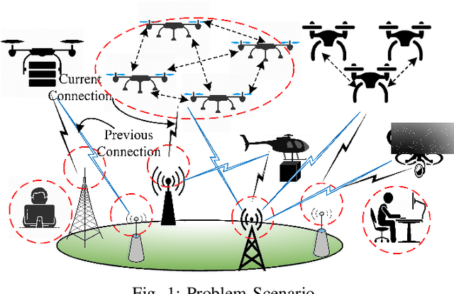
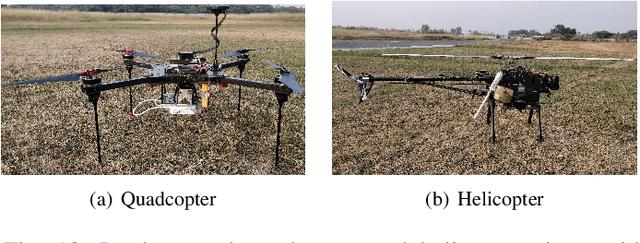
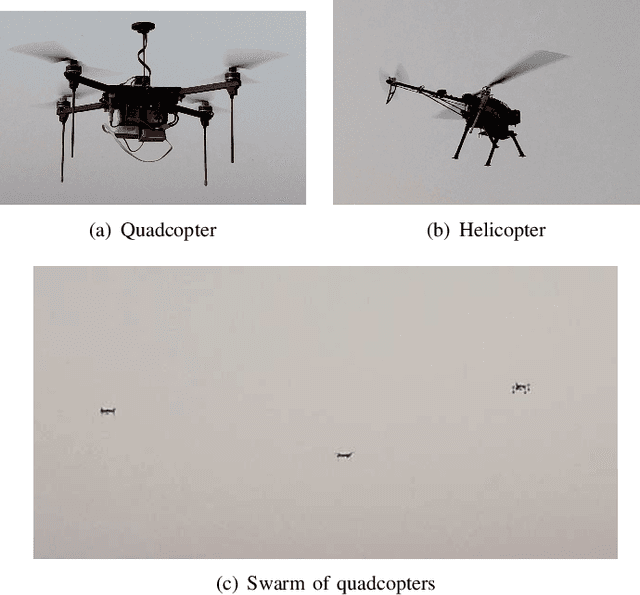
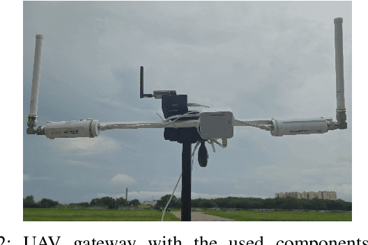
The rapid growth of UAV applications necessitates a robust communication and networking architecture capable of addressing the diverse requirements of various applications concurrently, rather than relying on application-specific solutions. This paper proposes a generic and reliable multi-UAV communication and networking architecture designed to support the varying demands of heterogeneous applications, including short-range and long-range communication, star and mesh topologies, different data rates, and multiple wireless standards. Our architecture accommodates both adhoc and infrastructure networks, ensuring seamless connectivity throughout the network. Additionally, we present the design of a multi-protocol UAV gateway that enables interoperability among various communication protocols. Furthermore, we introduce a data processing and service layer framework with a graphical user interface of a ground control station that facilitates remote control and monitoring from any location at any time. We practically implemented the proposed architecture and evaluated its performance using different metrics, demonstrating its effectiveness.
Communication and Energy-Aware Multi-UAV Coverage Path Planning for Networked Operations
Nov 05, 2024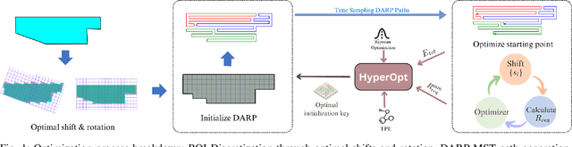
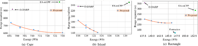
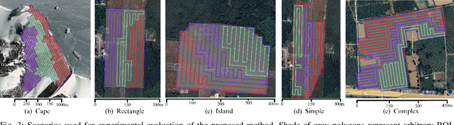

This paper presents a communication and energy-aware Multi-UAV Coverage Path Planning (mCPP) method for scenarios requiring continuous inter-UAV communication, such as cooperative search and rescue and surveillance missions. Unlike existing mCPP solutions that focus on energy, time, or coverage efficiency, our approach generates coverage paths that require minimal the communication range to maintain inter-UAV connectivity while also optimizing energy consumption. The mCPP problem is formulated as a multi-objective optimization task, aiming to minimize both the communication range requirement and energy consumption. Our approach significantly reduces the communication range needed for maintaining connectivity while ensuring energy efficiency, outperforming state-of-the-art methods. Its effectiveness is validated through simulations on complex and arbitrary shaped regions of interests, including scenarios with no-fly zones. Additionally, real-world experiment demonstrate its high accuracy, achieving 99\% consistency between the estimated and actual communication range required during a multi-UAV coverage mission involving three UAVs.