 Add to Chrome
 Add to Firefox
 Add to Edge
Overhead Detection: Beyond 8-bits and RGB
Aug 07, 2018
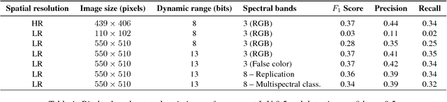
This study uses the challenging and publicly available SpaceNet dataset to establish a performance baseline for a state-of-the-art object detector in satellite imagery. Specifically, we examine how various features of the data affect building detection accuracy with respect to the Intersection over Union metric. We demonstrate that the performance of the R-FCN detection algorithm on imagery with a 1.5 meter ground sample distance and three spectral bands increases by over 32% by using 13-bit data, as opposed to 8-bit data at the same spatial and spectral resolution. We also establish accuracy trends with respect to building size and scene density. Finally, we propose and evaluate multiple methods for integrating additional spectral information into off-the-shelf deep learning architectures. Interestingly, our methods are robust to the choice of spectral bands and we note no significant performance improvement when adding additional bands.
* 10 pages, 8 figures, 2 tables
xView: Objects in Context in Overhead Imagery
Feb 22, 2018
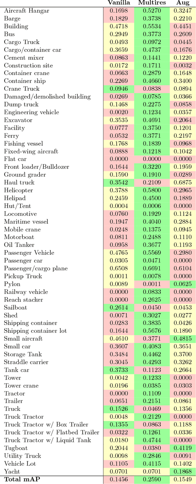
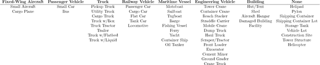
We introduce a new large-scale dataset for the advancement of object detection techniques and overhead object detection research. This satellite imagery dataset enables research progress pertaining to four key computer vision frontiers. We utilize a novel process for geospatial category detection and bounding box annotation with three stages of quality control. Our data is collected from WorldView-3 satellites at 0.3m ground sample distance, providing higher resolution imagery than most public satellite imagery datasets. We compare xView to other object detection datasets in both natural and overhead imagery domains and then provide a baseline analysis using the Single Shot MultiBox Detector. xView is one of the largest and most diverse publicly available object-detection datasets to date, with over 1 million objects across 60 classes in over 1,400 km^2 of imagery.