 Add to Chrome
 Add to Firefox
 Add to Edge
TRIG: Trajectory-Rig Decoupled Metric Geometry Learning
Jul 07, 2026
Vision-centric autonomous driving requires accurate metric geometry and ego-motion estimation from synchronized multi-camera observations. Recent visual geometry models show strong performance in pose estimation, depth prediction, and 3D reconstruction, but are not tailored to rigid multi-camera driving systems. They often encode camera poses as entangled representations, in which time-varying ego-motion and static camera-rig geometry are jointly modeled, limiting the utilization of vehicle-side geometric priors. We propose Trajectory-Rig Decoupled Metric Geometry Learning (TRIG), a geometry perception framework for autonomous driving. TRIG factorizes camera poses into ego-trajectory and camera-rig components, enabling separate modeling of ego-motion and static multi-camera topology. We introduce decoupled pose encoding and supervision, which separately constrain trajectory evolution and rig geometry for metric-consistent learning. Moreover, sparse Temporal--Spatial attention separates cross-camera interaction from temporal aggregation, reducing global attention cost while preserving geometric reasoning. Experiments on five autonomous driving benchmarks show that TRIG achieves state-of-the-art performance in pose estimation, metric depth prediction, and 3D reconstruction.

NDT-Map-Code: A 3D global descriptor for real-time loop closure detection in lidar SLAM
Jul 17, 2023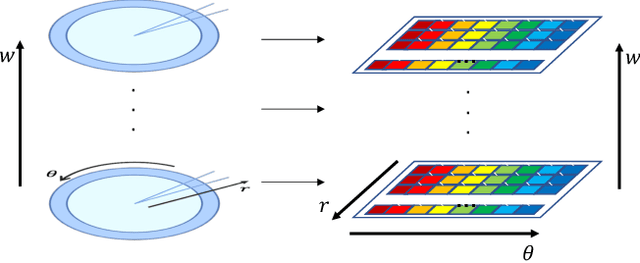
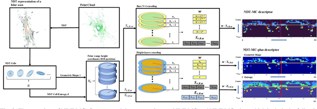

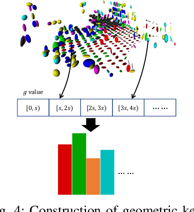
Loop-closure detection, also known as place recognition, aiming to identify previously visited locations, is an essential component of a SLAM system. Existing research on lidar-based loop closure heavily relies on dense point cloud and 360 FOV lidars. This paper proposes an out-of-the-box NDT (Normal Distribution Transform) based global descriptor, NDT-Map-Code, designed for both on-road driving and underground valet parking scenarios. NDT-Map-Code can be directly extracted from the NDT map without the need for a dense point cloud, resulting in excellent scalability and low maintenance cost. The NDT representation is leveraged to identify representative patterns, which are further encoded according to their spatial location (bearing, range, and height). Experimental results on the NIO underground parking lot dataset and the KITTI dataset demonstrate that our method achieves significantly better performance compared to the state-of-the-art.
Optimized SC-F-LOAM: Optimized Fast LiDAR Odometry and Mapping Using Scan Context
Apr 11, 2022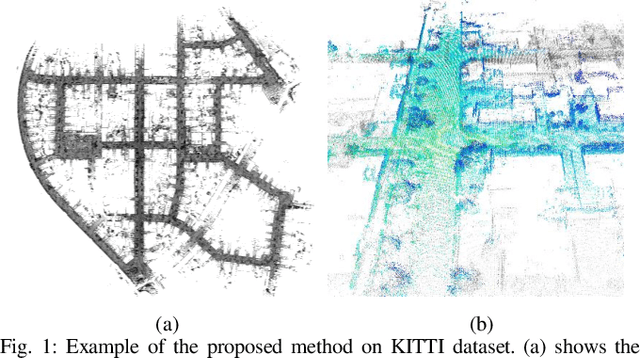
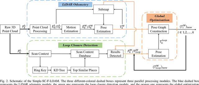
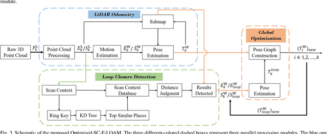
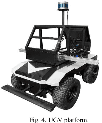
LiDAR odometry can achieve accurate vehicle pose estimation for short driving range or in small-scale environments, but for long driving range or in large-scale environments, the accuracy deteriorates as a result of cumulative estimation errors. This drawback necessitates the inclusion of loop closure detection in a SLAM framework to suppress the adverse effects of cumulative errors. To improve the accuracy of pose estimation, we propose a new LiDAR-based SLAM method which uses F-LOAM as LiDAR odometry, Scan Context for loop closure detection, and GTSAM for global optimization. In our approach, an adaptive distance threshold (instead of a fixed threshold) is employed for loop closure detection, which achieves more accurate loop closure detection results. Besides, a feature-based matching method is used in our approach to compute vehicle pose transformations between loop closure point cloud pairs, instead of using the raw point cloud obtained by the LiDAR sensor, which significantly reduces the computation time. The KITTI dataset and a UGV platform are used for verifications of our method, and the experimental results demonstrate that the proposed method outperforms typical LiDAR odometry/SLAM methods in the literature. Our code is made publicly available for the benefit of the community.