 Add to Chrome
 Add to Firefox
 Add to Edge
Multi-Depth Uniform Coverage Path Planning for Unmanned Surface Vehicle Surveying
May 13, 2026
This paper introduces a novel automatic coverage path planning algorithm for bathymetry surveying with unmanned surface vehicles. The detection range of the mapping sensor employed - a multibeam echo sounder - is heavily influenced by local seafloor depths. Hence, a path designed to uniformly cover the sea surface does not guarantee uniform coverage of the seafloor. Yet this is currently the typical process for bathymetric surveys, with the simplistic boustrophedon scheme along manually selected waypoints at constant depths being the most widespread planner used. The proposed scheme incorporates coarse prior depth information to pre-process the target region and adaptively guide path generation and sensing range configuration. By explicitly accounting for depth variations, the proposed algorithm designs a coverage path with optimised spacing between survey passes that adjusts the sensing beam aperture to achieve more consistent seafloor coverage. The proposed method is shown to offer significant improvements in both synthetic and real-world scenarios. Validations in challenging synthetic terrains achieves coverage ratios beyond 99%, a marked improvement when compared with traditional boustrophedon paths revealing a maximum 75% coverage. The same trend appears in realistic simulations using real bathymetric data from a coastal harbour, with coverage reaching over 92%, and significantly surpassing boustrophedon sweeps with coverage rates below 65%. Beyond improved performance, the scheme also brings a fully automated design, suitable for autonomous marine vehicles, thus offering practical utilities for real-world applications.

Deep Learning for Accurate Vision-based Catch Composition in Tropical Tuna Purse Seiners
Nov 19, 2025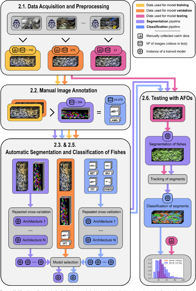
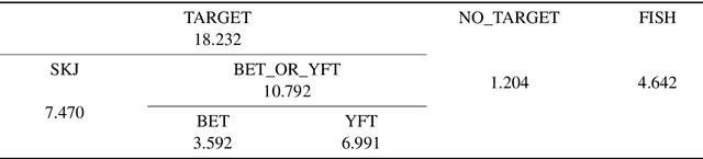
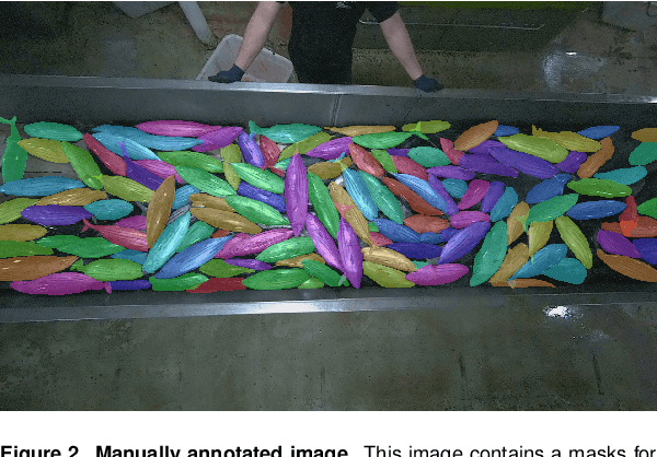

Purse seiners play a crucial role in tuna fishing, as approximately 69% of the world's tropical tuna is caught using this gear. All tuna Regional Fisheries Management Organizations have established minimum standards to use electronic monitoring (EM) in fisheries in addition to traditional observers. The EM systems produce a massive amount of video data that human analysts must process. Integrating artificial intelligence (AI) into their workflow can decrease that workload and improve the accuracy of the reports. However, species identification still poses significant challenges for AI, as achieving balanced performance across all species requires appropriate training data. Here, we quantify the difficulty experts face to distinguish bigeye tuna (BET, Thunnus Obesus) from yellowfin tuna (YFT, Thunnus Albacares) using images captured by EM systems. We found inter-expert agreements of 42.9% $\pm$ 35.6% for BET and 57.1% $\pm$ 35.6% for YFT. We then present a multi-stage pipeline to estimate the species composition of the catches using a reliable ground-truth dataset based on identifications made by observers on board. Three segmentation approaches are compared: Mask R-CNN, a combination of DINOv2 with SAM2, and a integration of YOLOv9 with SAM2. We found that the latest performs the best, with a validation mean average precision of 0.66 $\pm$ 0.03 and a recall of 0.88 $\pm$ 0.03. Segmented individuals are tracked using ByteTrack. For classification, we evaluate a standard multiclass classification model and a hierarchical approach, finding a superior generalization by the hierarchical. All our models were cross-validated during training and tested on fishing operations with fully known catch composition. Combining YOLOv9-SAM2 with the hierarchical classification produced the best estimations, with 84.8% of the individuals being segmented and classified with a mean average error of 4.5%.
IberFire -- a detailed creation of a spatio-temporal dataset for wildfire risk assessment in Spain
May 01, 2025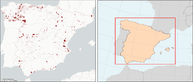
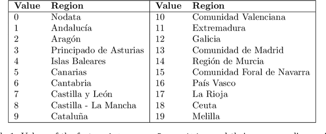
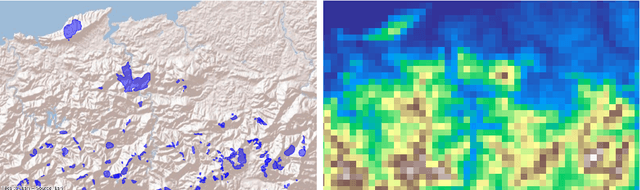
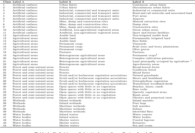
Wildfires pose a critical environmental issue to ecosystems, economies, and public safety, particularly in Mediterranean regions such as Spain. Accurate predictive models rely on high-resolution spatio-temporal data to capture the complex interplay of environmental and anthropogenic factors. To address the lack of localised and fine-grained datasets in Spain, this work introduces IberFire, a spatio-temporal datacube at 1 km x 1 km x 1-day resolution covering mainland Spain and the Balearic Islands from December 2007 to December 2024. IberFire integrates 260 features across eight main categories: auxiliary features, fire history, geography, topography, meteorology, vegetation indices, human activity, and land cover. All features are derived from open-access sources, ensuring transparency and real-time applicability. The data processing pipeline was implemented entirely using open-source tools, and the codebase has been made publicly available. This work not only enhances spatio-temporal granularity and feature diversity compared to existing European datacubes but also provides a reproducible methodology for constructing similar datasets. IberFire supports advanced wildfire risk modelling through Machine Learning (ML) and Deep Learning (DL) techniques, enables climate pattern analysis and informs strategic planning in fire prevention and land management. The dataset is publicly available on Zenodo to promote open research and collaboration.