 Add to Chrome
 Add to Firefox
 Add to Edge
FDIF: Formula-Driven supervised Learning with Implicit Functions for 3D Medical Image Segmentation
Mar 24, 2026Deep learning-based 3D medical image segmentation methods relies on large-scale labeled datasets, yet acquiring such data is difficult due to privacy constraints and the high cost of expert annotation. Formula-Driven Supervised Learning (FDSL) offers an appealing alternative by generating training data and labels directly from mathematical formulas. However, existing voxel-based approaches are limited in geometric expressiveness and cannot synthesize realistic textures. We introduce Formula-Driven supervised learning with Implicit Functions (FDIF), a framework that enables scalable pre-training without using any real data and medical expert annotations. FDIF introduces an implicit-function representation based on signed distance functions (SDFs), enabling compact modeling of complex geometries while exploiting the surface representation of SDFs to support controllable synthesis of both geometric and intensity textures. Across three medical image segmentation benchmarks (AMOS, ACDC, and KiTS) and three architectures (SwinUNETR, nnUNet ResEnc-L, and nnUNet Primus-M), FDIF consistently improves over a formula-driven method, and achieves performance comparable to self-supervised approaches pre-trained on large-scale real datasets. We further show that FDIF pre-training also benefits 3D classification tasks, highlighting implicit-function-based formula supervision as a promising paradigm for data-free representation learning. Code is available at https://github.com/yamanoko/FDIF.
Object Detection in Satellite Imagery using 2-Step Convolutional Neural Networks
Aug 09, 2018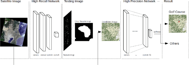
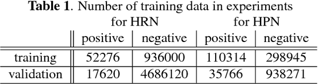
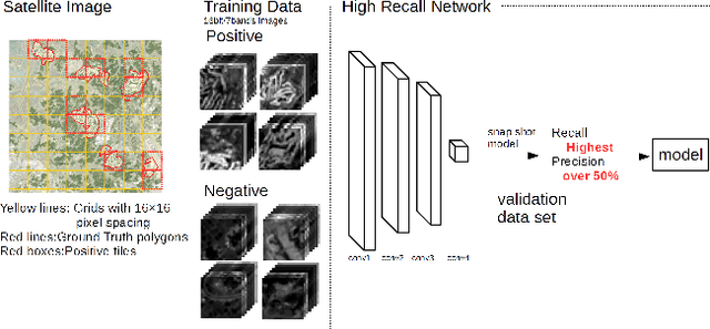
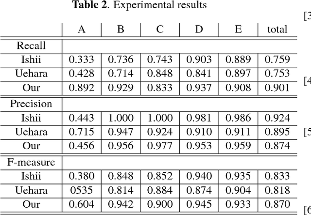
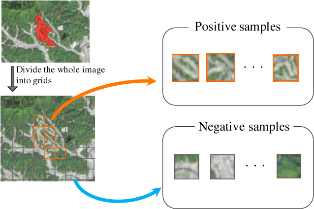
This paper presents an efficient object detection method from satellite imagery. Among a number of machine learning algorithms, we proposed a combination of two convolutional neural networks (CNN) aimed at high precision and high recall, respectively. We validated our models using golf courses as target objects. The proposed deep learning method demonstrated higher accuracy than previous object identification methods.
Object Detection of Satellite Images Using Multi-Channel Higher-order Local Autocorrelation
Jul 28, 2017
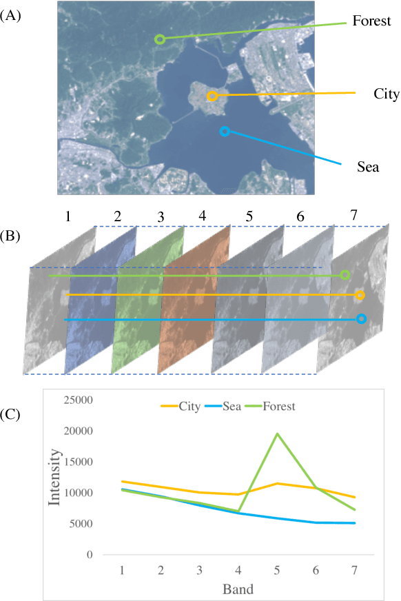
The Earth observation satellites have been monitoring the earth's surface for a long time, and the images taken by the satellites contain large amounts of valuable data. However, it is extremely hard work to manually analyze such huge data. Thus, a method of automatic object detection is needed for satellite images to facilitate efficient data analyses. This paper describes a new image feature extended from higher-order local autocorrelation to the object detection of multispectral satellite images. The feature has been extended to extract spectral inter-relationships in addition to spatial relationships to fully exploit multispectral information. The results of experiments with object detection tasks conducted to evaluate the effectiveness of the proposed feature extension indicate that the feature realized a higher performance compared to existing methods.