 Add to Chrome
 Add to Firefox
 Add to Edge
From Machine Learning to Large-Scale EO Products: Best Practices for Making Maps
Jul 27, 2026
Recent years have seen a rapid expansion in the production of large-scale geospatial maps derived from Earth observation (EO) data, driven largely by advances in machine learning (ML) and large computing infrastructure. Although the barrier to generating such maps has dropped substantially, established best practices have yet to emerge, and design decisions made early in the pipeline can quietly propagate errors into the final product. Producing a technically sound and scientifically credible product remains challenging. Choices made at every stage are tightly coupled: preprocessing decisions shape the training signal, dataset design governs what the model can learn and how reliably its performance can be assessed, and global-scale inference introduces engineering challenges in compute and data access at scale, as well as artifact mitigation. Furthermore, uncertainty quantification and independent map validation each require dedicated methodological attention that is often underestimated. This paper presents a concise, end-to-end account of the recommended practices spanning the pipeline from satellite data to an operational map product. We organize the discussion around six interconnected themes: the EO data infrastructure landscape, data selection and preprocessing, ML dataset construction and model training, uncertainty quantification, map production and distribution, and validation. This paper is a condensed version of a longer guide that provides greater depth across all stages, accessible online at ghjuliasialelli.github.io/MLEO-Maps/.

AGBD: A Global-scale Biomass Dataset
Jun 07, 2024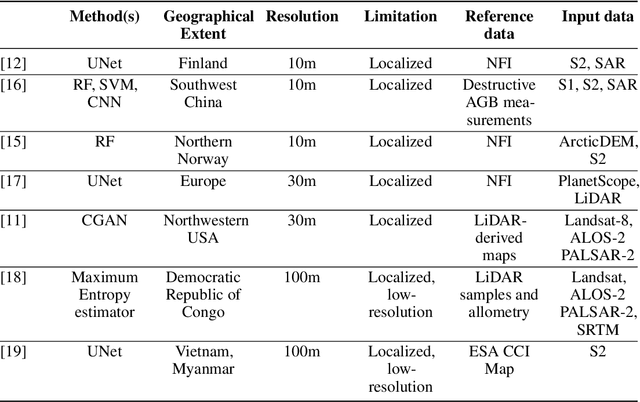
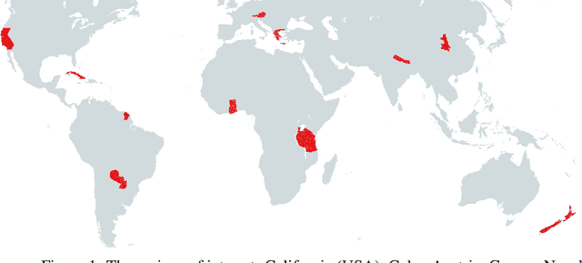
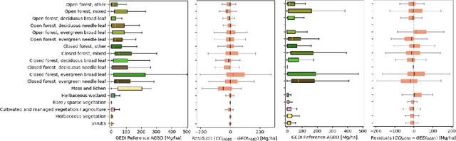
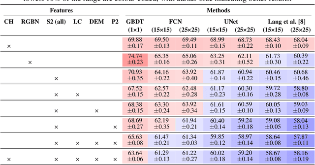
Accurate estimates of Above Ground Biomass (AGB) are essential in addressing two of humanity's biggest challenges, climate change and biodiversity loss. Existing datasets for AGB estimation from satellite imagery are limited. Either they focus on specific, local regions at high resolution, or they offer global coverage at low resolution. There is a need for a machine learning-ready, globally representative, high-resolution benchmark. Our findings indicate significant variability in biomass estimates across different vegetation types, emphasizing the necessity for a dataset that accurately captures global diversity. To address these gaps, we introduce a comprehensive new dataset that is globally distributed, covers a range of vegetation types, and spans several years. This dataset combines AGB reference data from the GEDI mission with data from Sentinel-2 and PALSAR-2 imagery. Additionally, it includes pre-processed high-level features such as a dense canopy height map, an elevation map, and a land-cover classification map. We also produce a dense, high-resolution (10m) map of AGB predictions for the entire area covered by the dataset. Rigorously tested, our dataset is accompanied by several benchmark models and is publicly available. It can be easily accessed using a single line of code, offering a solid basis for efforts towards global AGB estimation. The GitHub repository github.com/ghjuliasialelli/AGBD serves as a one-stop shop for all code and data.