 Add to Chrome
 Add to Firefox
 Add to Edge
High carbon stock mapping at large scale with optical satellite imagery and spaceborne LIDAR
Paper and Code
Jul 15, 2021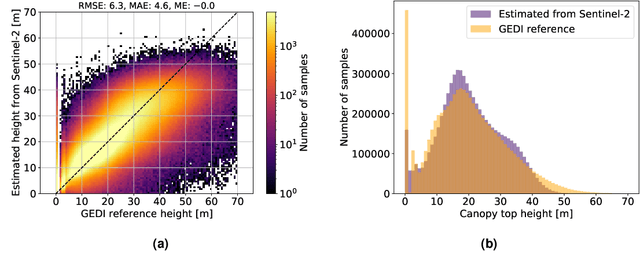
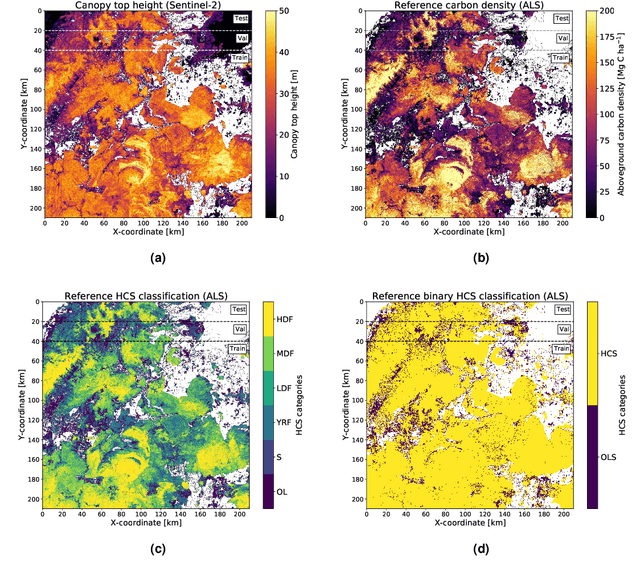
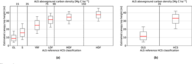
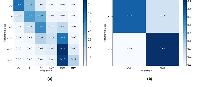
The increasing demand for commodities is leading to changes in land use worldwide. In the tropics, deforestation, which causes high carbon emissions and threatens biodiversity, is often linked to agricultural expansion. While the need for deforestation-free global supply chains is widely recognized, making progress in practice remains a challenge. Here, we propose an automated approach that aims to support conservation and sustainable land use planning decisions by mapping tropical landscapes at large scale and high spatial resolution following the High Carbon Stock (HCS) approach. A deep learning approach is developed that estimates canopy height for each 10 m Sentinel-2 pixel by learning from sparse GEDI LIDAR reference data, achieving an overall RMSE of 6.3 m. We show that these wall-to-wall maps of canopy top height are predictive for classifying HCS forests and degraded areas with an overall accuracy of 86 % and produce a first high carbon stock map for Indonesia, Malaysia, and the Philippines.