 Add to Chrome
 Add to Firefox
 Add to Edge
Identifying public values and spatial conflicts in urban planning
Jul 18, 2022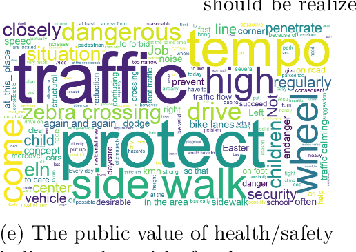
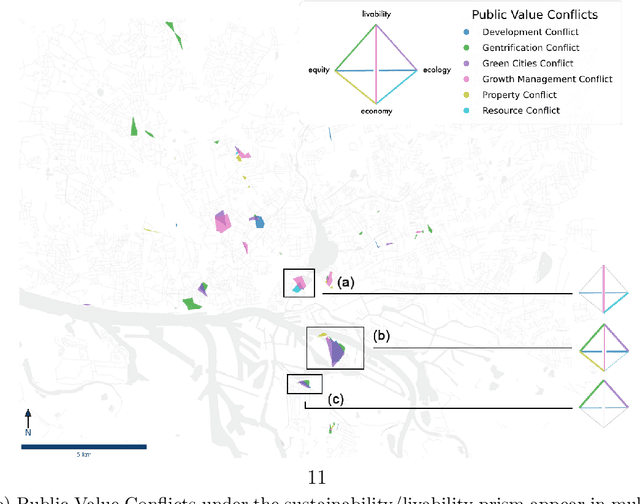
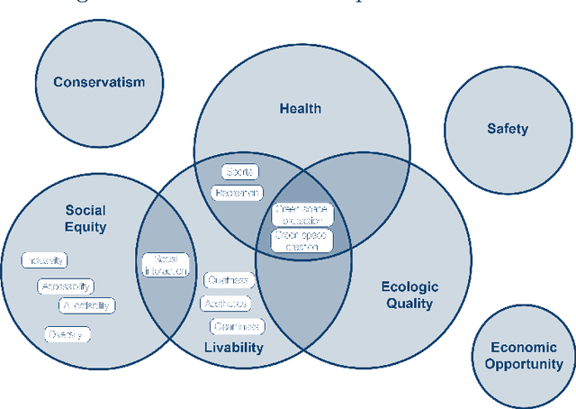
Identifying the diverse and often competing values of citizens, and resolving the consequent public value conflicts, are of significant importance for inclusive and integrated urban development. Scholars have highlighted that relational, value-laden urban space gives rise to many diverse conflicts that vary both spatially and temporally. Although notions of public value conflicts have been conceived in theory, there are very few empirical studies that identify such values and their conflicts in urban space. Building on public value theory and using a case-study mixed-methods approach, this paper proposes a new approach to empirically investigate public value conflicts in urban space. Using unstructured participatory data of 4,528 citizen contributions from a Public Participation Geographic Information Systems in Hamburg, Germany, natural language processing and spatial clustering techniques are used to identify areas of potential value conflicts. Four expert workshops assess and interpret these quantitative findings. Integrating both quantitative and qualitative results, 19 general public values and a total of 9 archetypical conflicts are identified. On the basis of these results, this paper proposes a new conceptual tool of Public Value Spheres that extends the theoretical notion of public-value conflicts and helps to further account for the value-laden nature of urban space.
Extracting Spatiotemporal Demand for Public Transit from Mobility Data
Jun 05, 2020
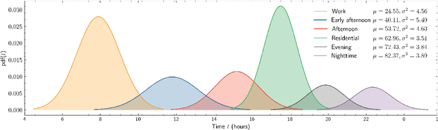
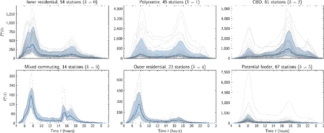
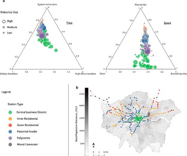
With people constantly migrating to different urban areas, our mobility needs for work, services and leisure are transforming rapidly. The changing urban demographics pose several challenges for the efficient management of transit services. To forecast transit demand, planners often resort to sociological investigations or modelling that are either difficult to obtain, inaccurate or outdated. How can we then estimate the variegated demand for mobility? We propose a simple method to identify the spatiotemporal demand for public transit in a city. Using a Gaussian mixture model, we decompose empirical ridership data into a set of temporal demand profiles representative of ridership over any given day. A case of approximately 4.6 million daily transit traces from the Greater London region reveals distinct demand profiles. We find that a weighted mixture of these profiles can generate any station traffic remarkably well, uncovering spatially concentric clusters of mobility needs. Our method of analysing the spatiotemporal geography of a city can be extended to other urban regions with different modes of public transit.