 Add to Chrome
 Add to Firefox
 Add to Edge
AlphaEarth Foundations: An embedding field model for accurate and efficient global mapping from sparse label data
Jul 29, 2025Unprecedented volumes of Earth observation data are continually collected around the world, but high-quality labels remain scarce given the effort required to make physical measurements and observations. This has led to considerable investment in bespoke modeling efforts translating sparse labels into maps. Here we introduce AlphaEarth Foundations, an embedding field model yielding a highly general, geospatial representation that assimilates spatial, temporal, and measurement contexts across multiple sources, enabling accurate and efficient production of maps and monitoring systems from local to global scales. The embeddings generated by AlphaEarth Foundations are the only to consistently outperform all previous featurization approaches tested on a diverse set of mapping evaluations without re-training. We will release a dataset of global, annual, analysis-ready embedding field layers from 2017 through 2024.
Annual field-scale maps of tall and short crops at the global scale using GEDI and Sentinel-2
Dec 19, 2022


Crop type maps are critical for tracking agricultural land use and estimating crop production. Remote sensing has proven an efficient and reliable tool for creating these maps in regions with abundant ground labels for model training, yet these labels remain difficult to obtain in many regions and years. NASA's Global Ecosystem Dynamics Investigation (GEDI) spaceborne lidar instrument, originally designed for forest monitoring, has shown promise for distinguishing tall and short crops. In the current study, we leverage GEDI to develop wall-to-wall maps of short vs tall crops on a global scale at 10 m resolution for 2019-2021. Specifically, we show that (1) GEDI returns can reliably be classified into tall and short crops after removing shots with extreme view angles or topographic slope, (2) the frequency of tall crops over time can be used to identify months when tall crops are at their peak height, and (3) GEDI shots in these months can then be used to train random forest models that use Sentinel-2 time series to accurately predict short vs. tall crops. Independent reference data from around the world are then used to evaluate these GEDI-S2 maps. We find that GEDI-S2 performed nearly as well as models trained on thousands of local reference training points, with accuracies of at least 87% and often above 90% throughout the Americas, Europe, and East Asia. Systematic underestimation of tall crop area was observed in regions where crops frequently exhibit low biomass, namely Africa and South Asia, and further work is needed in these systems. Although the GEDI-S2 approach only differentiates tall from short crops, in many landscapes this distinction goes a long way toward mapping the main individual crop types. The combination of GEDI and Sentinel-2 thus presents a very promising path towards global crop mapping with minimal reliance on ground data.
Outlining where humans live -- The World Settlement Footprint 2015
Oct 28, 2019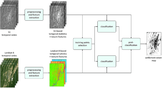
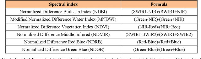
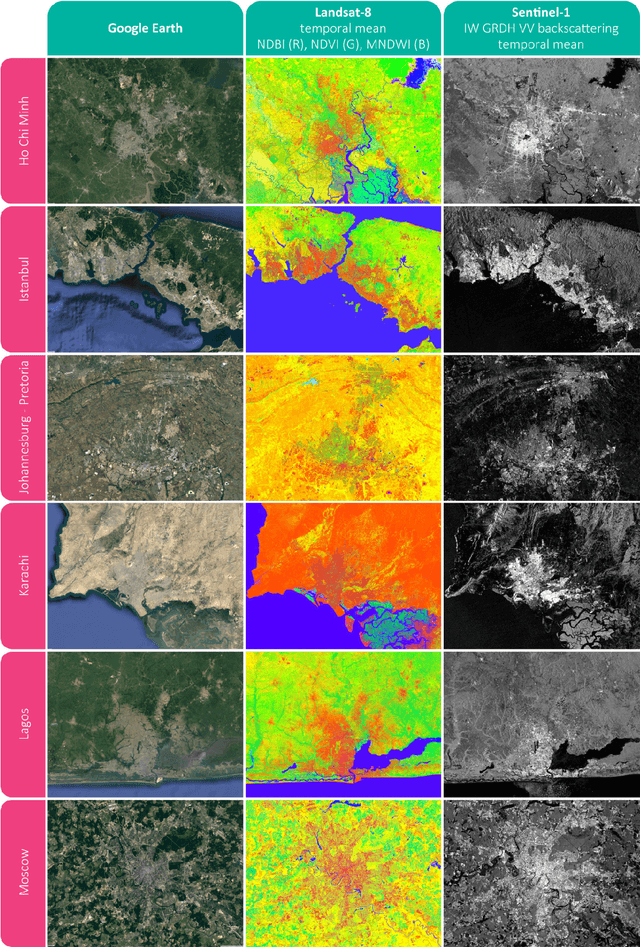
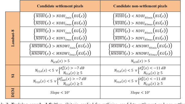
Human settlements are the cause and consequence of most environmental and societal changes on Earth; however, their location and extent is still under debate. We provide here a new 10m resolution (0.32 arc sec) global map of human settlements on Earth for the year 2015, namely the World Settlement Footprint 2015 (WSF2015). The raster dataset has been generated by means of an advanced classification system which, for the first time, jointly exploits open-and-free optical and radar satellite imagery. The WSF2015 has been validated against 900,000 samples labelled by crowdsourcing photointerpretation of very high resolution Google Earth imagery and outperforms all other similar existing layers; in particular, it considerably improves the detection of very small settlements in rural regions and better outlines scattered suburban areas. The dataset can be used at any scale of observation in support to all applications requiring detailed and accurate information on human presence (e.g., socioeconomic development, population distribution, risks assessment, etc.).