 Add to Chrome
 Add to Firefox
 Add to Edge
Image-Guided Pavement Defect Recognition in GPR Data with novel 3D Deep Learning Architecture
Aug 19, 2026
Ground Penetrating Radar (GPR) is a widely adopted non-destructive sensing technology for subsurface inspection in civil and transportation engineering. Despite its potential for pavement condition assessment, the large-scale application of GPR in automated inspection has two key challenges: the scarcity of annotated real-world datasets and the lack of deep learning models designed for the unique characteristics of 3-Dimensional (3D) GPR data. This study addresses these limitations by firstly introducing a cost-effective data preparation pipeline that integrates orthomosaic Red Green Blue (RGB) imagery with 3D GPR scans to generate annotated 3D GPR datasets. The proposed method uses the aligned segments of RGB and GPR data, using pavement surface images as a reference to transfer labels of surface-visible defects to corresponding GPR segments, enabling efficient large-scale annotation in a real-world dataset collected on a highway section under operation. In addition to the dataset contribution, we propose a specialised 3D Convolutional Neural Network (CNN) architecture incorporating residual connections, mixed convolutional kernel sizes, and both depthwise and channelwise attention mechanisms to enhance feature representation and defect classification. The model is evaluated on binary classification tasks for detecting patch and crack defects in pavement structures. Experimental results demonstrate that the proposed network outperforms baseline architectures across multiple evaluation metrics. Ablation studies further confirm the effectiveness of the designed architectural components. This work contributes a scalable and practical method for real-world dataset generation, along with a novel deep learning framework.

Automated Dilated Spatio-Temporal Synchronous Graph Modeling for Traffic Prediction
Jul 22, 2022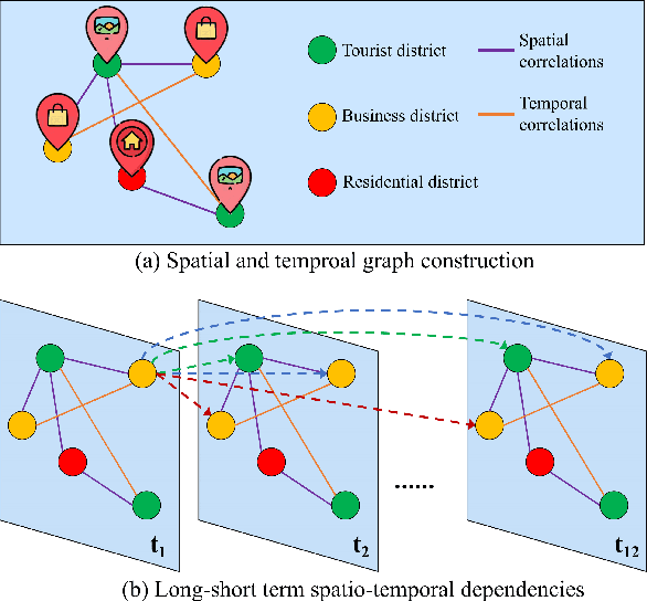
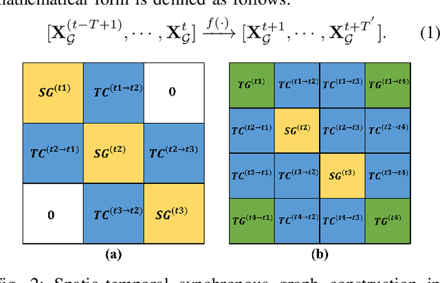
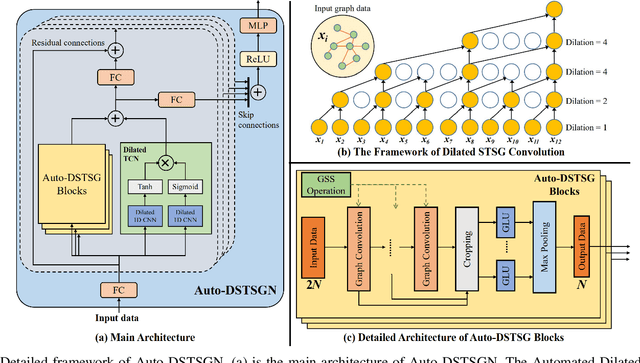
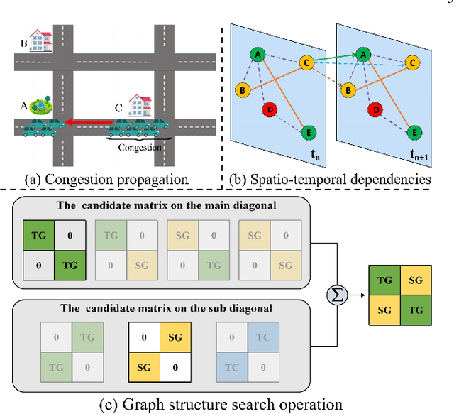
Accurate traffic prediction is a challenging task in intelligent transportation systems because of the complex spatio-temporal dependencies in transportation networks. Many existing works utilize sophisticated temporal modeling approaches to incorporate with graph convolution networks (GCNs) for capturing short-term and long-term spatio-temporal dependencies. However, these separated modules with complicated designs could restrict effectiveness and efficiency of spatio-temporal representation learning. Furthermore, most previous works adopt the fixed graph construction methods to characterize the global spatio-temporal relations, which limits the learning capability of the model for different time periods and even different data scenarios. To overcome these limitations, we propose an automated dilated spatio-temporal synchronous graph network, named Auto-DSTSGN for traffic prediction. Specifically, we design an automated dilated spatio-temporal synchronous graph (Auto-DSTSG) module to capture the short-term and long-term spatio-temporal correlations by stacking deeper layers with dilation factors in an increasing order. Further, we propose a graph structure search approach to automatically construct the spatio-temporal synchronous graph that can adapt to different data scenarios. Extensive experiments on four real-world datasets demonstrate that our model can achieve about 10% improvements compared with the state-of-art methods. Source codes are available at https://github.com/jinguangyin/Auto-DSTSGN.