 Add to Chrome
 Add to Firefox
 Add to Edge
Dense labeling of large remote sensing imagery with convolutional neural networks: a simple and faster alternative to stitching output label maps
May 30, 2018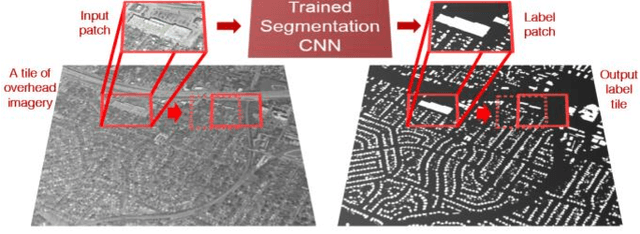
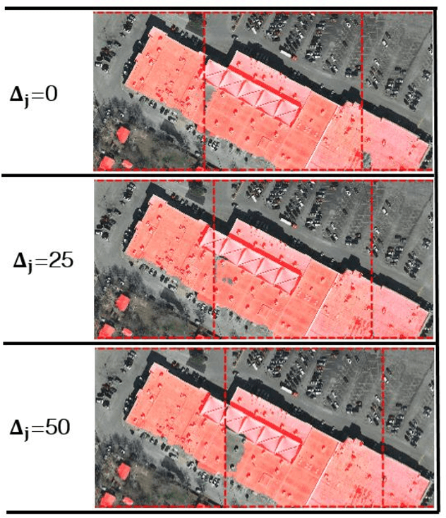
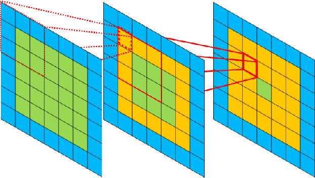
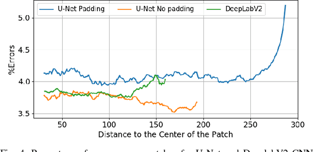
In this work we consider the application of convolutional neural networks (CNNs) for pixel-wise labeling (a.k.a., semantic segmentation) of remote sensing imagery (e.g., aerial color or hyperspectral imagery). Remote sensing imagery is usually stored in the form of very large images, referred to as "tiles", which are too large to be segmented directly using most CNNs and their associated hardware. As a result, during label inference, smaller sub-images, called "patches", are processed individually and then "stitched" (concatenated) back together to create a tile-sized label map. This approach suffers from computational ineffiency and can result in discontinuities at output boundaries. We propose a simple alternative approach in which the input size of the CNN is dramatically increased only during label inference. This does not avoid stitching altogether, but substantially mitigates its limitations. We evaluate the performance of the proposed approach against a vonventional stitching approach using two popular segmentation CNN models and two large-scale remote sensing imagery datasets. The results suggest that the proposed approach substantially reduces label inference time, while also yielding modest overall label accuracy increases. This approach contributed to our wining entry (overall performance) in the INRIA building labeling competition.
Application of a semantic segmentation convolutional neural network for accurate automatic detection and mapping of solar photovoltaic arrays in aerial imagery
Jan 11, 2018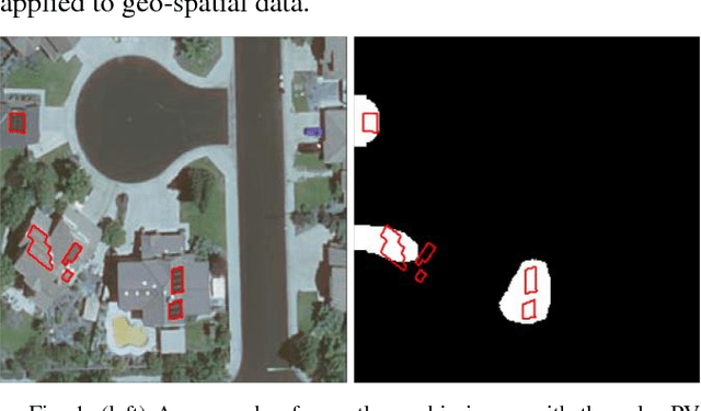
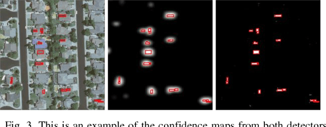
We consider the problem of automatically detecting small-scale solar photovoltaic arrays for behind-the-meter energy resource assessment in high resolution aerial imagery. Such algorithms offer a faster and more cost-effective solution to collecting information on distributed solar photovoltaic (PV) arrays, such as their location, capacity, and generated energy. The surface area of PV arrays, a characteristic which can be estimated from aerial imagery, provides an important proxy for array capacity and energy generation. In this work, we employ a state-of-the-art convolutional neural network architecture, called SegNet (Badrinarayanan et. al., 2015), to semantically segment (or map) PV arrays in aerial imagery. This builds on previous work focused on identifying the locations of PV arrays, as opposed to their specific shapes and sizes. We measure the ability of our SegNet implementation to estimate the surface area of PV arrays on a large, publicly available, dataset that has been employed in several previous studies. The results indicate that the SegNet model yields substantial performance improvements with respect to estimating shape and size as compared to a recently proposed convolutional neural network PV detection algorithm.
Automatic Detection of Solar Photovoltaic Arrays in High Resolution Aerial Imagery
Jul 20, 2016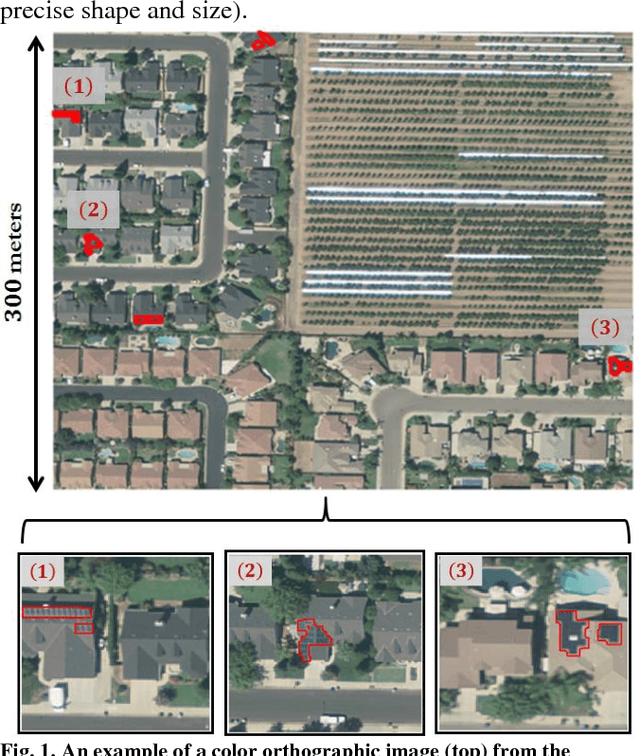
The quantity of small scale solar photovoltaic (PV) arrays in the United States has grown rapidly in recent years. As a result, there is substantial interest in high quality information about the quantity, power capacity, and energy generated by such arrays, including at a high spatial resolution (e.g., counties, cities, or even smaller regions). Unfortunately, existing methods for obtaining this information, such as surveys and utility interconnection filings, are limited in their completeness and spatial resolution. This work presents a computer algorithm that automatically detects PV panels using very high resolution color satellite imagery. The approach potentially offers a fast, scalable method for obtaining accurate information on PV array location and size, and at much higher spatial resolutions than are currently available. The method is validated using a very large (135 km^2) collection of publicly available [1] aerial imagery, with over 2,700 human annotated PV array locations. The results demonstrate the algorithm is highly effective on a per-pixel basis. It is likewise effective at object-level PV array detection, but with significant potential for improvement in estimating the precise shape/size of the PV arrays. These results are the first of their kind for the detection of solar PV in aerial imagery, demonstrating the feasibility of the approach and establishing a baseline performance for future investigations.