 Add to Chrome
 Add to Firefox
 Add to Edge
Leveraging Semantic Maps for City-Scale Cross-View Localization
Jul 28, 2026
We want robots to localize in previously untraversed environments against commonly available prior data. Rich semantic data available from OpenStreetMap can be useful in this task. However, existing methods either ignore this semantic information, directly matching panoramas and overhead imagery, or dramatically compress the semantic information, working with a small set of fixed classes. To leverage this rich semantic information, two challenges need to be overcome. First, useful semantic information needs to be extracted from the robot's egocentric observations. Second, the observed information must be quickly associated with the large prior semantic map (e.g., up to 628 km^2). We show that VLMs are effective at both extracting relevant landmarks from panoramas, and identifying feasible correspondences between these landmarks and prior overhead landmarks. However, using VLMs to propose all correspondences scales poorly as the number of mapped landmarks increases. Instead, we propose distilling a lightweight matcher from a VLM which computes correspondences for all entities in a map. We use this output to form an observation likelihood which is fused over time with a Bayes filter to create a time series of pose estimates. To support further investigation into generalizable cross-view methods that leverage semantic information, we release a dataset of extracted semantics and evaluation trajectories spanning eleven environments, including panoramas we collected in a snowstorm and at night in Boston. We demonstrate our method, trained on a single city's fair-weather data, generalizes across location, lighting, weather, and other challenges. Code and datasets are available at https://efahnestock.github.io/loci/.

Belief Roadmaps with Uncertain Landmark Evanescence
Jan 29, 2025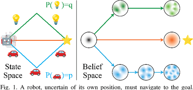

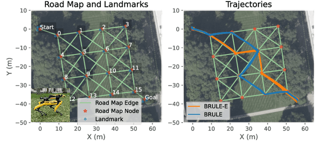
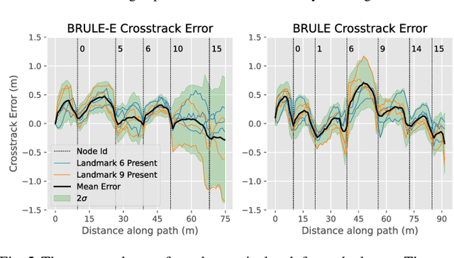
We would like a robot to navigate to a goal location while minimizing state uncertainty. To aid the robot in this endeavor, maps provide a prior belief over the location of objects and regions of interest. To localize itself within the map, a robot identifies mapped landmarks using its sensors. However, as the time between map creation and robot deployment increases, portions of the map can become stale, and landmarks, once believed to be permanent, may disappear. We refer to the propensity of a landmark to disappear as landmark evanescence. Reasoning about landmark evanescence during path planning, and the associated impact on localization accuracy, requires analyzing the presence or absence of each landmark, leading to an exponential number of possible outcomes of a given motion plan. To address this complexity, we develop BRULE, an extension of the Belief Roadmap. During planning, we replace the belief over future robot poses with a Gaussian mixture which is able to capture the effects of landmark evanescence. Furthermore, we show that belief updates can be made efficient, and that maintaining a random subset of mixture components is sufficient to find high quality solutions. We demonstrate performance in simulated and real-world experiments. Software is available at https://bit.ly/BRULE.