 Add to Chrome
 Add to Firefox
 Add to Edge
Robostral Navigate
Jul 24, 2026
Deploying navigation systems at scale requires a recipe that minimizes sensor assumptions, generalizes across robot embodiments, and trains efficiently. Yet, today's best systems depend on depth sensors, multi-camera rigs, or pre-built maps, limiting the hardware they support and increasing deployment cost. We introduce Robostral Navigate, an 8B vision-language model built around this scalability objective. The model consumes only a stream of monocular RGB images - the most ubiquitous sensor across robotic platforms and predicts waypoints by pointing to the next target location in the current camera view. Operating purely in image space, rather than robot-specific coordinates, makes the policy naturally robust to changes in camera intrinsics and scene scale, enabling deployment across wheeled, legged, and aerial robots without recalibration. We generate 2.4 million trajectories across 350k simulated scenes to reduce the reliance on real-world data collection and scale easily. We further introduce a prefix-caching training recipe that packs entire episodes into single training sequences, reducing training tokens by 22x and cutting training time from months to days. A tree-based attention mask prevents conditioning on previous ground-truth actions, encouraging visually grounded action prediction, and reinforcement learning is used to further improve exploration and recovery capabilities. On the Room-to-Room and Room-Across-Room in Continuous Environments (R2R-CE and RxR-CE) benchmarks, Robostral Navigate sets a new state of the art. On R2R-CE, it achieves a 77.4% success rate, surpassing the best monocular method by 10.5 points and the strongest depth- or multi-camera system by 5.3 points despite using only a single RGB camera. On RxR-CE, it reaches 75.1% success rate, outperforming all monocular baselines.

A Random Finite Set Approach for Dynamic Occupancy Grid Maps with Real-Time Application
Sep 10, 2016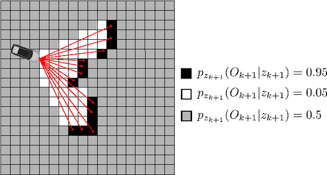
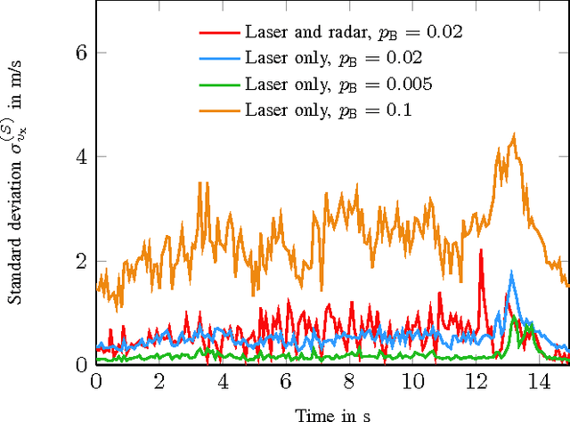
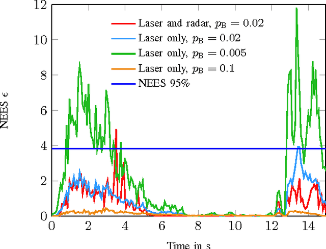
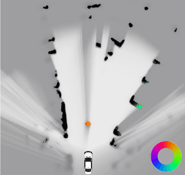
Grid mapping is a well established approach for environment perception in robotic and automotive applications. Early work suggests estimating the occupancy state of each grid cell in a robot's environment using a Bayesian filter to recursively combine new measurements with the current posterior state estimate of each grid cell. This filter is often referred to as binary Bayes filter (BBF). A basic assumption of classical occupancy grid maps is a stationary environment. Recent publications describe bottom-up approaches using particles to represent the dynamic state of a grid cell and outline prediction-update recursions in a heuristic manner. This paper defines the state of multiple grid cells as a random finite set, which allows to model the environment as a stochastic, dynamic system with multiple obstacles, observed by a stochastic measurement system. It motivates an original filter called the probability hypothesis density / multi-instance Bernoulli (PHD/MIB) filter in a top-down manner. The paper presents a real-time application serving as a fusion layer for laser and radar sensor data and describes in detail a highly efficient parallel particle filter implementation. A quantitative evaluation shows that parameters of the stochastic process model affect the filter results as theoretically expected and that appropriate process and observation models provide consistent state estimation results.