 Add to Chrome
 Add to Firefox
 Add to Edge
The Impact of Federated Learning on Distributed Remote Sensing Archives
Apr 13, 2026
Remote sensing archives are inherently distributed: Earth observation missions such as Sentinel-1, Sentinel-2, and Sentinel-3 have collectively accumulated more than 5 petabytes of imagery, stored and processed across many geographically dispersed platforms. Training machine learning models on such data in a centralized fashion is impractical due to data volume, sovereignty constraints, and geographic distribution. Federated learning (FL) addresses this by keeping data local and exchanging only model updates. A central challenge for remote sensing is the non-IID nature of Earth observation data: label distributions vary strongly by geographic region, degrading the convergence of standard FL algorithms. In this paper, we conduct a systematic empirical study of three FL strategies -- FedAvg, FedProx, and bulk synchronous parallel (BSP) -- applied to multi-label remote sensing image classification under controlled non-IID label-skew conditions. We evaluate three convolutional neural network (CNN) architectures of increasing depth (LeNet, AlexNet, and ResNet-34) and analyze the joint effect of algorithm choice, model capacity, client fraction, client count, batch size, and communication cost. Experiments on the UC Merced multi-label dataset show that FedProx outperforms FedAvg for deeper architectures under data heterogeneity, that BSP approaches centralized accuracy at the cost of high sequential communication, and that LeNet provides the best accuracy-communication trade-off for the dataset scale considered.

ECLAIR: A High-Fidelity Aerial LiDAR Dataset for Semantic Segmentation
Apr 16, 2024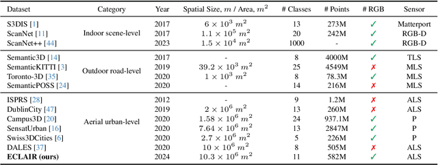
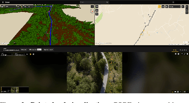

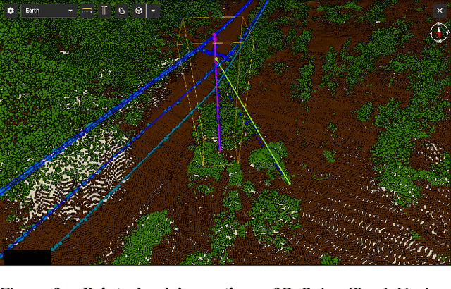
We introduce ECLAIR (Extended Classification of Lidar for AI Recognition), a new outdoor large-scale aerial LiDAR dataset designed specifically for advancing research in point cloud semantic segmentation. As the most extensive and diverse collection of its kind to date, the dataset covers a total area of 10$km^2$ with close to 600 million points and features eleven distinct object categories. To guarantee the dataset's quality and utility, we have thoroughly curated the point labels through an internal team of experts, ensuring accuracy and consistency in semantic labeling. The dataset is engineered to move forward the fields of 3D urban modeling, scene understanding, and utility infrastructure management by presenting new challenges and potential applications. As a benchmark, we report qualitative and quantitative analysis of a voxel-based point cloud segmentation approach based on the Minkowski Engine.