 Add to Chrome
 Add to Firefox
 Add to Edge
AI-Driven Predictive Modelling for Groundwater Salinization in Israel
Feb 07, 2026Increasing salinity and contamination of groundwater is a serious issue in many parts of the world, causing degradation of water resources. The aim of this work is to form a comprehensive understanding of groundwater salinization underlying causal factors and identify important meteorological, geological and anthropogenic drivers of salinity. We have integrated different datasets of potential covariates, to create a robust framework for machine learning based predictive models including Random Forest (RF), XGBoost, Neural network, Long Short-Term Memory (LSTM), convolution neural network (CNN) and linear regression (LR), of groundwater salinity. Additionally, Recursive Feature Elimination (RFE) followed by Global sensitivity analysis (GSA) and Explainable AI (XAI) based SHapley Additive exPlanations (SHAP) were used to estimate the importance scores and find insights into the drivers of salinization. We also did causality analysis via Double machine learning using various predictive models. From these analyses, key meteorological (Precipitation, Temperature), geological (Distance from river, Distance to saline body, TWI, Shoreline distance), and anthropogenic (Area of agriculture field, Treated Wastewater) covariates are identified to be influential drivers of groundwater salinity across Israel. XAI analysis also identified Treated Wastewater (TWW) as an essential anthropogenic driver of salinity, its significance being context-dependent but critical in vulnerable hydro-climatic environment. Our approach provides deeper insight into global salinization mechanisms at country scale, reducing AI model uncertainty and highlighting the need for tailored strategies to address salinity.
Combining Physically-Based Modeling and Deep Learning for Fusing GRACE Satellite Data: Can We Learn from Mismatch?
Jan 31, 2019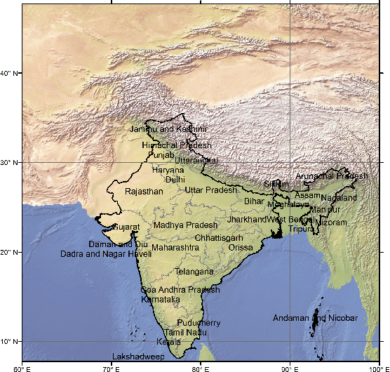
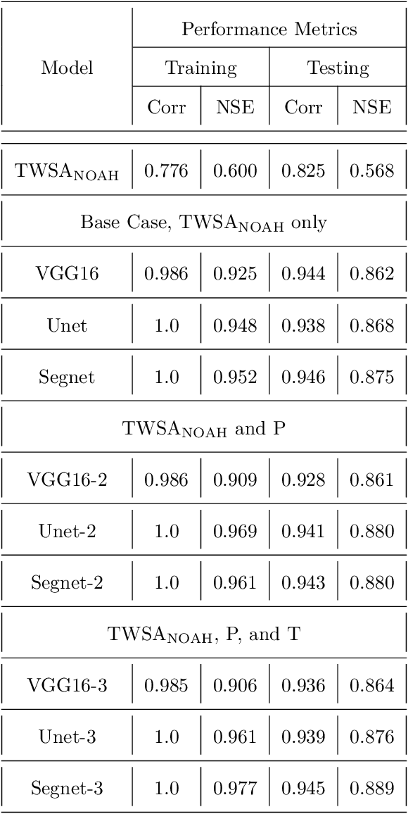
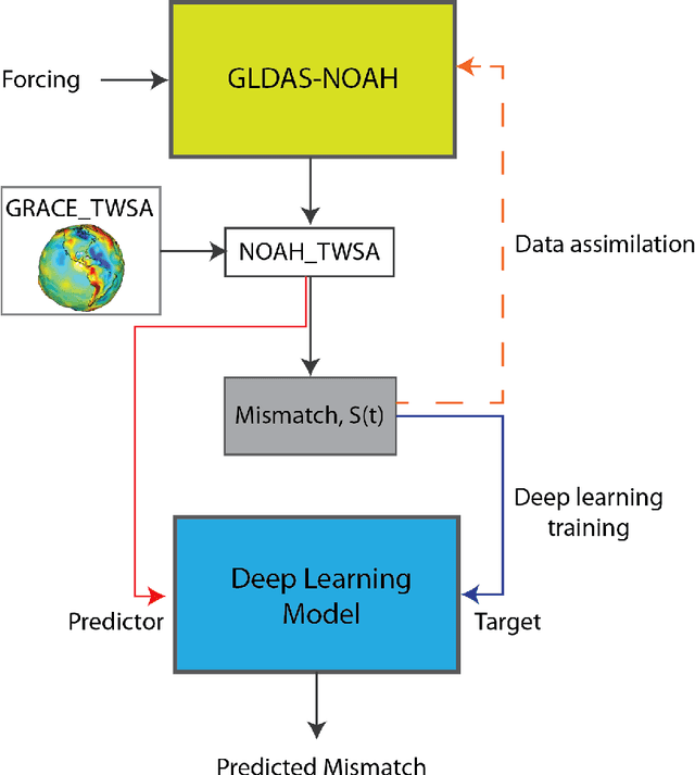
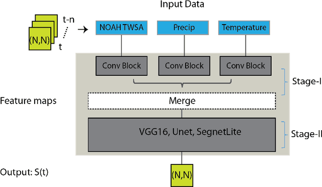
Global hydrological and land surface models are increasingly used for tracking terrestrial total water storage (TWS) dynamics, but the utility of existing models is hampered by conceptual and/or data uncertainties related to various underrepresented and unrepresented processes, such as groundwater storage. The gravity recovery and climate experiment (GRACE) satellite mission provided a valuable independent data source for tracking TWS at regional and continental scales. Strong interests exist in fusing GRACE data into global hydrological models to improve their predictive performance. Here we develop and apply deep convolutional neural network (CNN) models to learn the spatiotemporal patterns of mismatch between TWS anomalies (TWSA) derived from GRACE and those simulated by NOAH, a widely used land surface model. Once trained, our CNN models can be used to correct the NOAH simulated TWSA without requiring GRACE data, potentially filling the data gap between GRACE and its follow-on mission, GRACE-FO. Our methodology is demonstrated over India, which has experienced significant groundwater depletion in recent decades that is nevertheless not being captured by the NOAH model. Results show that the CNN models significantly improve the match with GRACE TWSA, achieving a country-average correlation coefficient of 0.94 and Nash-Sutcliff efficient of 0.87, or 14\% and 52\% improvement respectively over the original NOAH TWSA. At the local scale, the learned mismatch pattern correlates well with the observed in situ groundwater storage anomaly data for most parts of India, suggesting that deep learning models effectively compensate for the missing groundwater component in NOAH for this study region.