 Add to Chrome
 Add to Firefox
 Add to Edge
Xona Pulsar Compatibility with GNSS
Sep 19, 2025At least ten emerging providers are developing satellite navigation systems for low Earth orbit (LEO). Compatibility with existing GNSS in L-band is critical to their successful deployment and for the larger ecosystem. Xona is deploying Pulsar, a near 260-satellite LEO constellation offering dual L-band navigation services near L1 and L5. Designed for interoperability, Pulsar provides centimeter-level accuracy, resilience, and authentication, while maintaining a format that existing GNSS receivers can support through a firmware update. This study examines Pulsar's compatibility with GPS and Galileo by evaluating C/N0 degradation caused by the introduction of its X1 and X5 signals. Using spectrally compact QPSK modulation, Pulsar minimizes interference despite higher signal power. Theoretical analysis is supported by hardware testing across a range of commercial GNSS receivers in both lab-based simulation and in-orbit live-sky conditions. The study confirms Pulsar causes no adverse interference effects to existing GNSS, supporting coexistence and integration within the global PNT ecosystem.
* 15 pages, 12 figures
Satellite Navigation for the Age of Autonomy
May 19, 2020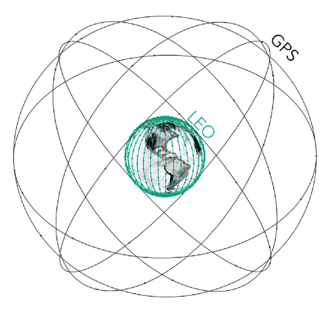
Global Navigation Satellite Systems (GNSS) brought navigation to the masses. Coupled with smartphones, the blue dot in the palm of our hands has forever changed the way we interact with the world. Looking forward, cyber-physical systems such as self-driving cars and aerial mobility are pushing the limits of what localization technologies including GNSS can provide. This autonomous revolution requires a solution that supports safety-critical operation, centimeter positioning, and cyber-security for millions of users. To meet these demands, we propose a navigation service from Low Earth Orbiting (LEO) satellites which deliver precision in-part through faster motion, higher power signals for added robustness to interference, constellation autonomous integrity monitoring for integrity, and encryption / authentication for resistance to spoofing attacks. This paradigm is enabled by the 'New Space' movement, where highly capable satellites and components are now built on assembly lines and launch costs have decreased by more than tenfold. Such a ubiquitous positioning service enables a consistent and secure standard where trustworthy information can be validated and shared, extending the electronic horizon from sensor line of sight to an entire city. This enables the situational awareness needed for true safe operation to support autonomy at scale.
* 11 pages, 8 figures, 2020 IEEE/ION Position, Location and Navigation Symposium (PLANS)