 Add to Chrome
 Add to Firefox
 Add to Edge
JigsawHSI: a network for Hyperspectral Image classification
Jun 06, 2022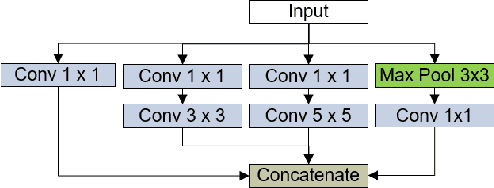
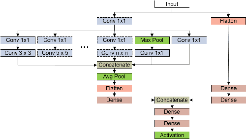
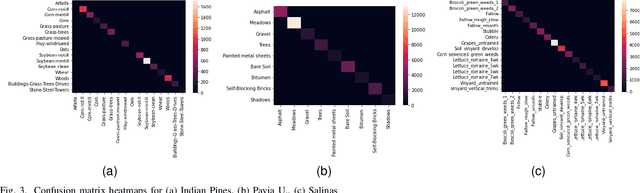
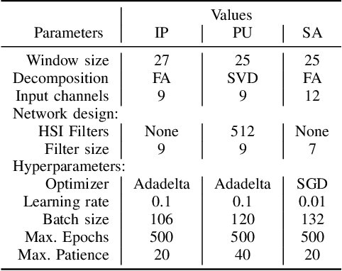
This article describes the performance of JigsawHSI,a convolutional neural network (CNN) based on Inception but tailored for geoscientific analyses, on classification with the Indian Pines, Pavia University and Salinas hyperspectral image data sets. The network is compared against HybridSN, a spectral-spatial 3D-CNN followed by 2D-CNN that achieves state-of-the-art results in the datasets. This short article proves that JigsawHSI is able to meet or exceed HybridSN performance in all three cases. Additionally, the code and toolkit are made available.
Monitoring the Impacts of a Tailings Dam Failure Using Satellite Images
Jan 30, 2021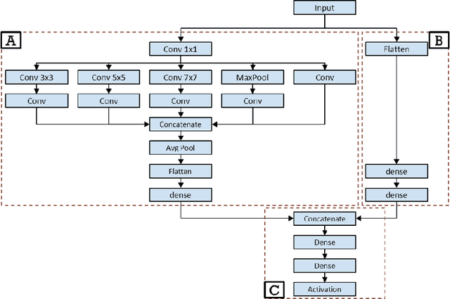
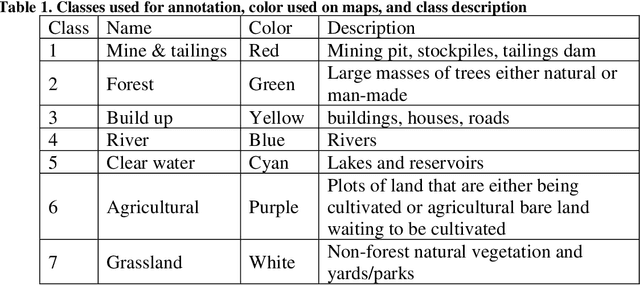
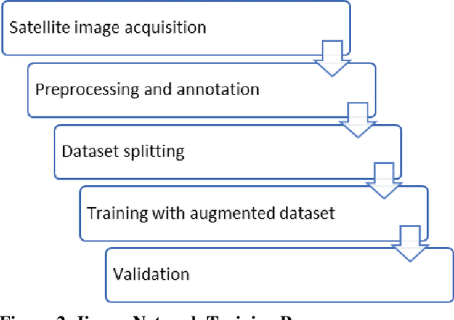
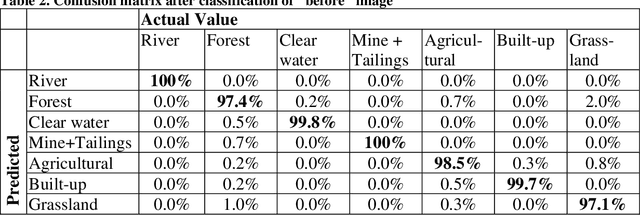
Monitoring dam failures using satellite images provides first responders with efficient management of early interventions. It is also equally important to monitor spatial and temporal changes in the inundation area to track the post-disaster recovery. On January 25th, 2019, the tailings dam of the C\'orrego do Feij\~ao iron ore mine, located in Brumadinho, Brazil, collapsed. This disaster caused more than 230 fatalities and 30 missing people leading to damage on the order of multiple billions of dollars. This study uses Sentinel-2 satellite images to map the inundation area and assess and delineate the land use and land cover impacted by the dam failure. The images correspond to data captures from January 22nd (3 days before), and February 02 (7 days after the collapse). Satellite images of the region were classified for before and aftermath of the disaster implementing a machine learning algorithm. In order to have sufficient land cover types to validate the quality and accuracy of the algorithm, 7 classes were defined: mine, forest, build-up, river, agricultural, clear water, and grassland. The developed classification algorithm yielded a high accuracy (99%) for the image before the collapse. This paper determines land cover impact using two different models, 1) by using the trained network in the "after" image, and 2) by creating a second network, trained in a subset of points of the "after" image, and then comparing the land cover results of the two trained networks. In the first model, applying the trained network to the "after" image, the accuracy is still high (86%), but lower than using the second model (98%). This strategy can be applied at a low cost for monitoring and assessment by using openly available satellite information and, in case of dam collapse or with a larger budget, higher resolution and faster data can be obtained by fly-overs on the area of concern.