 Add to Chrome
 Add to Firefox
 Add to Edge
So2Sat LCZ42: A Benchmark Dataset for Global Local Climate Zones Classification
Dec 19, 2019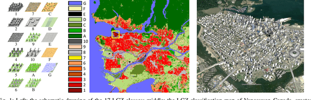
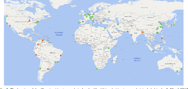
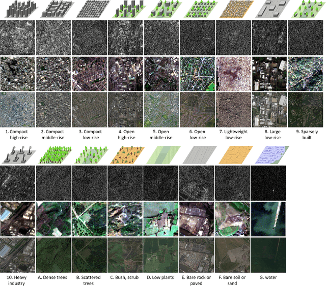
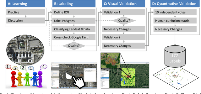
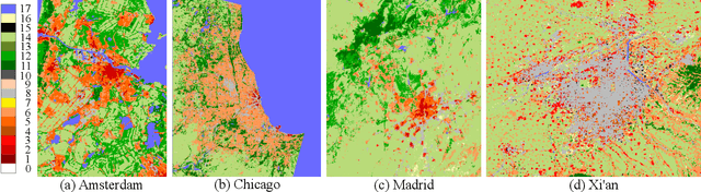
Access to labeled reference data is one of the grand challenges in supervised machine learning endeavors. This is especially true for an automated analysis of remote sensing images on a global scale, which enables us to address global challenges such as urbanization and climate change using state-of-the-art machine learning techniques. To meet these pressing needs, especially in urban research, we provide open access to a valuable benchmark dataset named "So2Sat LCZ42," which consists of local climate zone (LCZ) labels of about half a million Sentinel-1 and Sentinel-2 image patches in 42 urban agglomerations (plus 10 additional smaller areas) across the globe. This dataset was labeled by 15 domain experts following a carefully designed labeling work flow and evaluation process over a period of six months. As rarely done in other labeled remote sensing dataset, we conducted rigorous quality assessment by domain experts. The dataset achieved an overall confidence of 85%. We believe this LCZ dataset is a first step towards an unbiased globallydistributed dataset for urban growth monitoring using machine learning methods, because LCZ provide a rather objective measure other than many other semantic land use and land cover classifications. It provides measures of the morphology, compactness, and height of urban areas, which are less dependent on human and culture. This dataset can be accessed from http://doi.org/10.14459/2018mp1483140.
Fusion of Heterogeneous Earth Observation Data for the Classification of Local Climate Zones
May 29, 2019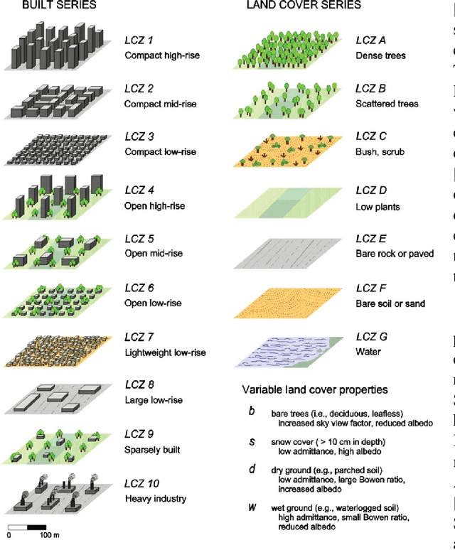
This paper proposes a novel framework for fusing multi-temporal, multispectral satellite images and OpenStreetMap (OSM) data for the classification of local climate zones (LCZs). Feature stacking is the most commonly-used method of data fusion but does not consider the heterogeneity of multimodal optical images and OSM data, which becomes its main drawback. The proposed framework processes two data sources separately and then combines them at the model level through two fusion models (the landuse fusion model and building fusion model), which aim to fuse optical images with landuse and buildings layers of OSM data, respectively. In addition, a new approach to detecting building incompleteness of OSM data is proposed. The proposed framework was trained and tested using data from the 2017 IEEE GRSS Data Fusion Contest, and further validated on one additional test set containing test samples which are manually labeled in Munich and New York. Experimental results have indicated that compared to the feature stacking-based baseline framework the proposed framework is effective in fusing optical images with OSM data for the classification of LCZs with high generalization capability on a large scale. The classification accuracy of the proposed framework outperforms the baseline framework by more than 6% and 2%, while testing on the test set of 2017 IEEE GRSS Data Fusion Contest and the additional test set, respectively. In addition, the proposed framework is less sensitive to spectral diversities of optical satellite images and thus achieves more stable classification performance than state-of-the art frameworks.