 Add to Chrome
 Add to Firefox
 Add to Edge
A Numerically-Robust ROS 2 Port of iG-LIO: Diagnosing and Fixing Toolchain-Induced Failures in Incremental GICP LiDAR-Inertial Odometry
Jul 10, 2026
iG-LIO is a tightly-coupled LiDAR-inertial odometry system fusing generalized-ICP and point-to-plane constraints in an iterated error-state Kalman filter over an incremental voxel map. We report an open-source ROS 2 Jazzy port of the original ROS 1 implementation and, more importantly, the diagnosis of environment-induced numerical failures that appear only after the port: a mechanically faithful migration -- estimation mathematics left unchanged -- compiled and ran, yet diverged with NaN internal values. Both causes trace to the modern ROS 2 toolchain, not the algorithm: a Quality-of-Service (QoS) mismatch that silently drops and reorders IMU samples, and an uninitialized parallel-reduce accumulator arising from the oneTBB + Eigen combination shipped with current distributions. We further correct Ouster point-field parsing to ensure correct point cloud undistortion with newer Ouster revisions, add Velodyne Velarray M1600 support, provide both a compile-time-gated Livox CustomMsg path and a driver-free path for Livox sensors publishing standard PointCloud2 (e.g. Mid-360), and expose the runtime via YAML. The result has been validated in an Ouster OS0 Rev7, an Ouster OS1 Rev 7, and a Livox MID-360. This report is a citable reference for the port itself, not a claim on the underlying algorithm [1]. The ROS 2 port of iG-LIO described in this document can be found at https://github.com/Forestry-Robotics-UC/ig_lio/tree/ros2-jazzy.

3D Multi-Robot Exploration with a Two-Level Coordination Strategy and Prioritization
Jul 07, 2023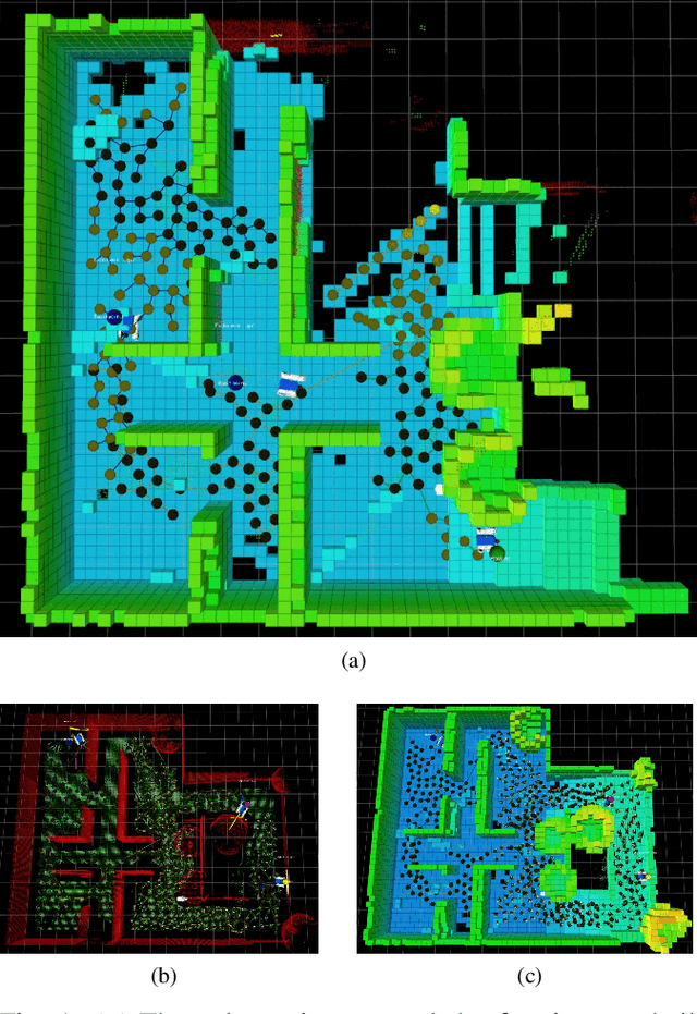
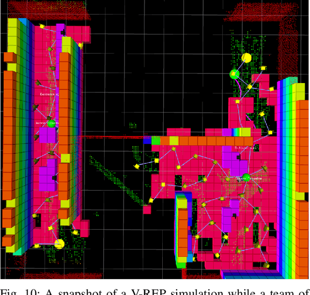
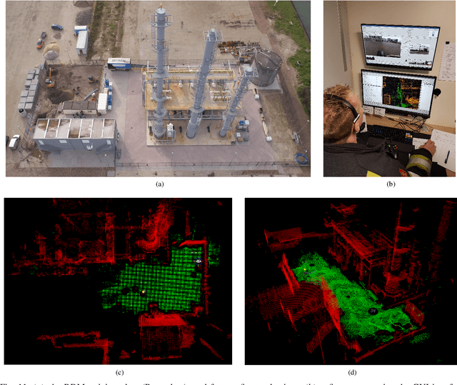
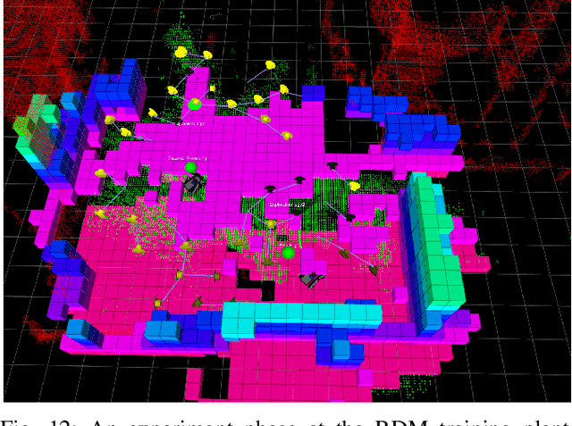
This work presents a 3D multi-robot exploration framework for a team of UGVs moving on uneven terrains. The framework was designed by casting the two-level coordination strategy presented in [1] into the context of multi-robot exploration. The resulting distributed exploration technique minimizes and explicitly manages the occurrence of conflicts and interferences in the robot team. Each robot selects where to scan next by using a receding horizon next-best-view approach [2]. A sampling-based tree is directly expanded on segmented traversable regions of the terrain 3D map to generate the candidate next viewpoints. During the exploration, users can assign locations with higher priorities on-demand to steer the robot exploration toward areas of interest. The proposed framework can be also used to perform coverage tasks in the case a map of the environment is a priori provided as input. An open-source implementation is available online.
A localization approach for autonomous underwater vehicles: A ROS-Gazebo framework
Nov 14, 2018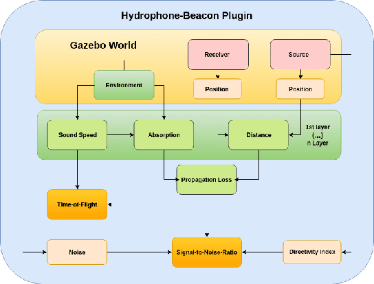
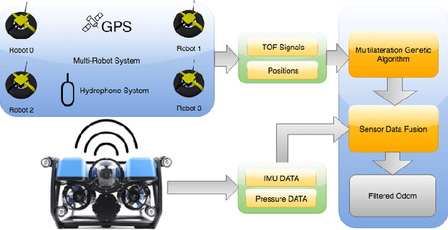
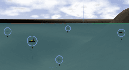
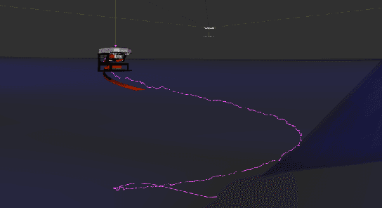
Autonomous Underwater Vehicles (AUVs) have the ability to operate in harsh underwater environments without endangering human lives in the process. Nevertheless, just like their ground and aerial counterparts, AUVs need to be able to estimate their own position. Yet, unlike ground and aerial robots, estimating the pose of AUVs is very challenging, with only a few high-cost technological solutions available in the market. In this paper, we present the development of a realistic underwater acoustic model, implemented within the Robot Operating System (ROS) and the Gazebo simulator framework, for localization of AUVs using a set of water surface robots, time of flight of underwater propagated acoustic waves, and a multilateration genetic algorithm approach.
SocialRobot: Towards a Personalized Elderly Care Mobile Robot
Sep 14, 2018

SocialRobot is a collaborative European project, which focuses on providing a practical and interactive solution to improve the quality of life of elderly people. Having this in mind, a state of the art robotic mobile platform has been integrated with virtual social care technology to meet the elderly individual needs and requirements, following a human centered approach. In this short paper, we make an overview of SocialRobot, the developed architecture and the human-robot interactive scenarios being prepared and tested in the framework of the project for dissemination and exploitation purposes.