 Add to Chrome
 Add to Firefox
 Add to Edge
PseudoMapLabeler: Confidence-Aware Pseudo-Label Generation for Semi-Supervised Online Mapping
Aug 12, 2026
A critical challenge in deploying online HD map construction systems to real-world scenarios is the scarcity of labeled training data, which limits model generalization in diverse environments. To address this limitation, we propose a teacher-student semi-supervised learning (SSL) framework that generates high-quality pseudo-labels from unlabeled data through confidence-aware map refinement. Our approach first trains a teacher model on limited labeled data, then leverages Beta-distribution-based confidence maps to assess the reliability of predicted map elements across temporal observations. Unlike conventional filtering methods that discard entire elements, we introduce a spatial clipping technique that selectively preserves high-confidence regions while removing unreliable segments. The refined map elements serve as map priors that improve the teacher model's prediction accuracy on unlabeled data in a second pass. These enhanced predictions become pseudo-labels for training a student model from scratch, followed by fine-tuning on the original labeled data. Experimental results on the nuScenes dataset demonstrate that our teacher-student framework with refined pseudo-labels improves performance by +6.1 mAP under a low-label regime compared to training on labeled data alone, offering a practical solution to the labeled data scarcity problem in online HD map construction.

D2HDMap: Non-visible Driveline Map Prior for Online Vectorized HD Map Prediction
Jun 17, 2026Accurate, up-to-date representations of road structures are critical for the safe operation of autonomous vehicles. Existing systems rely either on costly, maintenance-heavy high-definition (HD) maps which compromise safety when outdated, or purely sensor-based online mapping which struggles with long-range reliability and occlusion. Systems incorporating map prior information into online mapping seek to overcome drawbacks of both approaches by combining them in some way. We propose 'Driveline To HD Map' (D2HDMap), an online mapping system that injects a lightweight, non-visible driveline prior to guide the estimation of visible road structures such as lane dividers, road boundaries and crosswalks. This prior incurs less effort to create and update compared to full HD map priors used in other approaches. We also show that training with such a prior can improve generalization at inference time when no prior is available. Ablation studies conducted on the nuScenes and Argoverse 2 dataset demonstrate that models trained using a driveline prior largely retain performance even when priors are not available. On a geographically disjoint split, D2HDMap achieves 44.8 mAP, surpassing recent state-of-the-art. Additionally, noise-aware training substantially increases robustness to realistic localization error.
Using Language and Road Manuals to Inform Map Reconstruction for Autonomous Driving
Jun 12, 2025Lane-topology prediction is a critical component of safe and reliable autonomous navigation. An accurate understanding of the road environment aids this task. We observe that this information often follows conventions encoded in natural language, through design codes that reflect the road structure and road names that capture the road functionality. We augment this information in a lightweight manner to SMERF, a map-prior-based online lane-topology prediction model, by combining structured road metadata from OSM maps and lane-width priors from Road design manuals with the road centerline encodings. We evaluate our method on two geo-diverse complex intersection scenarios. Our method shows improvement in both lane and traffic element detection and their association. We report results using four topology-aware metrics to comprehensively assess the model performance. These results demonstrate the ability of our approach to generalize and scale to diverse topologies and conditions.
SD++: Enhancing Standard Definition Maps by Incorporating Road Knowledge using LLMs
Feb 04, 2025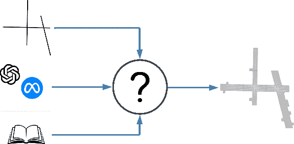
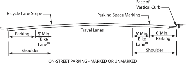
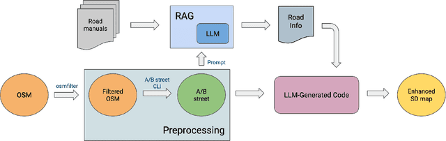
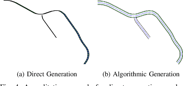
High-definition maps (HD maps) are detailed and informative maps capturing lane centerlines and road elements. Although very useful for autonomous driving, HD maps are costly to build and maintain. Furthermore, access to these high-quality maps is usually limited to the firms that build them. On the other hand, standard definition (SD) maps provide road centerlines with an accuracy of a few meters. In this paper, we explore the possibility of enhancing SD maps by incorporating information from road manuals using LLMs. We develop SD++, an end-to-end pipeline to enhance SD maps with location-dependent road information obtained from a road manual. We suggest and compare several ways of using LLMs for such a task. Furthermore, we show the generalization ability of SD++ by showing results from both California and Japan.