 Add to Chrome
 Add to Firefox
 Add to Edge
DeeperRadar: End-to-End MIMO Radar Design and Multi-Modal Fusion for Autonomous Vehicle Perception
Jul 19, 2026
DeeperRadar is a radar-centric, sensor-stack-conditioned framework that co-designs radar sensing and multi-modal 3D detection for autonomous mobility by learning a sparse acquisition pattern end-to-end with the fusion model. A learnable MIMO design module is trained end-to-end within a fusion network that operates directly on raw radar ADC data together with camera images and LiDAR point clouds. During training, the design module is supervised by the other sensors, enabling the system to learn both which receiver antennas to activate and the effective number of them. At deployment, the design module is removed and replaced by the learned sparse subsampling mask, leaving the downstream model architecture unchanged. Evaluated on the RADIal dataset, DeeperRadar discovers sparse, task-aware radar configurations that match or exceed full-array baselines while using fewer receivers, potentially reducing radar cost and integration complexity. These results show that learned optimal MIMO radar design depends on the fusion stack and the downstream perception task.

MESSI: A Multi-Elevation Semantic Segmentation Image Dataset of an Urban Environment
May 13, 2025This paper presents a Multi-Elevation Semantic Segmentation Image (MESSI) dataset comprising 2525 images taken by a drone flying over dense urban environments. MESSI is unique in two main features. First, it contains images from various altitudes, allowing us to investigate the effect of depth on semantic segmentation. Second, it includes images taken from several different urban regions (at different altitudes). This is important since the variety covers the visual richness captured by a drone's 3D flight, performing horizontal and vertical maneuvers. MESSI contains images annotated with location, orientation, and the camera's intrinsic parameters and can be used to train a deep neural network for semantic segmentation or other applications of interest (e.g., localization, navigation, and tracking). This paper describes the dataset and provides annotation details. It also explains how semantic segmentation was performed using several neural network models and shows several relevant statistics. MESSI will be published in the public domain to serve as an evaluation benchmark for semantic segmentation using images captured by a drone or similar vehicle flying over a dense urban environment.
Finding a Landing Site on an Urban Area: A Multi-Resolution Probabilistic Approach
Apr 26, 2022
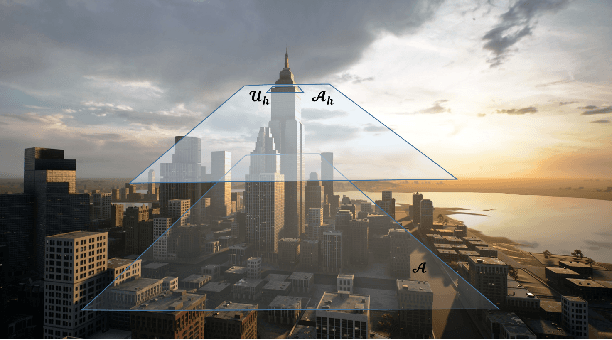
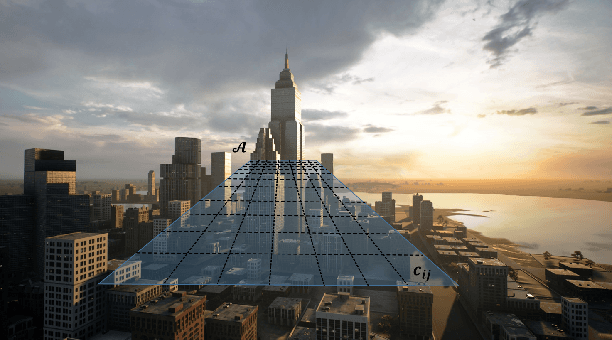
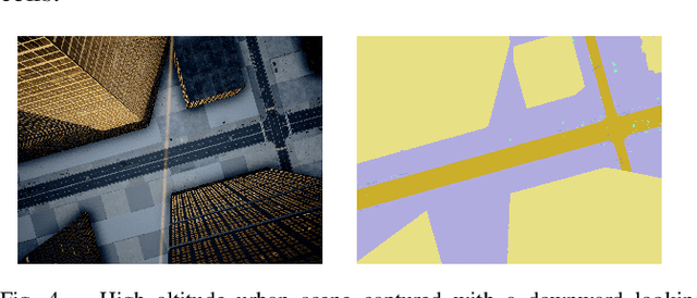
This paper considers the problem of finding a landing spot for a drone in a dense urban environment. The conflicting requirement of fast exploration and high resolution is solved using a multi-resolution approach, by which visual information is collected by the drone at decreasing altitudes so that spatial resolution of the acquired images increases monotonically. A probability distribution is used to capture the uncertainty of the decision process for each terrain patch. The distributions are updated as information from different altitudes is collected. When the confidence level for one of the patches becomes larger than a pre-specified threshold, suitability for landing is declared. One of the main building blocks of the approach is a semantic segmentation algorithm that attaches probabilities to each pixel of a single view. The decision algorithm combines these probabilities with a priori data and previous measurements to obtain the best estimates. Feasibility is illustrated by presenting a number of examples generated by a realistic closed-loop simulator.