 Add to Chrome
 Add to Firefox
 Add to Edge
Physics Driven Image Simulation from Commercial Satellite Imagery
Apr 21, 2025Physics driven image simulation allows for the modeling and creation of realistic imagery beyond what is afforded by typical rendering pipelines. We aim to automatically generate a physically realistic scene for simulation of a given region using satellite imagery to model the scene geometry, drive material estimates, and populate the scene with dynamic elements. We present automated techniques to utilize satellite imagery throughout the simulated scene to expedite scene construction and decrease manual overhead. Our technique does not use lidar, enabling simulations that could not be constructed previously. To develop a 3D scene, we model the various components of the real location, addressing the terrain, modelling man-made structures, and populating the scene with smaller elements such as vegetation and vehicles. To create the scene we begin with a Digital Surface Model, which serves as the basis for scene geometry, and allows us to reason about the real location in a common 3D frame of reference. These simulated scenes can provide increased fidelity with less manual intervention for novel locations on earth, and can facilitate algorithm development, and processing pipelines for imagery ranging from UV to LWIR $(200nm-20\mu m)$.
Learning Dense Stereo Matching for Digital Surface Models from Satellite Imagery
Dec 11, 2018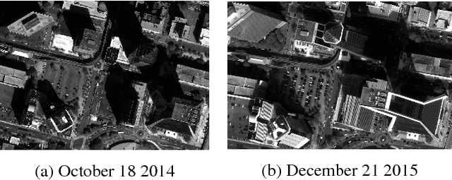
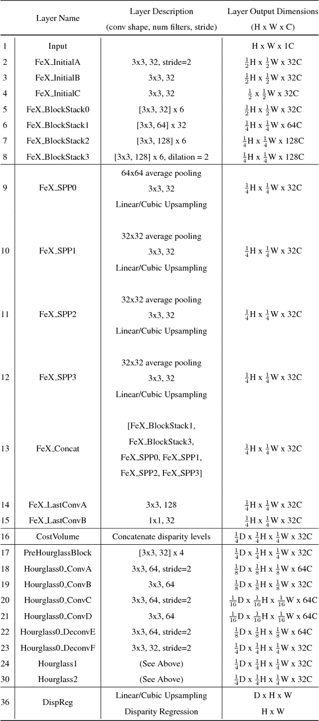
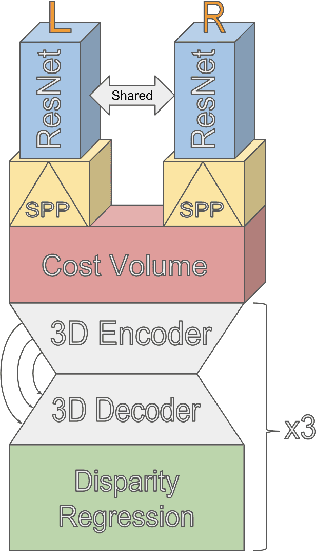
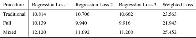
Digital Surface Model generation from satellite imagery is a difficult task that has been largely overlooked by the deep learning community. Stereo reconstruction techniques developed for terrestrial systems including self driving cars do not translate well to satellite imagery where image pairs vary considerably. In this work we present neural network tailored for Digital Surface Model generation, a ground truthing and training scheme which maximizes available hardware, and we present a comparison to existing methods. The resulting models are smooth, preserve boundaries, and enable further processing. This represents one of the first attempts at leveraging deep learning in this domain.