 Add to Chrome
 Add to Firefox
 Add to Edge
Support Vector Machine for Determining Euler Angles in an Inertial Navigation System
Dec 07, 2022


The paper discusses the improvement of the accuracy of an inertial navigation system created on the basis of MEMS sensors using machine learning (ML) methods. As input data for the classifier, we used infor-mation obtained from a developed laboratory setup with MEMS sensors on a sealed platform with the ability to adjust its tilt angles. To assess the effectiveness of the models, test curves were constructed with different values of the parameters of these models for each core in the case of a linear, polynomial radial basis function. The inverse regularization parameter was used as a parameter. The proposed algorithm based on MO has demonstrated its ability to correctly classify in the presence of noise typical for MEMS sensors, where good classification results were obtained when choosing the optimal values of hyperpa-rameters.
* 7 pages, 5 figures, 5 formulas
Construction of Object Boundaries for the Autopilotof a Surface Robot from Satellite Imagesusing Computer Vision Methods
Dec 05, 2022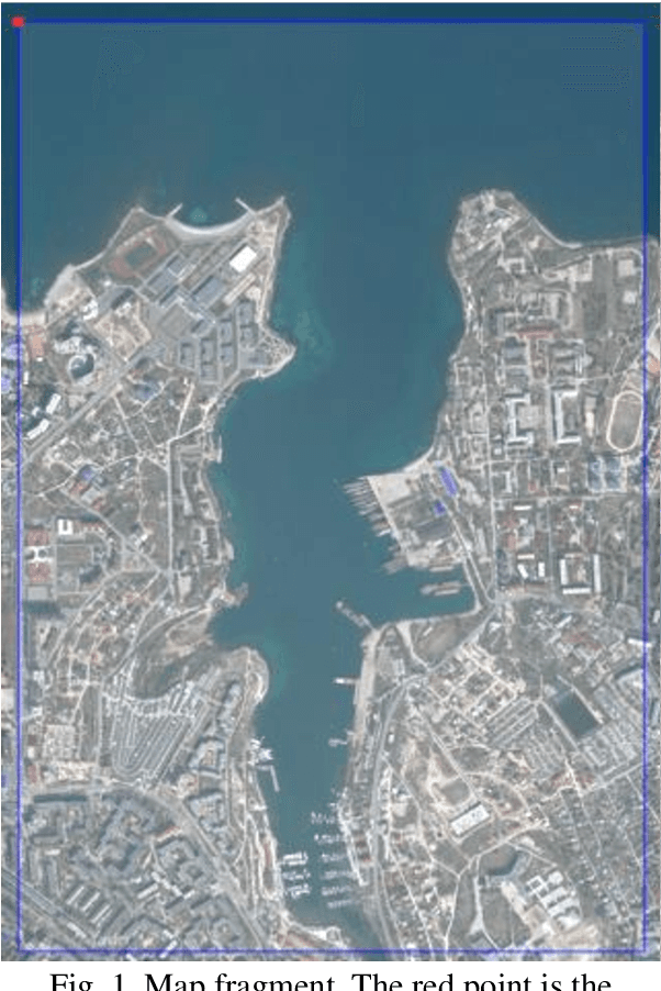

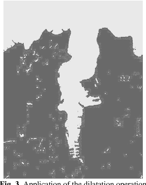
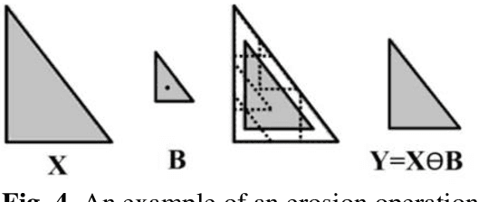
An algorithm and a program for detecting the boundaries of water bodies for the autopilot module of asurface robot are proposed. A method for detecting water objects on satellite maps by the method of finding a color in the HSV color space, using erosion, dilation - methods of digital image filtering is applied.The following operators for constructing contours on the image are investigated: the operators of Sobel,Roberts, Prewitt, and from them the one that detects the boundary more accurately is selected for thismodule. An algorithm for calculating the GPS coordinates of the contours is created. The proposed algorithm allows saving the result in a format suitable for the surface robot autopilot module.
* 9 pages, 11 figures, 24 formulas
Increasing the Accuracy of Sound Velocity Measurement in a Vector Single-Beam Acoustic Current Velocity Meter
Nov 30, 2022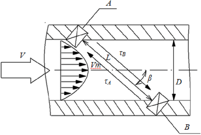
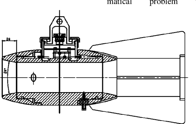
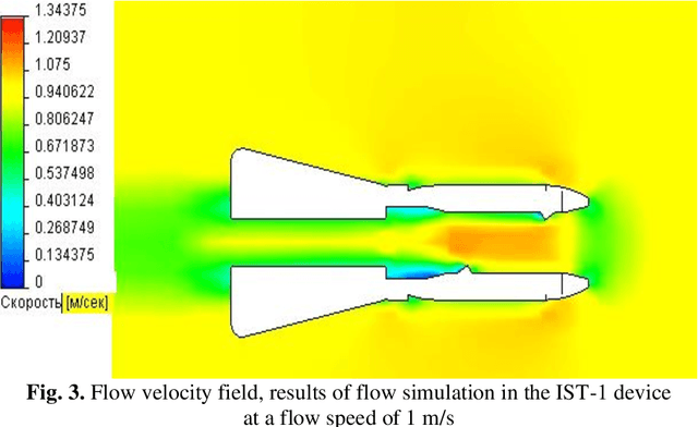
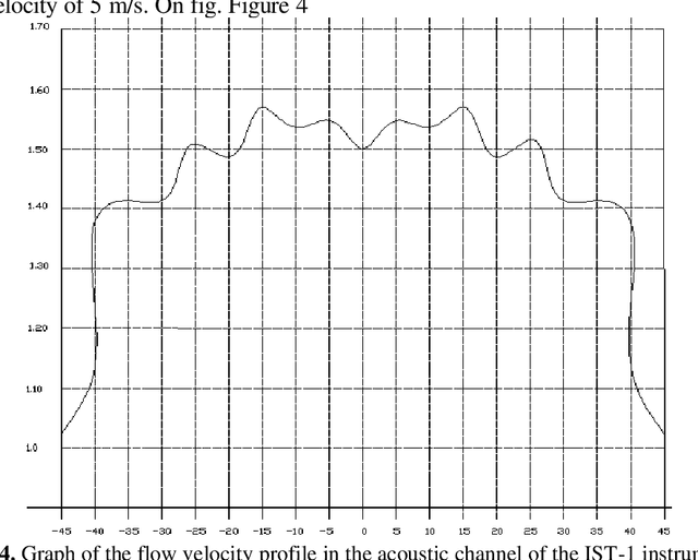
Acoustic flow velocity and direction meters from the IST series, which can be integrated into various measuring systems, are considered. The simulation of the flow profile in the measuring tube was carried out depending on the free flow velocity. A measurement method has been developed that uses the transit time of repeated acoustic signals reflected from the transducers, which makes it possible to take into account time hardware delays and a change in the length of the measuring base, which affect the determination of the speed of sound and flow, while increasing the accuracy of measuring the sound speed parameters with simultaneous measuring the flow velocity and temperatures for liquid media of different densities.
* 9 pages, 9 figures, 10 formulas
Application of the YOLOv5 Model for the Detection of Microobjects in the Marine Environment
Nov 28, 2022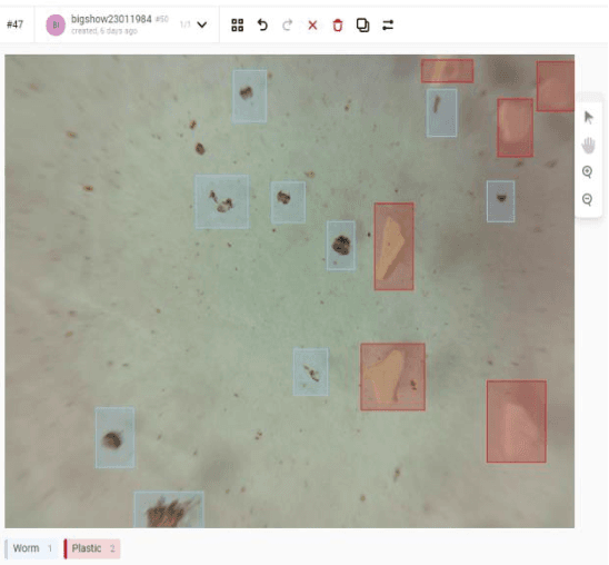
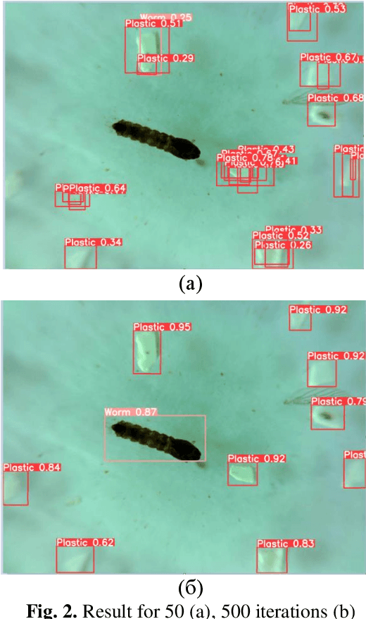
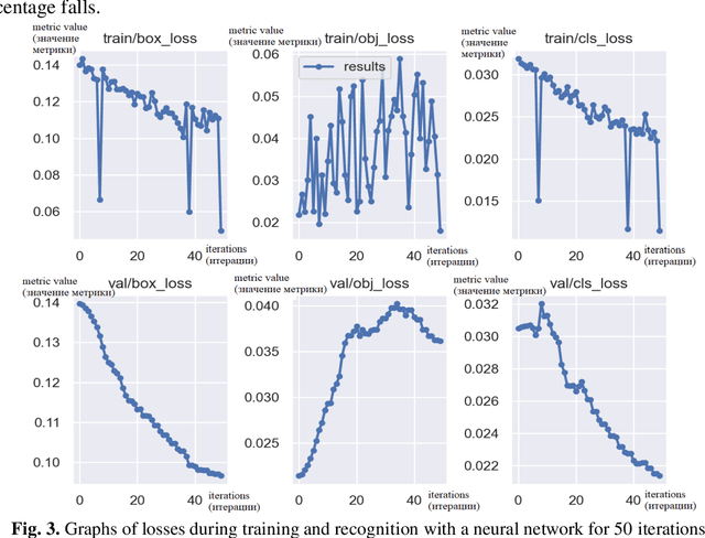
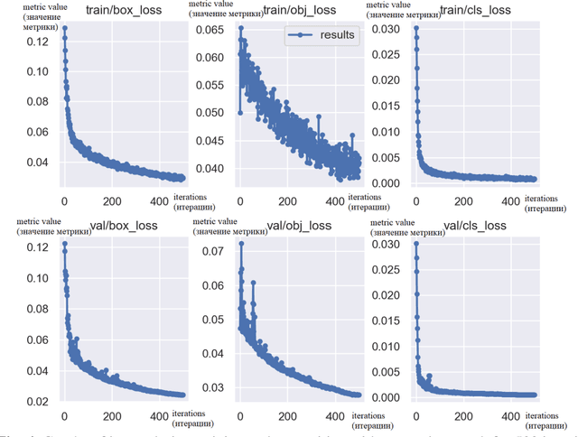
The efficiency of using the YOLOV5 machine learning model for solving the problem of automatic de-tection and recognition of micro-objects in the marine environment is studied. Samples of microplankton and microplastics were prepared, according to which a database of classified images was collected for training an image recognition neural network. The results of experiments using a trained network to find micro-objects in photo and video images in real time are presented. Experimental studies have shown high efficiency, comparable to manual recognition, of the proposed model in solving problems of detect-ing micro-objects in the marine environment.
Development of In Situ Acoustic Instruments for The Aquatic Environment Study
Sep 14, 2021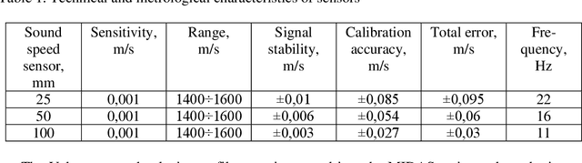
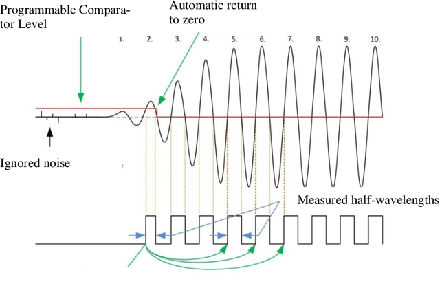
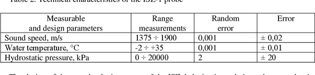
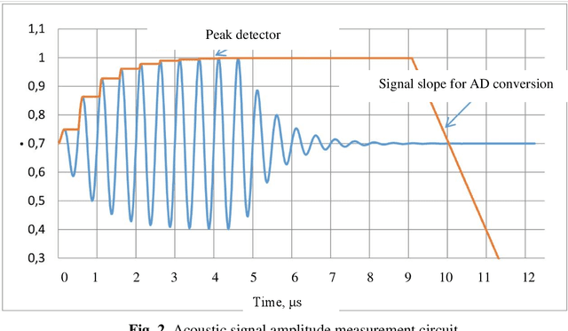
Based on the analysis of existing acoustic methods and instruments, a prototype of an automated instrument has been developed to perform joint measurements in situ of two parameters: sound speed and ultrasound attenuation. The device is based on existing sound velocity profilers. It was proposed to replace the TDC-GP22 converters used in the sound speed meter ISZ-1 with more advanced modern modified converters TDC-GP30, which can significantly improve the accuracy of measuring the amplitude of the reflected acoustic signal. The programs for processing signals from the primary acoustic transducer have been developed. The model of the device passed preliminary tests.
* 8 pages, 3 figures
Automated Environmental Monitoring Intelligent System Based on Compact Autonomous Robots for The Sevastopol Bay
Aug 25, 2021
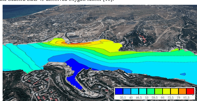
This paper proposes an intelligent system concept for automatic monitoring of aquatic en-vironment main parameters in order to detect their anomalies and assess quantitative and qualitative indicators, including the determination of the field under study spatial and tem-poral characteristics. The system is built on the basis of a small autonomous surface robots network. A conceptual model of a monitoring system for the implementation of environ-mental parameters automated integrated monitoring throughout the entire observation field is proposed. A software model has been developed and simulation experiments have been conducted to calculate the main indicators and assess environment spatial and temporal variability. According to the results of the simulation, control maps of the stations optimal density were formed. The proposed approach to solving the problem of monitoring the aquatic environment in comparison with the traditional has such advantages as scalability, flexibility, speed of deployment and clotting, self-organization, the ability to create a wide field of view by changing the number of robots.
* 7 pages, 3 figures