Get our free extension to see links to code for papers anywhere online!Free add-on: code for papers everywhere!Free add-on: See code for papers anywhere!
 Add to Chrome
 Add to Firefox
 Add to Edge
High-resolution land cover change from low-resolution labels: Simple baselines for the 2021 IEEE GRSS Data Fusion Contest
Paper and Code
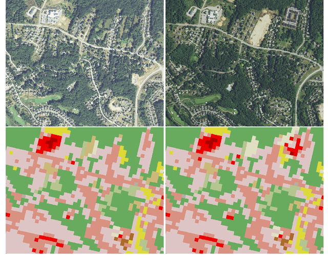
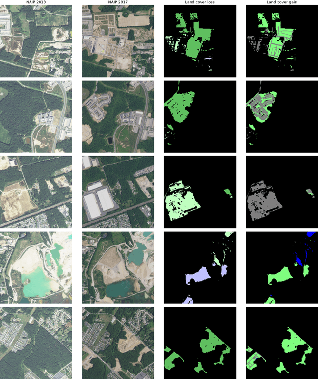
We present simple algorithms for land cover change detection in the 2021 IEEE GRSS Data Fusion Contest. The task of the contest is to create high-resolution (1m / pixel) land cover change maps of a study area in Maryland, USA, given multi-resolution imagery and label data. We study several baseline models for this task and discuss directions for further research. See https://dfc2021.blob.core.windows.net/competition-data/dfc2021_index.txt for the data and https://github.com/calebrob6/dfc2021-msd-baseline for an implementation of these baselines.
* 10 pages
View paper on