 Add to Chrome
 Add to Firefox
 Add to Edge
Connectivity-Aware UAV Path Planning with Aerial Coverage Maps
Paper and Code
Jun 01, 2019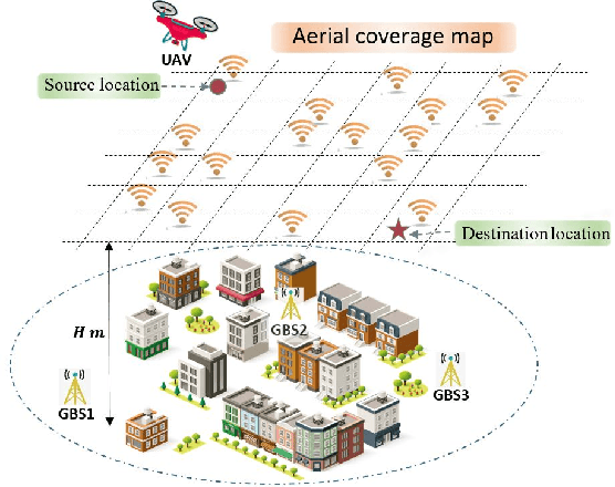
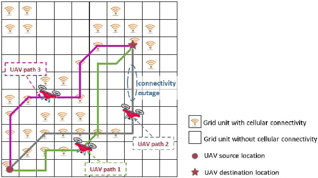
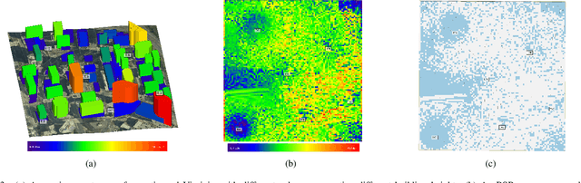
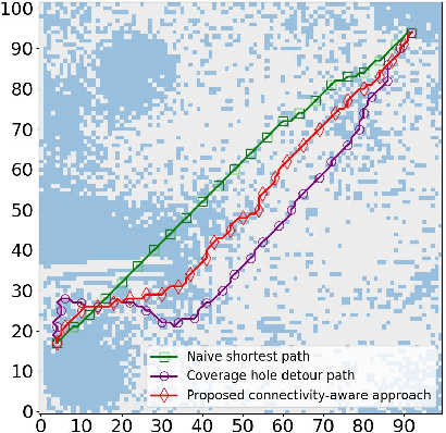
Cellular networks are promising to support effective wireless communications for unmanned aerial vehicles (UAVs), which will help to enable various long-range UAV applications. However, these networks are optimized for terrestrial users, and thus do not guarantee seamless aerial coverage. In this paper, we propose to overcome this difficulty by exploiting controllable mobility of UAVs, and investigate connectivity-aware UAV path planning. To explicitly impose communication requirements on UAV path planning, we introduce two new metrics to quantify the cellular connectivity quality of a UAV path. Moreover, aerial coverage maps are used to provide accurate locations of scattered coverage holes in the complicated propagation environment. We formulate the UAV path planning problem as finding the shortest path subject to connectivity constraints. Based on graph search methods, a novel connectivity-aware path planning algorithm with low complexity is proposed. The effectiveness and superiority of our proposed algorithm are demonstrated using the aerial coverage map of an urban section in Virginia, which is built by ray tracing. Simulation results also illustrate a tradeoff between the path length and connectivity quality of UAVs.