 Add to Chrome
 Add to Firefox
 Add to Edge
Real-time Geo-localization Using Satellite Imagery and Topography for Unmanned Aerial Vehicles
Paper and Code
Aug 07, 2021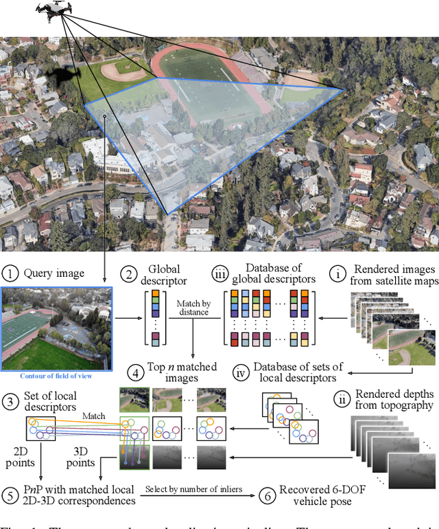
The capabilities of autonomous flight with unmanned aerial vehicles (UAVs) have significantly increased in recent times. However, basic problems such as fast and robust geo-localization in GPS-denied environments still remain unsolved. Existing research has primarily concentrated on improving the accuracy of localization at the cost of long and varying computation time in various situations, which often necessitates the use of powerful ground station machines. In order to make image-based geo-localization online and pragmatic for lightweight embedded systems on UAVs, we propose a framework that is reliable in changing scenes, flexible about computing resource allocation and adaptable to common camera placements. The framework is comprised of two stages: offline database preparation and online inference. At the first stage, color images and depth maps are rendered as seen from potential vehicle poses quantized over the satellite and topography maps of anticipated flying areas. A database is then populated with the global and local descriptors of the rendered images. At the second stage, for each captured real-world query image, top global matches are retrieved from the database and the vehicle pose is further refined via local descriptor matching. We present field experiments of image-based localization on two different UAV platforms to validate our results.