 Add to Chrome
 Add to Firefox
 Add to Edge
Generating Interpretable Poverty Maps using Object Detection in Satellite Images
Paper and Code
Feb 18, 2020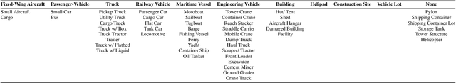
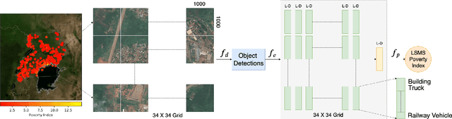
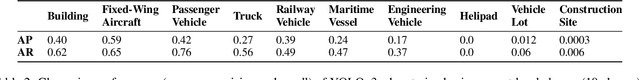
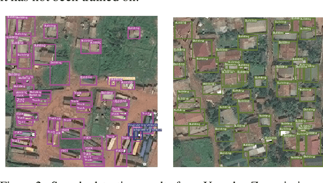
Accurate local-level poverty measurement is an essential task for governments and humanitarian organizations to track the progress towards improving livelihoods and distribute scarce resources. Recent computer vision advances in using satellite imagery to predict poverty have shown increasing accuracy, but they do not generate features that are interpretable to policymakers, inhibiting adoption by practitioners. Here we demonstrate an interpretable computational framework to accurately predict poverty at a local level by applying object detectors to high resolution (30cm) satellite images. Using the weighted counts of objects as features, we achieve 0.539 Pearson's r^2 in predicting village-level poverty in Uganda, a 31% improvement over existing (and less interpretable) benchmarks. Feature importance and ablation analysis reveal intuitive relationships between object counts and poverty predictions. Our results suggest that interpretability does not have to come at the cost of performance, at least in this important domain.