 Add to Chrome
 Add to Firefox
 Add to Edge
From Mobile Data to Business Insights: An End-to-End Analytics Framework for Large-Scale Urban Mobility Analysis and Decision Support
Jul 03, 2026
Real time location data derived from mobile applications is a powerful tool for addressing various urban challenges, including tourism planning, parking management, bus route optimization, and resource allocation. Besides, it offers invaluable insights for shaping strategic decisions in commercial domains such as location based services, market share analysis, and behavioral profiling. In this expansive study, we aim to address all of the aforementioned challenges by investigating the behaviors and patterns of smartphone users within urban environments, particularly in the domains of tourism, transportation, and retail. Our approach encompasses the development of a sophisticated data platform from inception to implementation, which includes the formulation of use cases, architectural design, and implementation of modules. We employ state of the art techniques and technologies, including data anonymization, ETL pipelines, and utilizing Google BigQuery and Vertex AI for data processing and machine learning model development. A modular architecture based on reusable analytical building blocks was developed to generate data products that support multiple stakeholder driven use cases. Additionally, we apply interactive data visualization techniques via Power BI to facilitate the effective interpretation of analytical findings by stakeholders. The developed models address a wide range of mobility analytics tasks, including mobility profiling, frequent trajectory mining, area of influence analysis, traffic anomaly detection, and origin destination pattern analysis. The results demonstrate the framework's ability to capture user mobility dynamics at fine spatial and temporal resolutions, providing actionable insights for urban planning and strategic business decision making.

Mining Human Mobility Data to Discover Locations and Habits
Sep 25, 2019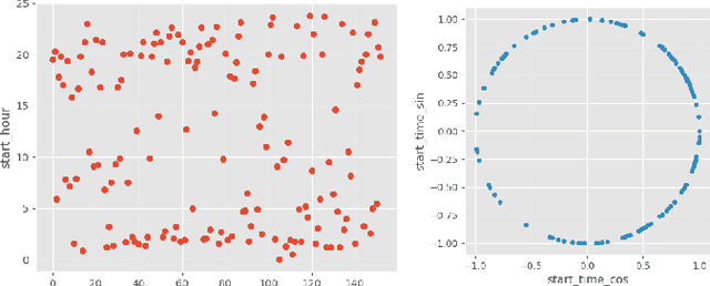
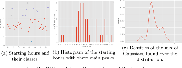
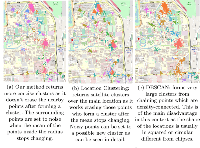
Many aspects of life are associated with places of human mobility patterns and nowadays we are facing an increase in the pervasiveness of mobile devices these individuals carry. Positioning technologies that serve these devices such as the cellular antenna (GSM networks), global navigation satellite systems (GPS), and more recently the WiFi positioning system (WPS) provide large amounts of spatio-temporal data in a continuous way. Therefore, detecting significant places and the frequency of movements between them is fundamental to understand human behavior. In this paper, we propose a method for discovering user habits without any a priori or external knowledge by introducing a density-based clustering for spatio-temporal data to identify meaningful places and by applying a Gaussian Mixture Model (GMM) over the set of meaningful places to identify the representations of individual habits. To evaluate the proposed method we use two real-world datasets. One dataset contains high-density GPS data and the other one contains GSM mobile phone data in a coarse representation. The results show that the proposed method is suitable for this task as many unique habits were identified. This can be used for understanding users' behavior and to draw their characterizing profiles having a panorama of the mobility patterns from the data.
Identifying Points of Interest and Similar Individuals from Raw GPS Data
Apr 19, 2019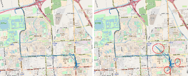

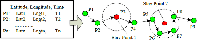
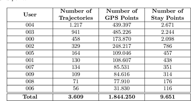
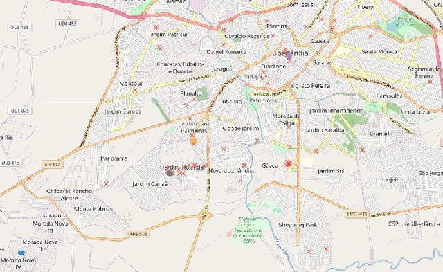
Smartphones and portable devices have become ubiquitous and part of everyone's life. Due to the fact of its portability, these devices are perfect to record individuals' traces and life-logging generating vast amounts of data at low costs. These data is emerging as a new source for studies in human mobility patterns raising the number of research projects and techniques aiming to analyze and retrieve useful information from it. The aim of this paper is to explore GPS raw data from different individuals in a community and apply data mining algorithms to identify meaningful places in a region and describe user's profiles and its similarities. We evaluate the proposed method with a real-world dataset. The experimental results show that the steps performed to identify points of interest (POIs) and further the similarity between the users are quite satisfactory serving as a supplement for urban planning and social networks.