 Add to Chrome
 Add to Firefox
 Add to Edge
From crown candidates to neighborhood screening: integrating optical GeoAI and spatial modeling for urban-canopy assessment in Davis, California
Aug 14, 2026
Timely urban-canopy information is essential for linking remote sensing with heat, mobility, and neighborhood planning. We developed an optical GeoAI workflow for Davis, California, using 2022 National Agriculture Imagery Program imagery (0.6 m RGB+NIR). DeepForest generated crown candidates; an NDVI threshold, non-maximum suppression, and box-prompted Segment Anything Model (ViT-B) produced a crown-anchored canopy surface. Analyses used the 25.92 km2 Census TIGER municipal boundary and a 100 m grid. The workflow retained 11,741 candidate crowns and mapped 2.43 km2 of canopy (9.37% of the city). On the identical extent, 87.8% of mapped canopy pixels and 97.4% of candidate centers agreed with the 2022 USDA/CAL FIRE LiDAR-assisted canopy product; the optical surface represented 34.2% of the reference canopy area (IoU 0.288; Dice 0.448). Approximately 49% of candidates occurred within 15 m of a road. Canopy was inversely associated with Landsat land-surface temperature (Spearman rho = -0.293; partial rho = -0.370 controlling for built probability), and spatial-lag modeling confirmed clear neighborhood structure. Two transparent attention surfaces combined canopy need with thermal and contextual indicators. The framework provides a reproducible, updateable screening layer that complements structural canopy products and municipal inventories while retaining assumptions, data provenance, and spatial diagnostics for planning interpretation.

A novel post-hoc explanation comparison metric and applications
Nov 17, 2023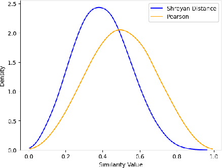
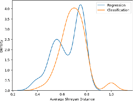
Explanatory systems make the behavior of machine learning models more transparent, but are often inconsistent. To quantify the differences between explanatory systems, this paper presents the Shreyan Distance, a novel metric based on the weighted difference between ranked feature importance lists produced by such systems. This paper uses the Shreyan Distance to compare two explanatory systems, SHAP and LIME, for both regression and classification learning tasks. Because we find that the average Shreyan Distance varies significantly between these two tasks, we conclude that consistency between explainers not only depends on inherent properties of the explainers themselves, but also the type of learning task. This paper further contributes the XAISuite library, which integrates the Shreyan distance algorithm into machine learning pipelines.
The XAISuite framework and the implications of explanatory system dissonance
Apr 15, 2023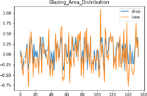
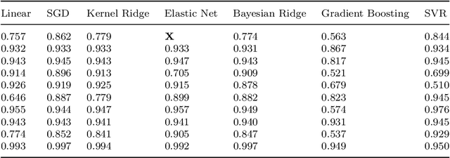
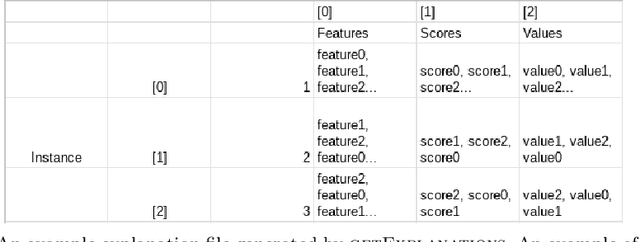
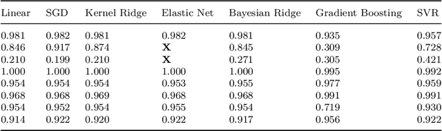
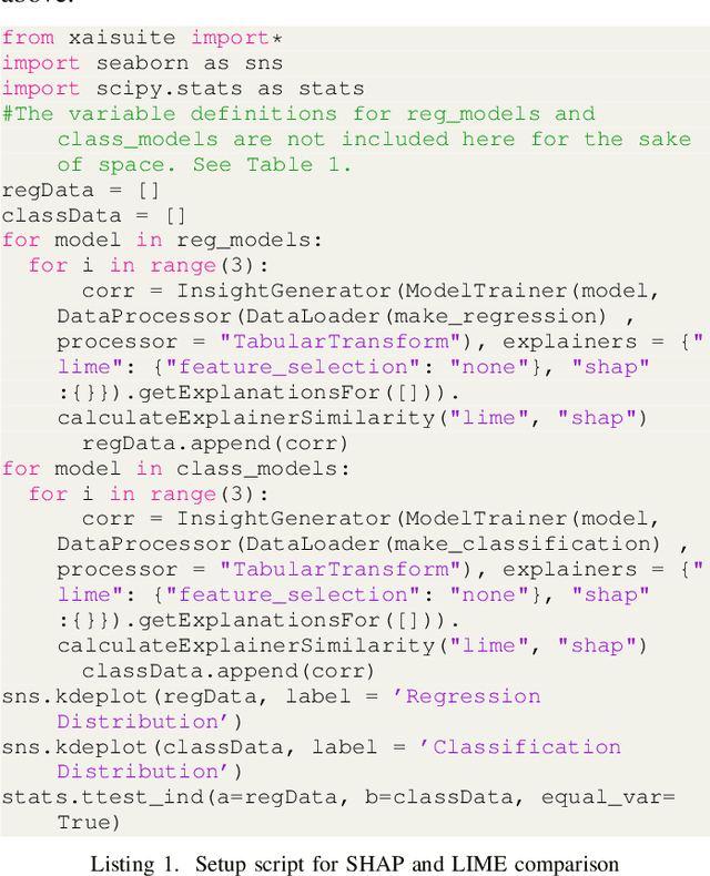
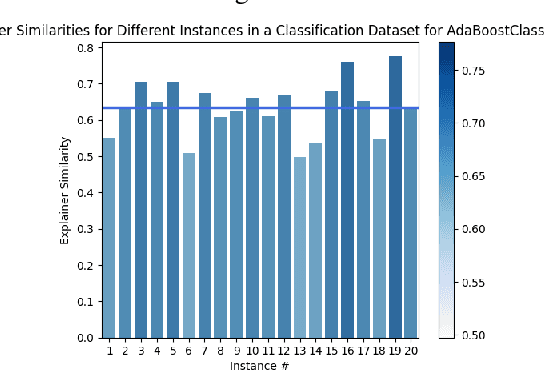
Explanatory systems make machine learning models more transparent. However, they are often inconsistent. In order to quantify and isolate possible scenarios leading to this discrepancy, this paper compares two explanatory systems, SHAP and LIME, based on the correlation of their respective importance scores using 14 machine learning models (7 regression and 7 classification) and 4 tabular datasets (2 regression and 2 classification). We make two novel findings. Firstly, the magnitude of importance is not significant in explanation consistency. The correlations between SHAP and LIME importance scores for the most important features may or may not be more variable than the correlation between SHAP and LIME importance scores averaged across all features. Secondly, the similarity between SHAP and LIME importance scores cannot predict model accuracy. In the process of our research, we construct an open-source library, XAISuite, that unifies the process of training and explaining models. Finally, this paper contributes a generalized framework to better explain machine learning models and optimize their performance.