 Add to Chrome
 Add to Firefox
 Add to Edge
RESOLVE: A Multi-Resolution and Multi-Modal Dataset for Roadside Cooperative Perception
Jun 30, 2026
LiDAR has increasingly been integrated into traffic cameras to expand coverage and mitigate occlusion in roadside cooperative perception. However, how unimodal and camera-LiDAR fusion architectures behave under variations in LiDAR point sparsity induced by sensor configurations and scene-dependent sensing conditions remains underexplored. We introduce RESOLVE, a large-scale real-world benchmark dataset featuring multi-resolution roadside LiDAR and synchronized camera-LiDAR sensing for systematic evaluation of unimodal and fusion-based architectures in roadside 3D detection and tracking. RESOLVE contains over 100k images and 26k point cloud frames with 220k manually annotated bounding boxes, captured at a real-world urban intersection across diverse lighting and weather conditions and spanning 10 classes of traffic participants. In particular, RESOLVE enables controlled evaluation across three LiDAR resolution levels while keeping all other sensing and environmental factors fixed. This allows fair cross-architecture comparisons under point cloud distribution shifts resulting from resolution variations, sensing distance, and training-inference resolution mismatches. Results from extensive benchmark experiments reveal insights into how multimodal fusion can compensate for LiDAR point sparsity, offering clues for designing cost-efficient roadside multimodal perception. The dataset and benchmark codes are available at https://github.com/ASU-Suo-Lab/RESOLVE.

High and Low Resolution Tradeoffs in Roadside Multimodal Sensing
Oct 02, 2024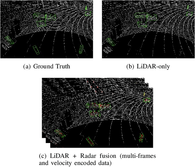
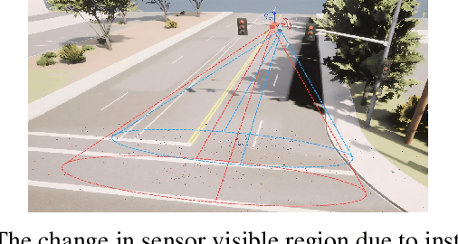
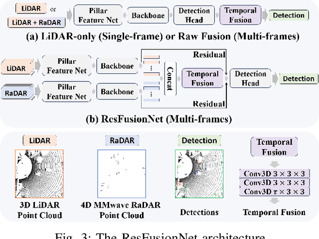
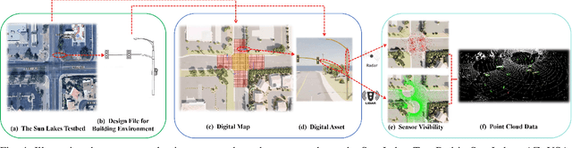
Designing roadside sensing for intelligent transportation applications requires balancing cost and performance,especially when choosing between high and low-resolution sensors. The tradeoff is challenging due to sensor heterogeneity,where different sensors produce unique data modalities due to varying physical principles. High-resolution LiDAR offers detailed point cloud, while 4D millimeter-wave radar, despite providing sparser data, delivers velocity information useful for distinguishing objects based on movement patterns. To assess whether reductions in spatial resolution can be compensated by the informational richness of sensors, particularly in recognizing both vehicles and vulnerable road users (VRUs), we propose Residual Fusion Net (ResFusionNet) to fuse multimodal data for 3D object detection. This enables a quantifiable tradeoff between spatial resolution and information richness across different modalities. Furthermore, we introduce a sensor placement algorithm utilizing probabilistic modeling to manage uncertainties in sensor visibility influenced by environmental or human-related factors. Through simulation-assisted ex-ante evaluation on a real-world testbed, our findings show marked marginal gains in detecting VRUs--an average of 16.7% for pedestrians and 11% for cyclists--when merging velocity-encoded radar with LiDAR, compared to LiDAR only configurations. Additionally, experimental results from 300 runs reveal a maximum loss of 11.5% and a average of 5.25% in sensor coverage due to uncertainty factors. These findings underscore the potential of using low spatial resolution but information-rich sensors to enhance detection capabilities for vulnerable road users while highlighting the necessity of thoroughly evaluating sensor modality heterogeneity, traffic participant diversity, and operational uncertainties when making sensor tradeoffs in practical applications.