 Add to Chrome
 Add to Firefox
 Add to Edge
Topology, homogeneity and scale factors for object detection: application of eCognition software for urban mapping using multispectral satellite image
Dec 06, 2018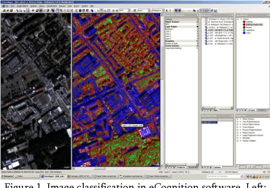
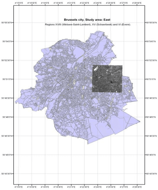
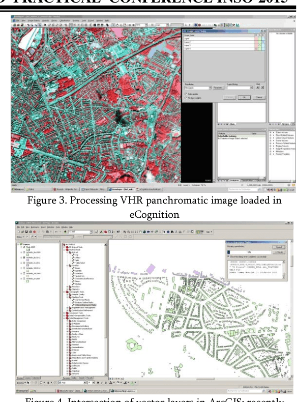
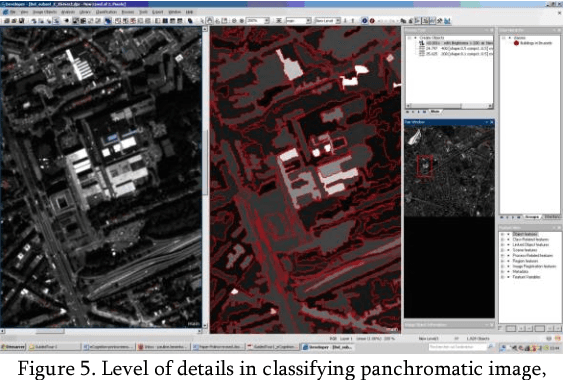
The research scope of this paper is to apply spatial object based image analysis (OBIA) method for processing panchromatic multispectral image covering study area of Brussels for urban mapping. The aim is to map different land cover types and more specifically, built-up areas from the very high resolution (VHR) satellite image using OBIA approach. A case study covers urban landscapes in the eastern areas of the city of Brussels, Belgium. Technically, this research was performed in eCognition raster processing software demonstrating excellent results of image segmentation and classification. The tools embedded in eCognition enabled to perform image segmentation and objects classification processes in a semi-automated regime, which is useful for the city planning, spatial analysis and urban growth analysis. The combination of the OBIA method together with technical tools of the eCognition demonstrated applicability of this method for urban mapping in densely populated areas, e.g. in megapolis and capital cities. The methodology included multiresolution segmentation and classification of the created objects.
* 6 pages, 12 figures, INSO2015, Ed. by A. Girgvliani et al. Akaki Tsereteli State University, Kutaisi (Imereti), Georgia
Urban-Rural Environmental Gradient in a Developing City: Testing ENVI GIS Functionality
Dec 06, 2018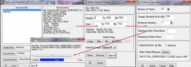
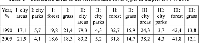
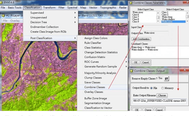
The research performs urban ecosystem analysis supported by ENVI GIS by integrated studies on land cover types and geospatial modeling of Taipei city. The paper deals with the role of anthropogenic pressure on the structure of the landscape and change of land cover types. Methods included assessment of the impact from anthropogenic activities on the natural ecosystems, evaluation of the rate and scale of landscape dynamics using remote sensing data and GIS. The research aims to assist environmentalists and city planners to evaluate strategies for specific objectives of urban development in Taiwan, China.
* 5 pages, 2 figures, 1 table