 Add to Chrome
 Add to Firefox
 Add to Edge
On the suitability of generalized regression neural networks for GNSS position time series prediction for geodetic applications in geodesy and geophysics
May 22, 2020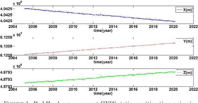
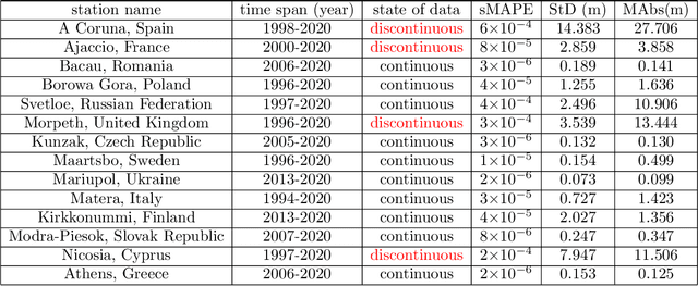
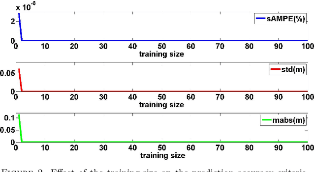
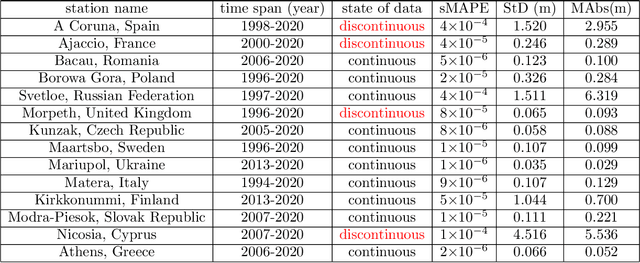
In this paper, the generalized regression neural network is used to predict the GNSS position time series. Using the IGS 24-hour final solution data for Bad Hamburg permanent GNSS station in Germany, it is shown that the larger the training of the network, the higher the accuracy is, regardless of the time span of the time series. In order to analyze the performance of the neural network in various conditions, 14 permanent stations are used in different countries, namely, Spain, France, Romania, Poland, Russian Federation, United Kingdom, Czech Republic, Sweden, Ukraine, Italy, Finland, Slovak Republic, Cyprus, and Greece. The performance analysis is divided into two parts, continuous data-without gaps-and discontinuous ones-having intervals of gaps with no data available. Three measure of error are presented, namely, symmetric mean absolute percentage error, standard deviation, and mean of absolute errors. It is shown that for discontinuous data the position can be predicted with an accuracy of up to 6 centimeters, while the continuous data positions present a higher prediction accuracy, as high as 3 centimeters. In order to compare the results of this machine learning algorithm with the traditional statistical approaches, the Theta method is used, which is well-established for high-accuracy time series prediction. The comparison shows that the generalized regression neural network machine learning algorithm presents better accuracy than the Theta method, possibly up to 250 times. In addition, it is approximately 4.6 times faster.
Identification and Classification of Phenomena in Multispectral Satellite Imagery Using a New Image Smoother Method and its Applications in Environmental Remote Sensing
Mar 17, 2020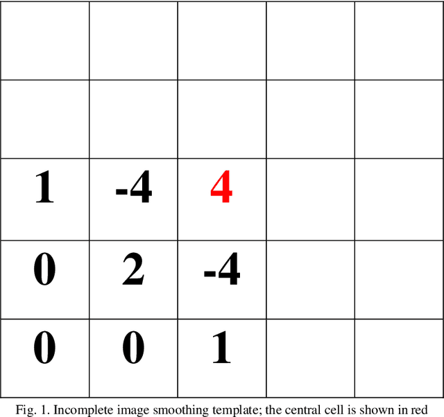
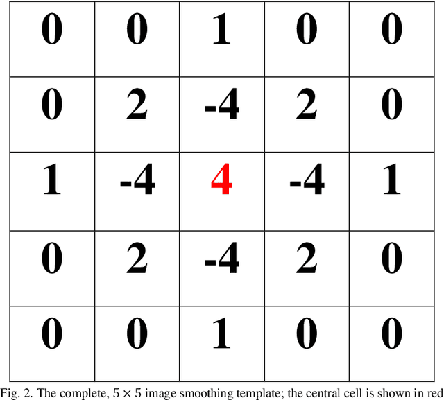
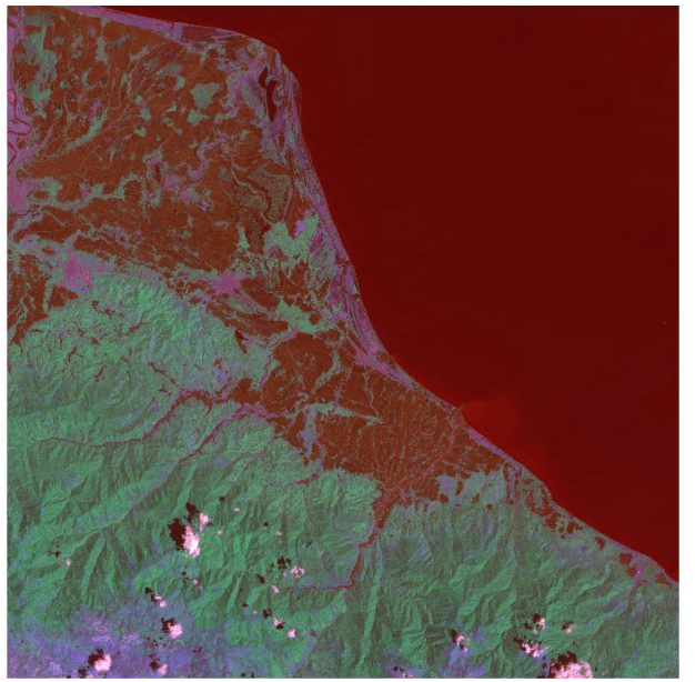
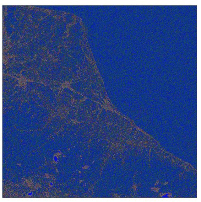
In this paper a new method of image smoothing for satellite imagery and its applications in environmental remote sensing are presented. This method is based on the global gradient minimization over the whole image. With respect to the image discrete identity, the continuous minimization problem is discretized. Using the finite difference numerical method of differentiation, a simple yet efficient 5*5-pixel template is derived. Convolution of the derived template with the image in different bands results in the discrimination of various image elements. This method is extremely fast, besides being highly precise. A case study is presented for the northern Iran, covering parts of the Caspian Sea. Comparison of the method with the usual Laplacian template reveals that it is more capable of distinguishing phenomena in the image.
Optimal Image Smoothing and Its Applications in Anomaly Detection in Remote Sensing
Mar 17, 2020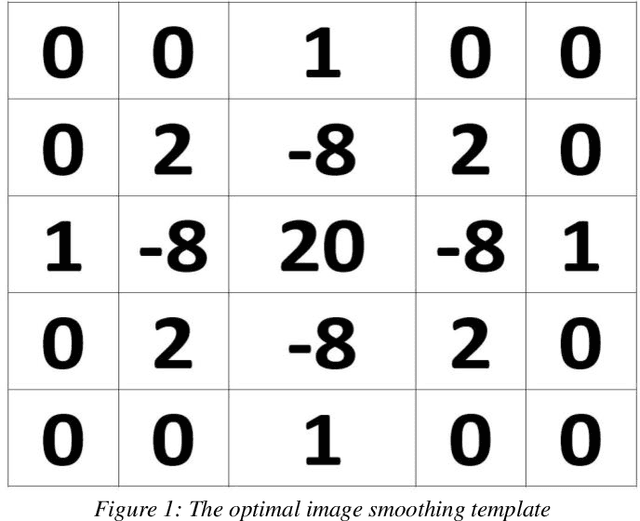
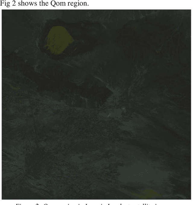
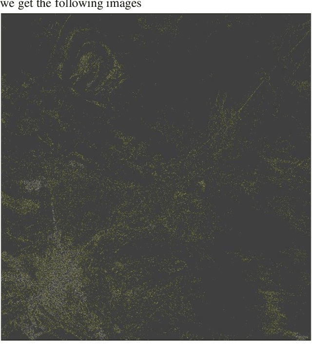
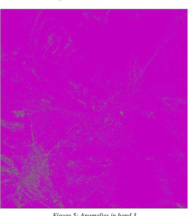
This paper is focused on deriving an optimal image smoother. The optimization is done through the minimization of the norm of the Laplace operator in the image coordinate system. Discretizing the Laplace operator and using the method of Euler-Lagrange result in a weighted average scheme for the optimal smoother. Satellite imagery can be smoothed by this optimal smoother. It is also very fast and can be used for detecting the anomalies in the image. A real anomaly detecting problem is considered for the Qom region in Iran. Satellite image in different bands are smoothed. Comparing the smoothed and original images in different bands, the maps of anomalies are presented. Comparison between the derived method and the existing methods reveals that it is more efficient in detecting anomalies in the region.