 Add to Chrome
 Add to Firefox
 Add to Edge
Fuzzy Rules and Evidence Theory for Satellite Image Analysis
Apr 08, 2011

Design of a fuzzy rule based classifier is proposed. The performance of the classifier for multispectral satellite image classification is improved using Dempster- Shafer theory of evidence that exploits information of the neighboring pixels. The classifiers are tested rigorously with two known images and their performance are found to be better than the results available in the literature. We also demonstrate the improvement of performance while using D-S theory along with fuzzy rule based classifiers over the basic fuzzy rule based classifiers for all the test cases.
Land cover classification using fuzzy rules and aggregation of contextual information through evidence theory
Nov 23, 2009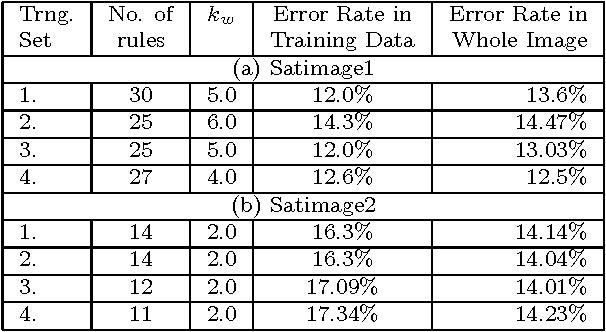
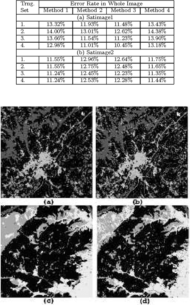
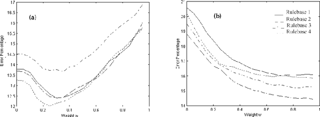
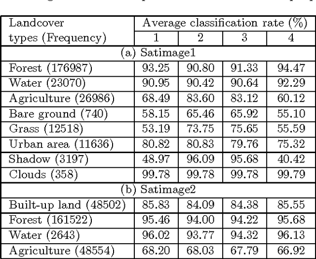
Land cover classification using multispectral satellite image is a very challenging task with numerous practical applications. We propose a multi-stage classifier that involves fuzzy rule extraction from the training data and then generation of a possibilistic label vector for each pixel using the fuzzy rule base. To exploit the spatial correlation of land cover types we propose four different information aggregation methods which use the possibilistic class label of a pixel and those of its eight spatial neighbors for making the final classification decision. Three of the aggregation methods use Dempster-Shafer theory of evidence while the remaining one is modeled after the fuzzy k-NN rule. The proposed methods are tested with two benchmark seven channel satellite images and the results are found to be quite satisfactory. They are also compared with a Markov random field (MRF) model-based contextual classification method and found to perform consistently better.
* 14 pages, 2 figures
Designing fuzzy rule based classifier using self-organizing feature map for analysis of multispectral satellite images
Nov 23, 2009
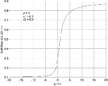
We propose a novel scheme for designing fuzzy rule based classifier. An SOFM based method is used for generating a set of prototypes which is used to generate a set of fuzzy rules. Each rule represents a region in the feature space that we call the context of the rule. The rules are tuned with respect to their context. We justified that the reasoning scheme may be different in different context leading to context sensitive inferencing. To realize context sensitive inferencing we used a softmin operator with a tunable parameter. The proposed scheme is tested on several multispectral satellite image data sets and the performance is found to be much better than the results reported in the literature.
* 23 pages, 7 figures