 Add to Chrome
 Add to Firefox
 Add to Edge
Automatic satellite building construction monitoring
Sep 29, 2022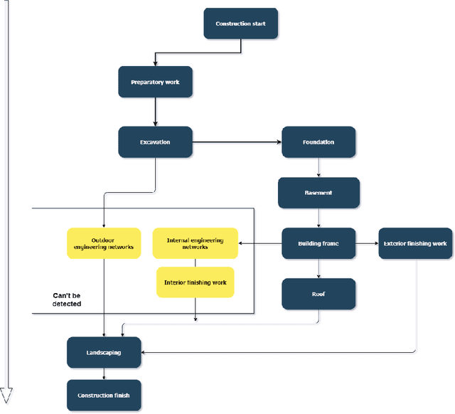
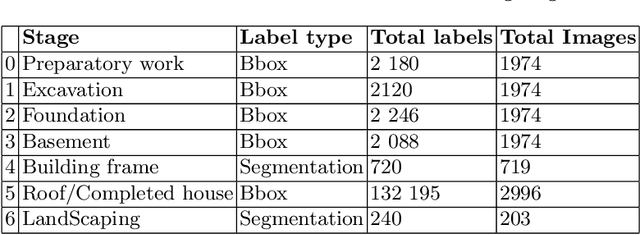
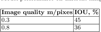
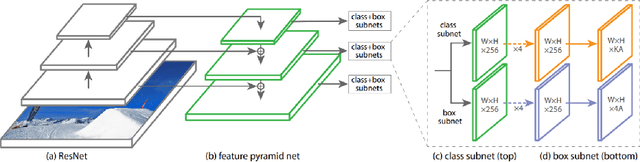
One of the promising applications of satellite images is building construction monitoring. It allows to control the construction progress around the world even in the locations that are hard to reach. One of the main hurdles of this approach is the interpretation of the image data. In this paper, we have employed several novel deep learning techniques to tackle the problem. Various image segmentation and object detection networks were combined into a unified pipeline, which was then used to determine the building construction progress.
Tabular GANs for uneven distribution
Oct 01, 2020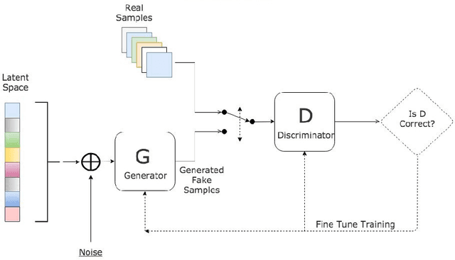
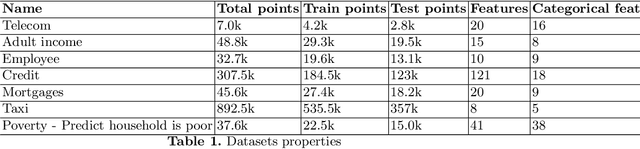

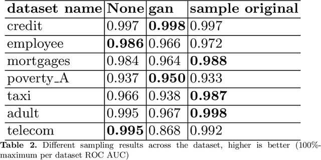
GANs are well known for success in the realistic image generation. However, they can be applied in tabular data generation as well. We will review and examine some recent papers about tabular GANs in action. We will generate data to make train distribution bring closer to the test. Then compare model performance trained on the initial train dataset, with trained on the train with GAN generated data, also we train the model by sampling train by adversarial training. We show that using GAN might be an option in case of uneven data distribution between train and test data.
Automatic salt deposits segmentation: A deep learning approach
Nov 21, 2018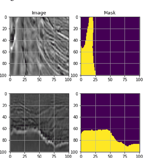
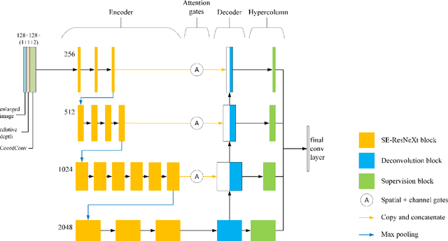
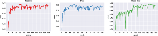
One of the most important applications of seismic reflection is the hydrocarbon exploration which is closely related to salt deposits analysis. This problem is very important even nowadays due to it's non-linear nature. Taking into account the recent developments in deep learning networks TGS-NOPEC Geophysical Company hosted the Kaggle competition for salt deposits segmentation problem in seismic image data. In this paper, we demonstrate the great performance of several novel deep learning techniques merged into a single neural network which achieved the 27th place (top 1%) in the mentioned competition. Using a U-Net with ResNeXt-50 encoder pre-trained on ImageNet as our base architecture, we implemented Spatial-Channel Squeeze & Excitation, Lovasz loss, CoordConv and Hypercolumn methods. The source code for our solution is made publicly available at https://github.com/K-Mike/Automatic-salt-deposits-segmentation.