 Add to Chrome
 Add to Firefox
 Add to Edge
Fire Risk Analysis By Using Sentinel-2 Data: The Case Study Of The Vesuvius In Campania, Italy
Jan 25, 2021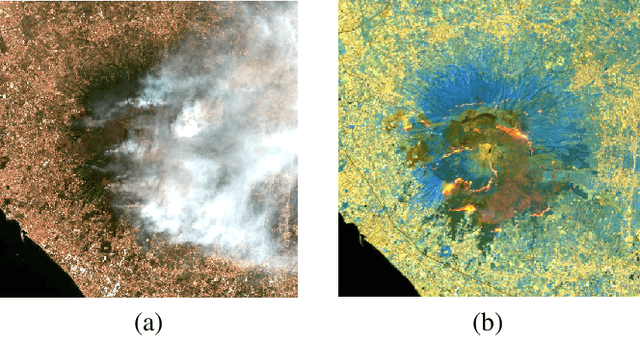
As sadly known, forest fires are part of a set of natural disasters that have always affected regions of the world typically characterized by a tropical climate with long periods of drought. However, due to climate changes of the recent years, other regions of our planet that were not affected by this plague have also had to deal with this phenomenon. One of them is certainly the Italian peninsula, and especially the regions of southern Italy. For this reason, the scientific community, and in particular that one of the remote sensing, plays an important role in the development of reliable techniques to provide useful support to the competent authorities. Therefore, in this work, the capability of the Normalized Differential Water Index (NDWI), derived from spaceborne remote sensing (RS) data, is assessed to monitor the forest fires occurred on a specific study area during the summer of 2017: the volcano Vesuvius, near Naples (in Campania, Italy). In particular, the index is obtained from Sentinel-2 multispectral images of the European Space Agency (ESA), which are free of charge and open accessible. Moreover, the twin Sentinel-2 (S-2) sensors allows to overcome some restrictions on time delivery and high frequency observation. These requirements are goodly matched by other spaceborne sensors, such as MODIS and VIIRS satellites, but at the expense of a lower spatial resolution.
A CNN-Based Super-Resolution Technique for Active Fire Detection on Sentinel-2 Data
Jun 25, 2019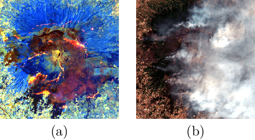
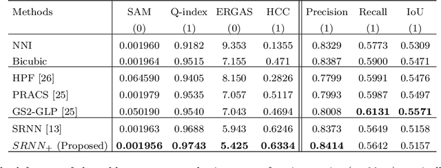
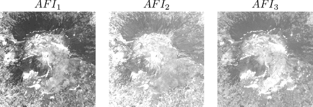
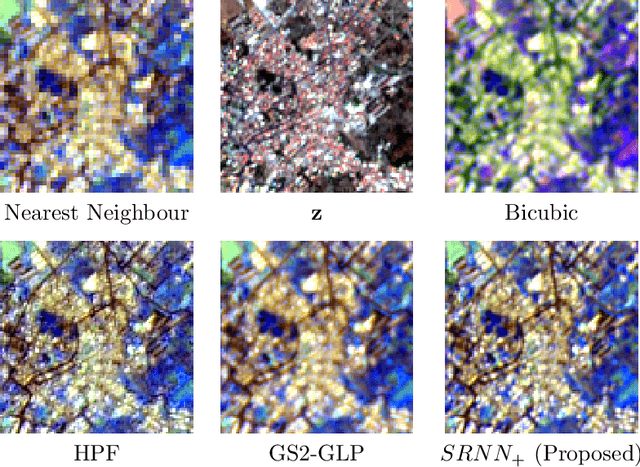
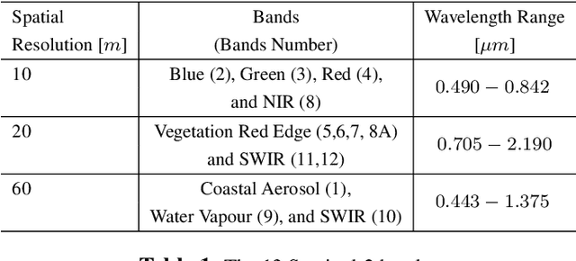
Remote Sensing applications can benefit from a relatively fine spatial resolution multispectral (MS) images and a high revisit frequency ensured by the twin satellites Sentinel-2. Unfortunately, only four out of thirteen bands are provided at the highest resolution of 10 meters, and the others at 20 or 60 meters. For instance the Short-Wave Infrared (SWIR) bands, provided at 20 meters, are very useful to detect active fires. Aiming to a more detailed Active Fire Detection (AFD) maps, we propose a super-resolution data fusion method based on Convolutional Neural Network (CNN) to move towards the 10-m spatial resolution the SWIR bands. The proposed CNN-based solution achieves better results than alternative methods in terms of some accuracy metrics. Moreover we test the super-resolved bands from an application point of view by monitoring active fire through classic indices. Advantages and limits of our proposed approach are validated on specific geographical area (the mount Vesuvius, close to Naples) that was damaged by widespread fires during the summer of 2017.