 Add to Chrome
 Add to Firefox
 Add to Edge
Satellite Image Time Series Analysis for Big Earth Observation Data
Apr 24, 2022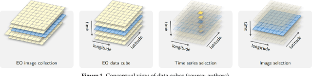
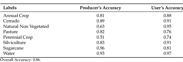
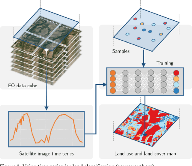
The development of analytical software for big Earth observation data faces several challenges. Designers need to balance between conflicting factors. Solutions that are efficient for specific hardware architectures can not be used in other environments. Packages that work on generic hardware and open standards will not have the same performance as dedicated solutions. Software that assumes that its users are computer programmers are flexible but may be difficult to learn for a wide audience. This paper describes sits, an open-source R package for satellite image time series analysis using machine learning. To allow experts to use satellite imagery to the fullest extent, sits adopts a time-first, space-later approach. It supports the complete cycle of data analysis for land classification. Its API provides a simple but powerful set of functions. The software works in different cloud computing environments. Satellite image time series are input to machine learning classifiers, and the results are post-processed using spatial smoothing. Since machine learning methods need accurate training data, sits includes methods for quality assessment of training samples. The software also provides methods for validation and accuracy measurement. The package thus comprises a production environment for big EO data analysis. We show that this approach produces high accuracy for land use and land cover maps through a case study in the Cerrado biome, one of the world's fast moving agricultural frontiers for the year 2018.
On the semantics of big Earth observation data for land classification
Apr 23, 2022
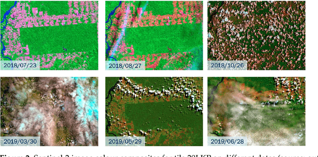
This paper discusses the challenges of using big Earth observation data for land classification. The approach taken is to consider pure data-driven methods to be insufficient to represent continuous change. We argue for sound theories when working with big data. After revising existing classification schemes such as FAO's Land Cover Classification System (LCCS), we conclude that LCCS and similar proposals cannot capture the complexity of landscape dynamics. We then investigate concepts that are being used for analyzing satellite image time series; we show these concepts to be instances of events. Therefore, for continuous monitoring of land change, event recognition needs to replace object identification as the prevailing paradigm. The paper concludes by showing how event semantics can improve data-driven methods to fulfil the potential of big data.