 Add to Chrome
 Add to Firefox
 Add to Edge
A Deep Learning Approach to Mapping Irrigation: IrrMapper-U-Net
Mar 04, 2021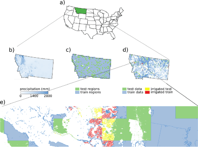
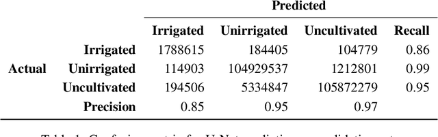
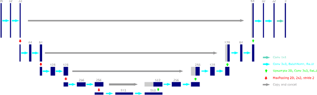
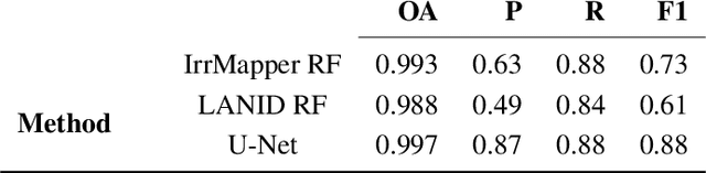
Accurate maps of irrigation are essential for understanding and managing water resources. We present a new method of mapping irrigation and demonstrate its accuracy for the state of Montana from years 2000-2019. The method is based off of an ensemble of convolutional neural networks that use reflectance information from Landsat imagery to classify irrigated pixels, that we call IrrMapper-U-Net. The methodology does not rely on extensive feature engineering and does not condition the classification with land use information from existing geospatial datasets. The ensemble does not need exhaustive hyperparameter tuning and the analysis pipeline is lightweight enough to be implemented on a personal computer. Furthermore, the proposed methodology provides an estimate of the uncertainty associated with classification. We evaluated our methodology and the resulting irrigation maps using a highly accurate novel spatially-explicit ground truth data set, using county-scale USDA surveys of irrigation extent, and using cadastral surveys. We found that that our method outperforms other methods of mapping irrigation in Montana in terms of overall accuracy and precision. We found that our method agrees better statewide with the USDA National Agricultural Statistics Survey estimates of irrigated area compared to other methods, and has far fewer errors of commission in rainfed agriculture areas. The method learns to mask clouds and ignore Landsat 7 scan-line failures without supervision, reducing the need for preprocessing data. This methodology has the potential to be applied across the entire United States and for the complete Landsat record.
Constraining subglacial processes from surface velocity observations using surrogate-based Bayesian inference
Jun 22, 2020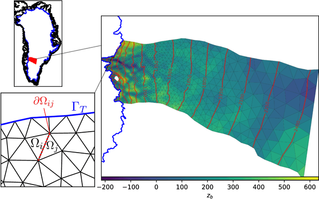
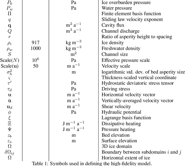
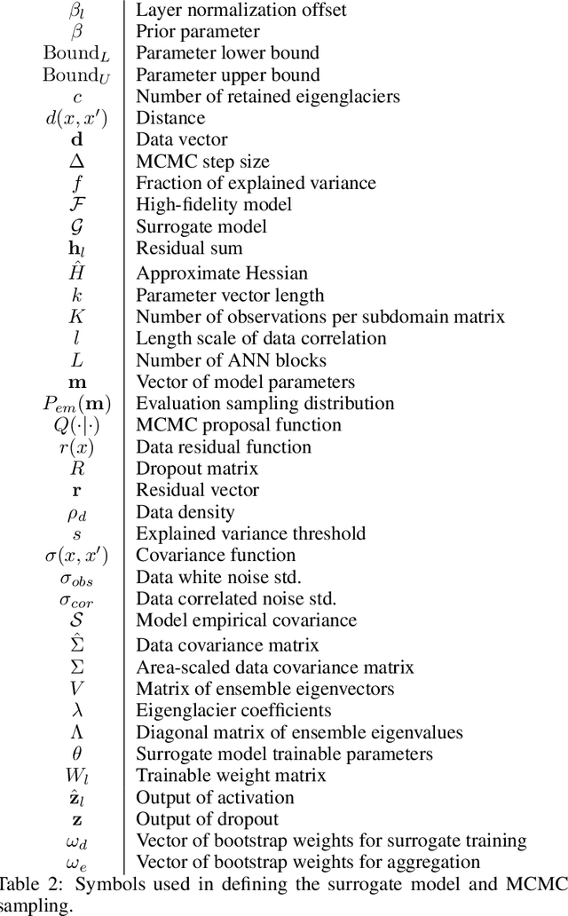
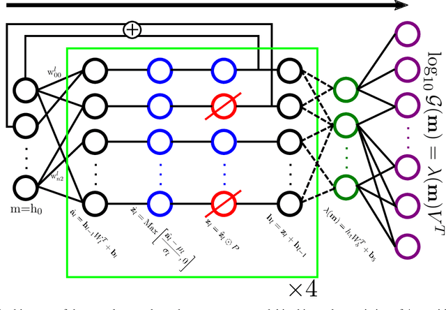
Basal motion is the primary mechanism for ice flux outside Antarctica, yet a widely applicable model for predicting it in the absence of retrospective observations remains elusive. This is due to the difficulty in both observing small-scale bed properties and predicting a time-varying water pressure on which basal motion putatively depends. We take a Bayesian approach to these problems by coupling models of ice dynamics and subglacial hydrology and conditioning on observations of surface velocity in southwestern Greenland to infer the posterior probability distributions for eight spatially and temporally constant parameters governing the behavior of both the sliding law and hydrologic model. Because the model is computationally expensive, classical MCMC sampling is intractable. We skirt this issue by training a neural network as a surrogate that approximates the model at a sliver of the computational cost. We find that surface velocity observations establish strong constraints on model parameters relative to a prior distribution and also elucidate correlations, while the model explains 60% of observed variance. However, we also find that several distinct configurations of the hydrologic system and stress regime are consistent with observations, underscoring the need for continued data collection and model development.
Velocity variations at Columbia Glacier captured by particle filtering of oblique time-lapse images
Nov 15, 2017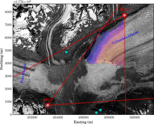
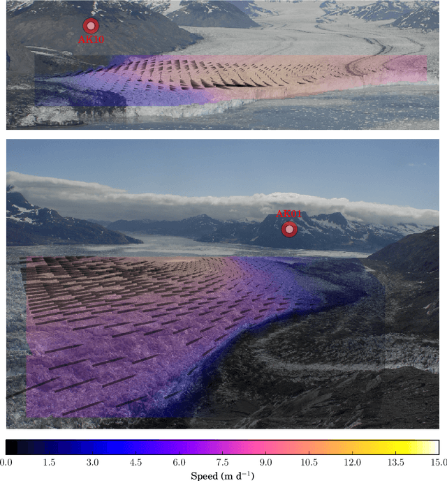
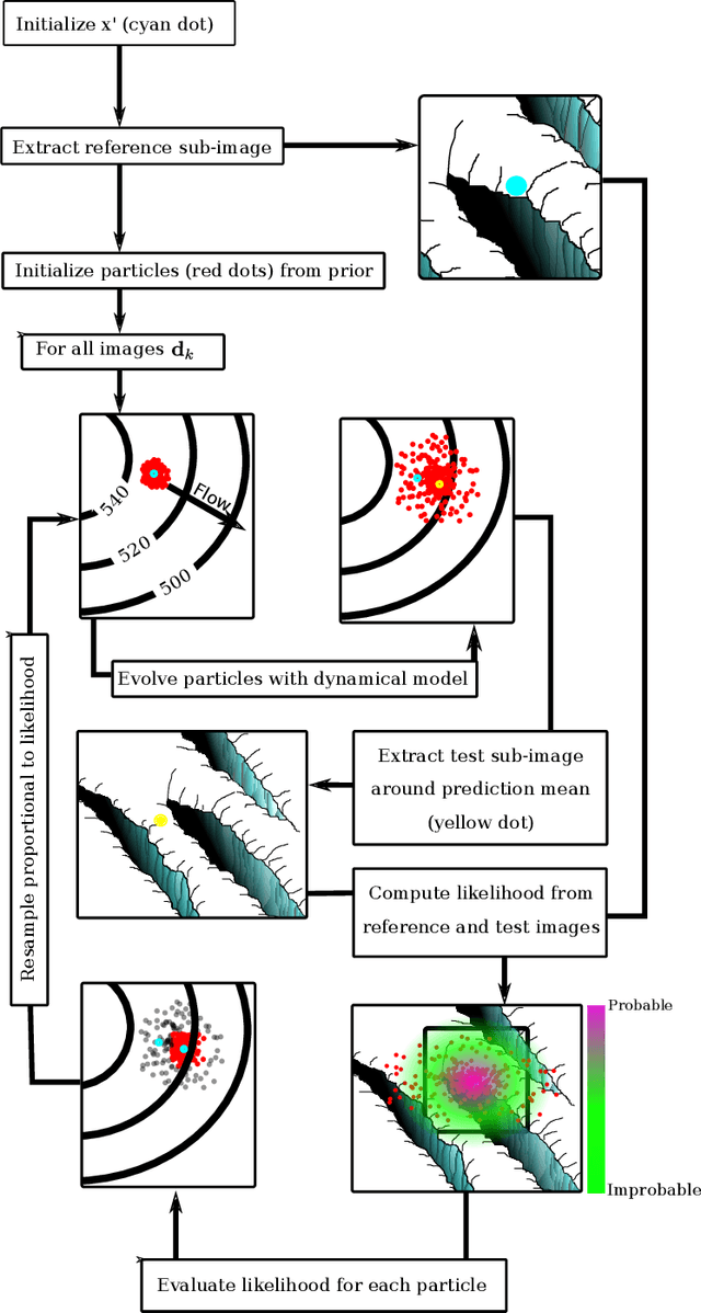
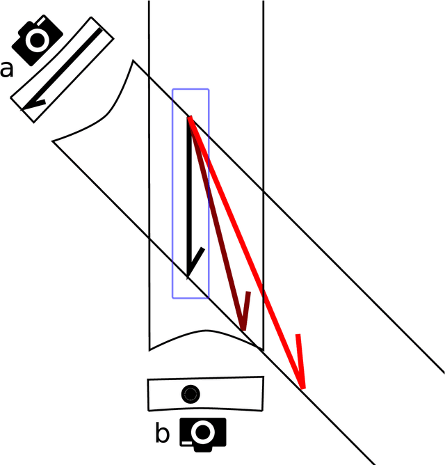
We develop a probabilistic method for tracking glacier surface motion based on time-lapse imagery, which works by sequentially resampling a stochastic state-space model according to a likelihood determined through correlation between reference and test images. The method is robust due to its natural handling of periodic occlusion and its capacity to follow multiple hypothesis displacements between images, and can improve estimates of velocity magnitude and direction through the inclusion of observations from an arbitrary number of cameras. We apply the method to an annual record of images from two cameras near the terminus of Columbia Glacier. While the method produces velocities at daily resolution, we verify our results by comparing eleven-day means to TerraSar-X. We find that Columbia Glacier transitions between a winter state characterized by moderate velocities and little temporal variability, to an early summer speed-up in which velocities are sensitive to increases in melt- and rainwater, to a fall slowdown, where velocities drop to below their winter mean and become insensitive to external forcing, a pattern consistent with the development and collapse of efficient and inefficient subglacial hydrologic networks throughout the year.