 Add to Chrome
 Add to Firefox
 Add to Edge
Modeling Food Popularity Dependencies using Social Media data
Jun 26, 2019The rise in popularity of major social media platforms have enabled people to share photos and textual information about their daily life. One of the popular topics about which information is shared is food. Since a lot of media about food are attributed to particular locations and restaurants, information like popularity of spatio-temporal popularity of various cuisines can be analysed. Tracking the popularity of food types and retail locations across space and time can also be useful for business owners and restaurant investors. In this work, we present an approach using off-the shelf machine learning techniques to identify trends and popularity of cuisine types in an area using geo-tagged data from social media, Google images and Yelp. After adjusting for time, we use the Kernel Density Estimation to get hot spots across the location and model the dependencies among food cuisines popularity using Bayesian Networks. We consider the Manhattan borough of New York City as the location for our analyses but the approach can be used for any area with social media data and information about retail businesses.
Modeling Severe Traffic Accidents With Spatial And Temporal Features
Jun 25, 2019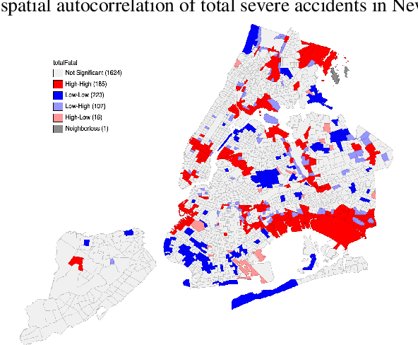
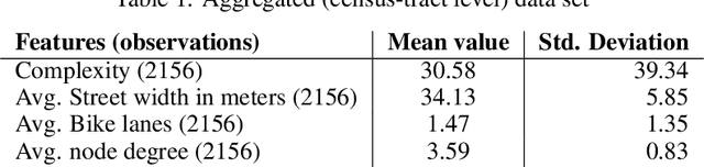
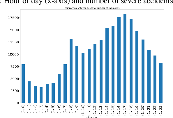
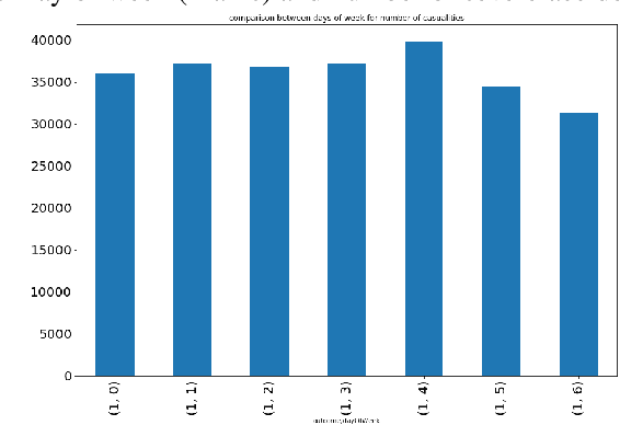
We present an approach to estimate the severity of traffic related accidents in aggregated (area-level) and disaggregated (point level) data. Exploring spatial features, we measure complexity of road networks using several area level variables. Also using temporal and other situational features from open data for New York City, we use Gradient Boosting models for inference and measuring feature importance along with Gaussian Processes to model spatial dependencies in the data. The results show significant importance of complexity in aggregated model as well as as other features in prediction which may be helpful in framing policies and targeting interventions for preventing severe traffic related accidents and injuries.