 Add to Chrome
 Add to Firefox
 Add to Edge
Post-Hurricane Damage Assessment Using Satellite Imagery and Geolocation Features
Paper and Code
Dec 15, 2020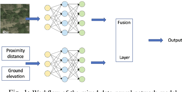
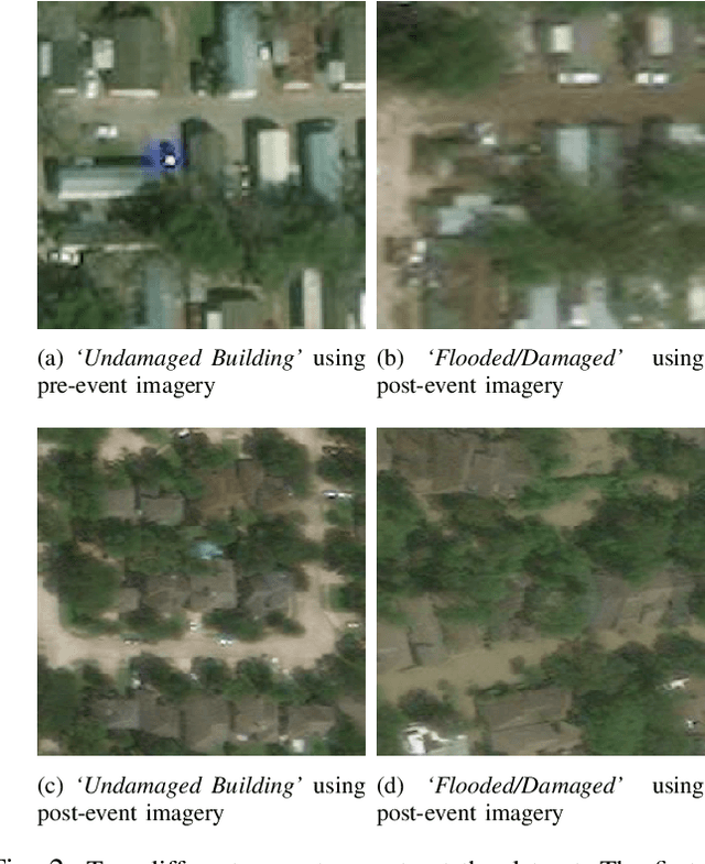
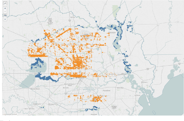
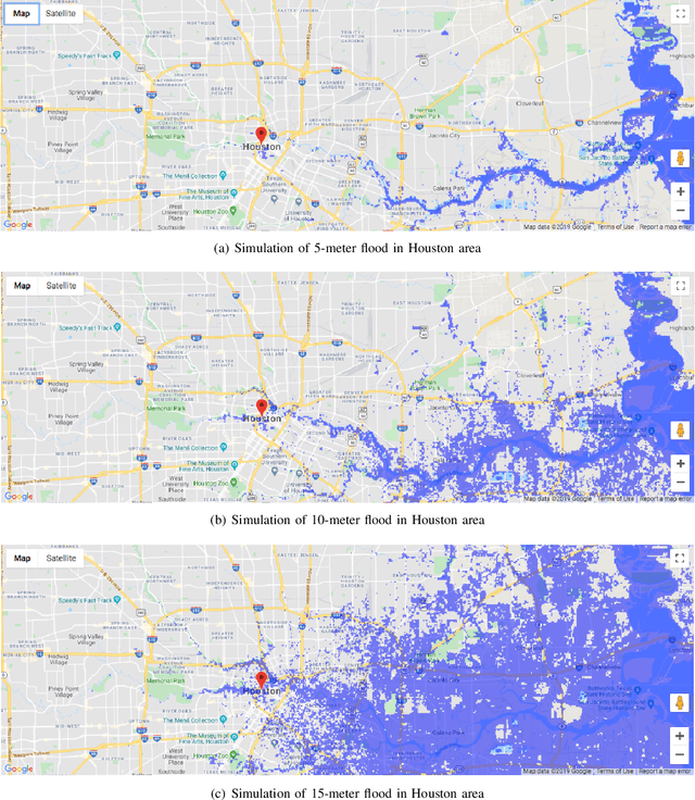
Gaining timely and reliable situation awareness after hazard events such as a hurricane is crucial to emergency managers and first responders. One effective way to achieve that goal is through damage assessment. Recently, disaster researchers have been utilizing imagery captured through satellites or drones to quantify the number of flooded/damaged buildings. In this paper, we propose a mixed data approach, which leverages publicly available satellite imagery and geolocation features of the affected area to identify damaged buildings after a hurricane. The method demonstrated significant improvement from performing a similar task using only imagery features, based on a case study of Hurricane Harvey affecting Greater Houston area in 2017. This result opens door to a wide range of possibilities to unify the advancement in computer vision algorithms such as convolutional neural networks and traditional methods in damage assessment, for example, using flood depth or bare-earth topology. In this work, a creative choice of the geolocation features was made to provide extra information to the imagery features, but it is up to the users to decide which other features can be included to model the physical behavior of the events, depending on their domain knowledge and the type of disaster. The dataset curated in this work is made openly available (DOI: 10.17603/ds2-3cca-f398).